Rotachtal Lake Constance
The Rotachtal Bodensee area is a protected area (SG number DE-8222342) in the southeast of the German state of Baden-Wuerttemberg, designated by the Tübingen regional council in accordance with Directive 92/43 / EEC (Fauna-Flora-Habitat Directive) .
location
The around 466 hectare (ha) large protected area Rotachtal Bodensee belongs naturally to the Bodensee basin and the Upper Swabian hill country . Its four areas are at a height of 398 to 658 m above sea level. NHN and extend to 62 percent (= 289.0 ha) in the Bodenseekreis ( Deggenhausertal , Friedrichshafen , Oberteuringen ) and 38 percent (= 177.2 ha) in the district of Ravensburg (municipality of Horgenzell ).
The sub-areas include the area of the Rotach between Horgenzell in the north and its confluence with Lake Constance between Eriskirch and Langenargen in the south.
Protection purpose
The main protection purpose is the preservation of the Rotach valley up to the confluence with Lake Constance with deeply cut ravines in the upper reaches, as well as the low moor area , Altweiherwiese and clay pit .
Habitat types
The large number of habitat types with near-natural ravine forests and alluvial forests , as well as marshy grass meadows as evidence of earlier land use, is mainly characterized by the following habitats: mixed forest (31%), moist and mesophilic grassland (26%), deciduous (15%) and coniferous forest (13%) ).
The following habitat types according to Annex I of the Habitats Directive occur in the area:
| EU code |
* | Habitat type (official name) | Short name |
|---|---|---|---|
| 3150 | Natural eutrophic lakes with magnopotamion or hydrocharition vegetation | Natural nutrient-rich lakes | |
| 3260 | Rivers of the planar to montane level with vegetation of the Ranunculion fluitantis and the Callitricho-Batrachion | Running waters with flooding aquatic vegetation | |
| 6410 | Pipe grass meadows on lime-rich soil, peaty and clayey-silty soils (Molinion caeruleae) | Pipe grass meadows | |
| 6430 | Moist tall herbaceous vegetation of the planar and montane to alpine level | Moist tall herbaceous vegetation | |
| 6510 | Lean lowland hay meadows ( Alopecurus pratensis, Sanguisorba officinalis ) | Lean, lowland hay meadows | |
| 7220 | * | Tufa springs (cratoneurion) | Tufa springs |
| 7230 | Lime-rich fens | Lime-rich fens | |
| 8210 | Limestone cliffs with crevice vegetation | Limestone cliffs with crevice vegetation | |
| 9130 | Woodruff beech forest (Asperulo-Fagetum) | Woodruff beech forest | |
| 9180 | * | Mixed ravine and hillside forests (Tilio-Acerion) | Mixed ravine and hillside forests |
| 91E0 | * | Alluvial forests with Alnus glutinosa and Fraxinus excelsior (Alno-Padion, Alnion incanae, Salicion albae) | Alluvial forests with alder, ash, willow |
Species inventory
The following types of community interest exist in the area:
| image | EU code |
* | Art | scientific name | Species group |
|---|---|---|---|---|---|

|
1013 | Four-toothed diaper snail | Vertigo geyeri | Snails | |

|
1014 | Narrow diaper snail | Vertigo angustior | Snails | |

|
1016 | Bellied diaper snail | Vertigo moulinisana | Snails | |

|
1032 | Small river mussel | Unio crassus | Shellfish | |

|
1083 | * | Stag beetle | Lucanus cervus | Beetle |

|
1093 | * | Stone cancer | Austropotamobius torrentium | Crayfish |

|
1131 | Strömer | Leuciscus souffia agassizi | Fish and round mouths | |

|
1163 | Bullhead | Cottus gobio | Fish and round mouths | |

|
1166 | Crested newt | Triturus cristatus | Amphibians | |

|
1193 | Yellow-bellied toad | Bombina variegata | Amphibians | |

|
1323 | Bechstein's bat | Myotis bechsteinii | Mammals | |

|
1324 | Great mouse ear | Myotis myotis | Mammals | |

|
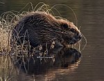
1337 | beaver | Castor fiber | Mammals | |

|
1902 | Yellow lady's slipper | Cypripedium calceolus | plants | |

|
1903 | Marsh glosswort | Liparis loeselii | plants |
Contiguous protected areas
The following protected areas are part of the FFH area:
| No. | Surname | Places | Area share [%] |
image |
|---|---|---|---|---|
| NSG 4.093 |
Altweiherwiese Large cohesive reeds with surrounding littered meadows and alder borders and willow bushes in them as a habitat for a rich flora and fauna. |
Oberteuringen | 16 | |
|
Altweiherwiese and Taldorfer Bach Geologically significant meltwater channel of the Würm late glacial as a valley section of the Ur-Argen . |
Oberteuringen | 4th | ||
| LSG 4.36.016 | Rotachtobel and Zußdorf Forest | Horgenzell | 28 | |
| LSG 4.35.001 |
Württemberg shore of Lake Constance Natural beaches and beach forests of Lake Constance with black poplar and oak trees as the predominant wood on the shore. |
Friedrichshafen |
See also
Web links
- Standard data sheet for the FFH area "Rotachtal Bodensee"
- Profile of the FFH area Rotachtal Bodensee in the protected area directory of the LUBW
- Regional Council Tübingen (Ed.): Management plan for the FFH area 8222-342 "Rotachtal Bodensee" . edited by INULA, Freiburg. December 1, 2017 (174 pages, baden-wuerttemberg.de [PDF]).
- Climate data and scenarios for the protected area from the Potsdam Institute for Climate Impact Research (PIK)
Individual evidence
Coordinates: 47 ° 45 ′ 20 " N , 9 ° 27 ′ 49" E
