Lower Argen and side valleys
|
FFH area "Lower Argen and side valleys"
|
||
|
Lower Argen between the A 96 and Geiselharz |
||
| location | Bodenseekreis , Ravensburg District , Baden-Württemberg , Germany | |
| Identifier | DE-8324-343 | |
| WDPA ID | 555522218 | |
| Natura 2000 ID | DE8324343 | |
| FFH area | 9.51 km² | |
| Geographical location | 47 ° 44 ' N , 9 ° 54' E | |
|
|
||
| Setup date | January 1, 2005 | |
| administration | Regional Council Tübingen | |
The Untere Argen and Seitentäler area is a protected area (SG number DE-8324343) in the south-east of the German state of Baden-Wuerttemberg, designated by the Tübingen regional council in accordance with Directive 92/43 / EEC (Fauna-Flora-Habitat Directive) .
location
The approximately 951 hectares (ha) large reserve Untere Argen and valleys is one natural area to Adelegg and Westallgäuer hills . Its nine partial areas are at an altitude of 496 to 737 m above sea level. NHN and extend to 3.1 hectares in the Lake Constance district ( Neukirch municipality ) and 979.7 hectares in the Ravensburg district (municipalities of Argenbühl , Amtzell , Bodnegg , Kißlegg and Waldburg , towns of Isny im Allgäu , Leutkirch im Allgäu and Wangen ).
The sub-areas essentially comprise the valley of the Lower Argen southeast of Isny up to the confluence with the Upper Argen near Neuravensburg , its tributaries, including the Eschach , Haslach and Karbach , and their peripheral areas.
Protection purpose
The main protection purpose is the preservation of the near-natural, alpine-influenced river landscape with high natural dynamics, deeply incised side valleys with sloping beech forests, spring areas ( spring moors , tuff formations), small, partly silted lakes, ponds , whistle grass meadows and alluvial forests .
Habitat types
The following habitat types according to Annex I of the Habitats Directive occur in the area:
| EU code |
* | Habitat type (official name) | Short name |
|---|---|---|---|
| 3140 | Oligo- to mesotrophic calcareous waters with benthic vegetation of chandelier algae | Lime-rich, nutrient-poor still waters with chandelier algae | |
| 3150 | Natural eutrophic lakes with magnopotamion or hydrocharition vegetation | Natural nutrient-rich lakes | |
| 3240 | Alpine rivers with riparian trees from Salix eleagnos | Alpine rivers with lavender-willow-bank trees | |
| 3260 | Rivers of the planar to montane level with vegetation of the Ranunculion fluitantis and the Callitricho-Batrachion | Running waters with flooding aquatic vegetation | |
| 6210 | Near-natural dry lime lawns and their stages of shrubbery (Festuco-Brometalia) | Lime grassland | |
| 6230 | * | Species-rich montane grass grass (and submontane on mainland Europe) on silicate soils | Species-rich bristle grass lawn |
| 6410 | Pipe grass meadows on lime-rich soil, peaty and clayey-silty soils (Molinion caeruleae) | Pipe grass meadows | |
| 6430 | Moist tall herbaceous vegetation of the planar and montane to alpine level | Moist tall herbaceous vegetation | |
| 6510 | Lean lowland hay meadows ( Alopecurus pratensis, Sanguisorba officinalis ) | Lean, lowland hay meadows | |
| 7140 | Transitional and swinging lawn bogs | Transitional and swinging lawn bogs | |
| 7210 | * | Calcareous swamps with Cladium mariscus and species of Caricion davallianae | Lime-rich swamps with Schneidried |
| 7220 | * | Tufa springs (cratoneurion) | Tufa springs |
| 7230 | Lime-rich fens | Lime-rich fens | |
| 8210 | Limestone cliffs with crevice vegetation | Limestone cliffs with crevice vegetation | |
| 9130 | Woodruff beech forest (Asperulo-Fagetum) | Woodruff beech forest | |
| 9180 | * | Mixed ravine and hillside forests (Tilio-Acerion) | Mixed ravine and hillside forests |
| 91E0 | * | Alluvial forests with Alnus glutinosa and Fraxinus excelsior (Alno-Padion, Alnion incanae, Salicion albae) | Alluvial forests with alder, ash, willow |
| 91F0 | Hardwood forests with Quercus robur, Ulmus laevis, Ulmus minor, Fraxinus excelsior or Fraxinus angustifolia (Ulmenion minoris) | Hardwood floodplain forests | |
| 9410 | Montane to alpine acidic spruce forests (Vaccinio-Piceetea) | Acidic coniferous forests (short name) |
Contiguous protected areas
The following protected areas are part of the FFH area:
| No. | Surname | Places | Area share [%] |
photo |
|---|---|---|---|---|
| LSG 4.36.070 | Adelegg and the associated tertiary foothills | Isny , Leutkirch | 8th | |
| NSG 4.282 | Bad | Neukirch | 1 |

|
| NSG 4.109 | Bimisdorf Mösle | Cheeks | 1 | |
| LSG 4.35.040 | Ice Age edges of the Argental with Argenaue | Neukirch | 1 |

|
| NSG 4.058 | Slope spring moor Bachholz | Cheeks | 1 | |
| LSG 4.36.072 | Young moraine landscape between Amtzell and Vogt | Amtzell , Bodnegg , Waldburg | 2 | |
| NSG 4.186 | Karbachmoos | Cheeks | 1 | |
| NSG 4.186 | Karbachtal | Cheeks | 4th | |
| NSG 4.183 | Krottental-Karbach | Amtzell , Wangen | 2 | |
| LSG 4.36.034 | Mittelsee and Oberer See | Cheeks | 2 | |
| NSG 4.067 | Devil's Lake | Cheeks | 1 |
Species inventory
The following types of community interest exist in the area:
| image | EU code |
* | Art | scientific name | Species group |
|---|---|---|---|---|---|

|
1013 | Four-toothed diaper snail | Vertigo geyeri | Snails | |

|
1014 | Narrow diaper snail | Vertigo angustior | Snails | |

|
1044 | Helmet Azure Maiden | Coenagrion mercuriale | Dragonflies | |

|
1065 | * | Golden piebald butterfly | Euphydryas aurinia | Butterflies |

|
1093 | * | Stone cancer | Austropotamobius torrentium | Crayfish |

|
1131 | Strömer | Leuciscus souffia agassizi | Fish and round mouths | |

|
1163 | Bullhead | Cottus gobio | Fish and round mouths | |

|
1166 | Crested newt | Triturus cristatus | Amphibians | |

|
1324 | Great mouse ear | Myotis myotis | Mammals | |

|
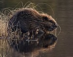
1337 | beaver | Castor fiber | Mammals | |

|
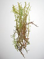
1381 | Glossy sickle moss | Drepanocladus vernicosus | Mosses | |

|
1902 | Yellow lady's slipper | Cypripedium calceolus | plants | |

|
1903 | Marsh glosswort | Liparis loeselii | plants |
See also
Web links
- Standard data sheet for the FFH area "Untere Argen and Seitentäler"
- Profile of the FFH area Untere Argen and side valleys in the protected area directory of the LUBW
- Climate data and scenarios for the protected area from the Potsdam Institute for Climate Impact Research (PIK)

