Umlachtal and Riss south of Biberach
|
FFH area "Umlachtal and Riss south of Biberach"
|
||
|
Wettenberger Ried |
||
| location | District of Biberach , District of Ravensburg , Baden-Württemberg , Germany | |
| Identifier | DE-7924-341 | |
| WDPA ID | 555522062 | |
| Natura 2000 ID | DE7924341 | |
| FFH area | 7.14 | |
| Geographical location | 48 ° 1 ' N , 9 ° 46' E | |
|
|
||
| Sea level | from 535 m to 653 m | |
| Setup date | January 1, 2005 | |
| administration | Regional Council Tübingen | |
The FFH area Umlachtal and Riss south of Biberach in Baden-Württemberg was designated in 2005 by the Tübingen regional council .
location
The 714 hectare Umlachtal and Riss protected area south of Biberach is located in the Riss-Aitrach-Platten natural area . The area is mostly in the district of Biberach with the communities Eberhardzell , Ingoldingen , Ummendorf , Hochdorf and Biberach an der Riss and with 0.7 ha in the district of Ravensburg with the community of Bad Wurzach . The area consists of a total of 9 sub-areas.
Protection purpose
Habitat types
The following habitat types according to Annex I of the Habitats Directive occur in the area:
| EU code |
* | Habitat type (official name) | Short name |
|---|---|---|---|
| 3150 | Natural eutrophic lakes with magnopotamion or hydrocharition vegetation | Natural nutrient-rich lakes | |
| 3160 | Dystrophic lakes and ponds | Dystrophic lakes | |
| 3260 | Rivers of the planar to montane level with vegetation of the Ranunculion fluitantis and the Callitricho-Batrachion | Running waters with flooding aquatic vegetation | |
| 6410 | Pipe grass meadows on lime-rich soil, peaty and clayey-silty soils (Molinion caeruleae) | Pipe grass meadows | |
| 6430 | Moist tall herbaceous vegetation of the planar and montane to alpine level | Moist tall herbaceous vegetation | |
| 6510 | Lean lowland hay meadows (Alopecurus pratensis, Sanguisorba officinalis) | Lean, lowland hay meadows | |
| 7120 | Degraded raised bogs that can still be renatured | Damaged raised bogs | |
| 7210 | * | Calcareous swamps with Cladium mariscus and species of Caricion davallianae | Lime-rich swamps with Schneidried |
| 7220 | * | Tufa springs (cratoneurion) | Tufa springs |
| 7230 | Lime-rich fens | Lime-rich fens | |
| 8210 | Limestone cliffs with crevice vegetation | Limestone cliffs with crevice vegetation | |
| 9110 | Grove beech forest (Luzulo-Fagetum) | Grove beech forest | |
| 9130 | Woodruff beech forest (Asperulo-Fagetum) | Woodruff beech forest | |
| 9180 | * | Mixed ravine and hillside forests (Tilio-Acerion) | Mixed ravine and hillside forests |
| 91D0 | * | Bog forests | Bog forests |
| 91E0 | * | Alluvial forests with Alnus glutinosa and Fraxinus excelsior (Alno-Padion, Alnion incanae, Salicion albae) | Alluvial forests with alder, ash, willow |
Species inventory
The following types of community interest exist in the area:
| image | EU code |
* | Art | scientific name | Species group |
|---|---|---|---|---|---|

|
1093 | * | Stone cancer | Austropotamobius torrentium | Crayfish |

|
1163 | Bullhead | Cottus gobio | Fish and round mouths | |

|
1166 | Crested newt | Triturus cristatus | Amphibians | |

|
1193 | Yellow-bellied toad | Bombina variegata | Amphibians | |

|
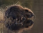
1337 | beaver | Castor fiber | Mammals |
Contiguous protected areas
The following nature reserves are part of the FFH area:
The Lindenweiher bird sanctuary lies entirely within the boundaries of the FFH area.
See also
Individual evidence
- ^ A b Tübingen regional council (ed.): Maintenance and development plan for the FFH area 7924-341 "Umlachtal and Riss south of Biberach" and the bird sanctuary 7924-401 "Lindenweiher". edited by Planstatt Senner & proECO environmental planning. June 2007 (112 pp., Baden-wuerttemberg.de [PDF]).
Web links
- Standard data sheet for the FFH area "Umlachtal and Riss south of Biberach"
- Profile of the FFH area Umlachtal and Riss south of Biberach in the LUBW's list of protected areas
- Regional Council Tübingen (ed.): Maintenance and development plan for the FFH area 7924-341 "Umlachtal and Riss south of Biberach" and the bird sanctuary 7924-401 "Lindenweiher". edited by Planstatt Senner & proECO environmental planning. June 2007 (112 pp., Baden-wuerttemberg.de [PDF]).

