Danube between Munderkingen and Ulm and northern Iller
|
FFH area "Danube between Munderkingen and Ulm and northern Iller"
|
||
|
The Iller near Illerkirchberg |
||
| location | Alb-Donau-Kreis , Biberach and Ulm districts , Baden-Württemberg , Germany | |
| Identifier | DE-7625-311 | |
| WDPA ID | 555624688 | |
| Natura 2000 ID | DE7625311 | |
| FFH area | 11.89 km² | |
| Geographical location | 48 ° 22 ' N , 9 ° 58' E | |
|
|
||
| Setup date | January 1, 2005 | |
| administration | Regional Council Tübingen | |
| particularities | 17 sub-areas | |
The FFH area Danube between Munderkingen and Ulm and the northern Iller is located in the east of Baden-Württemberg and is part of the European Natura 2000 network of protected areas . It was designated in 2015 through the amalgamation of three already existing FFH areas by the Tübingen regional council.
location
The approximately 1189 hectare protected area of the Danube between Munderkingen and Ulm and the northern Iller lies in the natural areas of the hill country of the lower Riss , Holzstocks , Unteres Illertal and Donauried . Its 17 sub-areas are located in the municipalities of Illerkirchberg , Illerrieden , Schnürpflingen , Dietenheim , Erbach , Oberdischingen , Öpfingen , Griesingen , Rottenacker , Ehingen an der Donau and Munderkingen in the Alb-Donau district , Schwendi and Wain in the Biberach district and in the independent city Ulm .
description
The nature of the landscape of the protected area is essentially shaped by the courses of the Danube and Iller rivers . It covers the entire course of the Danube between Munderkingen and Ulm as well as the parts of the Illertal in Baden-Württemberg between Illerrieden and where the Iller flows into the Danube. The Danube is strongly developed within the FFH area and provided with numerous barrages. The Donauaue is determined by intensively used grassland, which is structured by oxbow lakes and oxbow lakes.
The Illertal is defined within the area by steep valley slopes covered with sloping and ravine forests.
Both rivers are habitat for several strictly protected fish species such as asp , huchen and nerd .
According to the current state of knowledge, the area is home to the largest population of the petite pan snail in the Danube Valley in Baden-Württemberg.
history
The protected area was created by merging the original FFH areas 7724-341 “Danube between Munderkingen and Erbach”, 7625-341 “Danube Valley near Ulm” and 7726-341 “Illertal”. These have existed since 2005.
Protection purpose
Habitat types
The following habitat types according to Annex I of the Habitats Directive occur in the area:
| EU code |
* | Habitat type (official name) | Short name |
|---|---|---|---|
| 3150 | Natural eutrophic lakes with magnopotamion or hydrocharition vegetation | Natural nutrient-rich lakes | |
| 3260 | Rivers of the planar to montane level with vegetation of the Ranunculion fluitantis and the Callitricho-Batrachion | Running waters with flooding aquatic vegetation | |
| 6210 | * | Near-natural dry lime lawns and their stages of shrubbery (Festuco-Brometalia) (* special stands with remarkable orchids) | Lime grassland - orchid-rich stands * |
| 6410 | Pipe grass meadows on lime-rich soil, peaty and clayey-silty soils (Molinion caeruleae) | Pipe grass meadows | |
| 6430 | Moist tall herbaceous vegetation of the planar and montane to alpine level | Moist tall herbaceous vegetation | |
| 6510 | Lean lowland hay meadows (Alopecurus pratensis, Sanguisorba officinalis) | Lean, lowland hay meadows | |
| 7220 | * | Tufa springs (cratoneurion) | Tufa springs |
| 9130 | Woodruff beech forest (Asperulo-Fagetum) | Woodruff beech forest | |
| 9180 | * | Mixed ravine and hillside forests (Tilio-Acerion) | Mixed ravine and hillside forests |
| 91E0 | * | Alluvial forests with Alnus glutinosa and Fraxinus excelsior (Alno-Padion, Alnion incanae, Salicion albae) | Alluvial forests with alder, ash, willow |
| 91F0 | Alluvial hardwood forests with Quercus robur , Ulmus minor , Fraxinus excelsior or Fraxinus angustifolia (Ulmenion minoris) | Hardwood floodplain forests |
Species inventory
The following types of community interest exist in the area:
| image | EU code |
* | Art | scientific name | Species group |
|---|---|---|---|---|---|

|
1037 | Green hippopotamus | Ophigomphus cecilia | Dragonflies | |

|
1059 | Light blue ant bluebird | Maculinea teleius | Butterflies | |

|
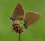
1061 | Dark blue ant bluebird | Maculinea nausithous | Butterflies | |

|
1096 | Brook lamprey | Lampetra planeri | Fish and round mouths | |

|
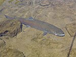
1105 | Huchen | Hucho hucho | Fish and round mouths | |

|
1130 | Asp | Aspius aspius | Fish and round mouths | |

|
1134 | Bitterling | Rhodeus sericeus | Fish and round mouths | |

|
1160 | nerd | Zingel nerd | Fish and round mouths | |

|
1163 | Bullhead | Cottus gobio | Fish and round mouths | |

|
1166 | Crested newt | Triturus cristatus | Amphibians | |

|
1193 | Yellow-bellied toad | Bombina variegata | Amphibians | |

|
1324 | Great mouse ear | Myotis myotis | Mammals | |

|
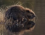
1337 | beaver | Castor fiber | Mammals | |

|
1381 | Green broom moss | Dicranum viride | Mosses | |

|
4056 | Dainty poppy snail | Anisus vorticulus | Snails |
Contiguous protected areas
The following nature reserves are part of the FFH area:
On the Bavarian side, the FFH area adjoins the Untere Illerauen .
See also
Individual evidence
- ↑ a b c Tübingen regional council (ed.): Management plan for the Natura 2000 area 7625-311 Danube between Munderkingen and Ulm and northern Illertal . edited by ILN Bühl. July 31, 2015 (136 pages, baden-wuerttemberg.de [PDF]).
Web links
- Standard data sheet for the FFH area "Danube between Munderkingen and Ulm and northern Iller"
- Profile of the FFH area Danube between Munderkingen and Ulm and northern Iller in the protected area directory of the LUBW
- Regional Council Tübingen (Ed.): Management plan for the Natura 2000 area 7625-311 Danube between Munderkingen and Ulm and northern Illertal . edited by ILN Bühl. July 31, 2015 (136 pages, baden-wuerttemberg.de [PDF]).

