Earbuds
Coordinates: 52 ° 37 ′ 39 ″ N , 10 ° 54 ′ 19 ″ E


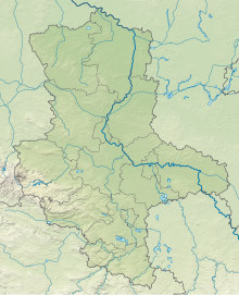
The nature reserve (NSG) Ohreaue lies on the western border of the Altmarkkreis Salzwedel in Saxony-Anhalt . It consists of two separate areas.
geography
The nature reserve belongs to the Lüneburg Heath - Wendland natural area and lies on the border with Lower Saxony in the area of the communities of Diesdorf and Jübar and the town of Klötze . It covers 673 hectares. The northern area extends from Waddekath to Wendischbrome . It is about 17 kilometers long in the northwest-southeast direction and mostly between 50 and 100 meters wide, but protrudes in several places to the east and borders Lower Saxony in the west. The area consists of the partly natural, partly straightened course of the Ohre and the surrounding wetlands . The state border with the largely silted up border ditch forms the western border of the nature reserve. The other area is several kilometers away between Steimke and Böckwitz . The Lower Saxony town of Brome lies between the two areas.
history
The area was designated as a nature reserve NSG 0195 in 2000 (date of regulation: June 29, 2000). The Altmarkkreis Salzwedel has been the sponsor since then.
Ecology, flora and fauna
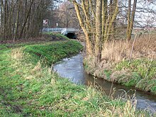
The extent of the NSG Ohreaue corresponds to the FFH area 275 "Ohreaue". In addition to the course of the river, there are floodplain forests , moist to wet grassland , including reed beds and large sedge meadows , but also some damp mixed forests , an alder break forest south of Wendischbrome and a raised bog overgrown with trees in the north of the area. In the former border strip with its slab path there is sand and dry grass . The Lower Saxon NSG Mittlere Ohreaue , established in 2007, joins along the entire western border of the northern area and forms with it and the NSG Ohreaue near Altendorf and Brome, which is also connected in Lower Saxony, a de facto unit as part of the Green Belt . The NSG is part of the Natura 2000 network .
The area is the habitat and food area of numerous threatened species. Otters and beavers use the otters on their hikes between Ise , Drömling and Dumme . Numerous species of birds like warblers , Beutelmeise , Warbler and Whinchat , but also gray wagtail , quail , barred warbler and Ortolan breed in the area. The fish species include gudgeon , loach and several species of sticklebacks . The confused candelabrum (Tolypella intricata) is only found in Saxony-Anhalt in a ditch east of the Wendischbrome– Nettgau road .
Fishing, hunting, forestry and agricultural use are permitted to a limited extent.
Web links
- Information on the NSG Ohreaue from LVWA Sachsen-Anhalt
- Ordinance map of the area (PDF file; 435 kB)
Individual evidence
- ↑ a b c d NSG Ohreaue at LVWA Sachsen-Anhalt , accessed on April 18, 2018.
- ↑ Regulation text of LVWA (PDF, 63 kB), accessed December 22, 2011


