Oleiros
| Oleiros | ||||||
|---|---|---|---|---|---|---|
|
||||||
| Basic data | ||||||
| Region : | Centro | |||||
| Sub-region : | Viseu Dão-Lafoes | |||||
| District : | Castelo Branco | |||||
| Concelho : | Oleiros | |||||
| Coordinates : | 39 ° 55 ′ N , 7 ° 55 ′ W | |||||
| Residents: | 2300 (as of June 30, 2011) | |||||
| Surface: | 115.49 km² (as of January 1, 2010) | |||||
| Population density : | 20 inhabitants per km² | |||||
| Oleiros district | ||||||
|
||||||
| Residents: | 5721 (as of June 30, 2011) | |||||
| Surface: | 471.08 km² (as of January 1, 2010) | |||||
| Population density : | 12 inhabitants per km² | |||||
| Number of municipalities : | 10 | |||||
| administration | ||||||
| Administration address: | Câmara Municipal de Oleiros Praça do Município 6160-409 Oleiros |
|||||
| President of the Câmara Municipal: | José Santos Marques ( PSD ) | |||||
| Website: | www.cm-oleiros.pt | |||||
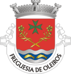
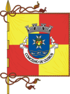
Oleiros is a small town ( Vila ) and a district ( Concelho ) in Portugal with 2300 inhabitants (as of June 30, 2011).
history
The current place of Oleiros was first mentioned in a document about a donation of territory by King Sancho I to the Hospitaller Order in 1194 . The place received its first city rights in 1232 , which King Manuel I renewed in 1513 and made Oleiros an independent circle outside of any ecclesiastical order.
On February 2nd, 1811 , Oleiros was the victim of some destruction by French troops passing through during the Napoleonic invasions . In the course of the administrative reforms after the Liberal Revolution in Portugal , the circle of Oleiros was significantly expanded in 1834 . After its brief dissolution, the independent circle of Oleiros has existed again since 1869 .
Culture and sights
The architectural monuments of Oleiros include various sacred buildings and historical public buildings. The historic town center is also a listed building.
Sections of the natural landscape of the surrounding forests of the Pinhal Interior Sul are protected as Grupo de Unidades de Paisagem do Pinhal do Centro (English: group of landscape units of the central pine forest). The existing network of hiking trails in the district is being expanded, and various river baths have been created and equipped with infrastructure and water sports. The circle is also addressing tourists, especially individual travelers on holiday close to nature in facilities of the rural tourism .
administration
circle
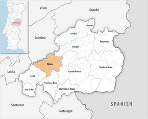
 Oleiros is the administrative seat of a district of the same name. The neighboring districts are (starting clockwise in the north): Fundão , Castelo Branco , Proença-a-Nova , Sertã and Pampilhosa da Serra .
The following municipalities ( freguesias ) are in the Oleiros district:
| local community | Population (2011) |
Area km² |
Density of population / km² |
LAU code |
|---|---|---|---|---|
| Álvaro | 237 | 29.41 | 8th | 050601 |
| Cambas | 309 | 48.54 | 6th | 050603 |
| Estreito - Vilar Barroco | 1.011 | 93.51 | 11 | 050613 |
| Isna | 209 | 27.94 | 7th | 050605 |
| Madeira | 171 | 26.87 | 6th | 050606 |
| Mosteiro | 307 | 17.70 | 17th | 050607 |
| Oleiros - Amieira | 2,422 | 143.64 | 17th | 050614 |
| Orvalho | 678 | 33.31 | 20th | 050609 |
| Sarnadas de Sao Simão | 217 | 31.00 | 7th | 050610 |
| Sobral | 160 | 19.16 | 8th | 050611 |
| Oleiros district | 5,721 | 471.08 | 12 | 0506 |
Population development

Municipal holiday
- Monday after the second Sunday in August
sons and daughters of the town
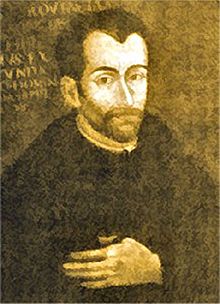
- Antonio Freire de Andrade (1580–1634), Jesuit missionary and explorer, was the first European to cross the Himalayas
- Armando Esteves Domingues (* 1957), Roman Catholic clergyman, auxiliary bishop in Porto
Web links
- Map of the Freguesia Oleiros at the Instituto Geográfico do Exército
- Official website
Individual evidence
- ↑ www.ine.pt - indicator resident population by place of residence and sex; Decennial in the database of the Instituto Nacional de Estatística
- ↑ a b Overview of code assignments from Freguesias on epp.eurostat.ec.europa.eu
- ↑ www.ine.pt - indicator resident population by place of residence and sex; Decennial in the database of the Instituto Nacional de Estatística
- ↑ www.verportugal.net , accessed February 14, 2013
- ↑ www.monumentos.pt , accessed on February 14, 2013
- ↑ ditto
- ↑ www.cm-oleiros.pt , accessed on February 14, 2013
- ↑ ditto


