
Ossenberg (Rheinberg)
|
Ossenberg
City of Rheinberg
Coordinates: 51 ° 34 ′ 10 ″ N , 6 ° 34 ′ 48 ″ E
|
|
|---|---|
| Residents : | 2100 |
| Incorporation : | April 1, 1951 |
| Incorporated into: | Borth |
| Postal code : | 47495 |
| Area code : | 02843 |
The village of Ossenberg is today a district of the city of Rheinberg on the left lower Rhine , until 1951 it was an independent municipality with a castle as a manor. After that, Ossenberg belonged to the municipality of Borth , which was incorporated into the city of Rheinberg in 1975 and today forms one of its four city districts.
Ossenberg is located three kilometers north of the core town of Rheinberg near the Rhine and today has around 2000 inhabitants. The historical core of the village and its main attraction is a manor or castle. In 2011 Ossenberg won the district competition Our village has a future (formerly Our village should be more beautiful ) and in 2012 represents the Wesel district at the state level.
To the place name
The place name Ossenberg is mostly interpreted as a combination of east and Berka , i.e. as a place in the east of Rheinberg , whose old name was Berke or Berka . The prefix Ossen- most likely goes back to a Lower Franconian form of the direction east . Bahlow 1985 offers another less probable explanation: according to this, os is an old European water word with the meaning "swamp, bog", to which u. a. the name Osna-brück can be traced back.
According to Gysseling 1960, the place name Berke comes from the Germanic word for birch . According to evidence from the early form Berke, Tiefenbach 2012 assumes a locative dative, ie “(place) near the birch”. The name of the birch is reconstructed in Germanic as * berkō or * berkjō (n) ; The different stem vowels in Berke and Birke result from these two forms . The / e / also shows the place name Berka in Thuringia, while the / i / also predominates in place names, e.g. B. Birklar , Birkenau , Birkenholm and many others. Older hypotheses about the origin of the name Berka can be found in the article Rheinberg .
Geographical location
Ossenberg, today a district of the city of Rheinberg on the left bank of the Rhine , is located in the Lower Rhine Plain directly on the Rhine , about 12 kilometers south of the district town of Wesel and 14 kilometers north of Moers . In the north it borders on the municipality of Alpen and the Rheinberg districts of Borth and Wallach , in the west on Millingen and in the south on the Rheinberg district.
Ossenberg forms since 1975 together with the living quarters Borth and Wallach the municipality Borth of city of Rheinberg. (The other districts are Rheinberg , Budberg and Orsoy .) The Ossenberg district includes the Rhine foreland nature reserve north of the Ossenberger Schleuse , which lies between the dike and the Rhine.
history
Early history
Ossenberg is located directly on the Rhine, which in earlier times did not flow towards the sea in a stable river bed as it does today, but divided into several arms in the Lower Rhine Plain, which flowed around many river islands. Before the Rhine was tamed by river regulation and dyke construction, such an area was hardly to be populated, at most in a few higher places. (See also the section "Ossenberg and the Rhine".)
Around the birth of Christ, the Celtic-Germanic mixed peoples of the Eburonen , Menapier and Cugerner , who are mentioned by Roman writers, lived on the lower Lower Rhine - but hardly directly on the river . Settlement remains or grave finds are not preserved in the Ossenberg area from this time. The Romans had occupied the left Lower Rhine since Emperor Augustus (attempts to establish a province of Germania on the right bank of the Rhine had been abandoned after the Varus Battle in 9 AD). The military camps Vetera I on the Fürstenberg near Xanten-Birten and Vetera II on the Bislicher Insel near Xanten were important bases of the Roman occupation on the Lower Rhine . The large Roman settlement in this area became Colonia Ulpia Traiana , from which the city of Xanten ( Ad Sanctos ) later emerged.
Franconian-Merovingian period
There is evidence that in the 5th and 6th centuries the Lower Rhine area was settled by Frankish tribes (Chamavers and Atturians), who had driven out the Romans. A burial ground or even a settlement has not yet been proven in the Ossenberg area for the Franconian period. The closest site to Ossenberg from this period is the Franconian- Merovingian burial ground in Rill in the neighboring municipality of the Alps . There, 80 graves were uncovered and examined in excavations in the early 20th century. In total, the cemetery of Rill comprised around 200 burials from the middle of the 5th to the 8th century. The dead were mainly buried in coffins or wooden burial chambers, but some were also buried in tree coffins (hollowed out tree trunks), which could indicate a Saxon or Frisian influence. The grave goods provide information about the costume, armament, equipment and social stratification of the Franconian population on the Lower Rhine. Occasional finds in the Lower Rhine burial grounds from this period ( Gellep , Stratum , Orsoy , Rill) also indicate more distant trade relationships, such as ceramics from the Eifel, Lombard bridles and fibulas , Ostrogothic buckled helmets and Scandinavian strap tongues .
At the end of the 7th century, the grave goods decrease, which is due either to the growing influence of Christianity, which is now also spreading in rural areas, or to the impoverishment of the population. The location of the burial ground in Rill on the highest elevation in the area is typical for many facilities from the Franconian period. At that time, there were settlement possibilities only in higher places ( Brinken and Spyken ), which were somewhat protected from the floods.
Knight seat Ossenberg

The history of the village is closely linked to the Ossenberg house or castle, first mentioned in documents in 1176. Initially, the "Herrlichkeit Ossenberg" was probably a fortified Franconian knight's seat, which then came into possession of Cologne . A family of the same name, which is mentioned several times in documents from the 14th century, is named as the first owner of Haus Ossenberg. In 1335 the brothers Wilhelm and Otto von Ossenberg sold larger pasture lands to the Kamp Abbey . The Xanten Abbey , the Kamp Abbey and other monasteries have verifiably property in Ossenberg. Otto von Ossenberg died around 1350 without a successor. On January 13, 1351 his widow Margaretha was enfeoffed by Count Friedrich von Moers with the bailiwick and glory of Ossenberg. The feudal power was disputed between the County of Moers and the Electorate of Cologne . By marrying that Magaretha with Arnt von Wevort, the property came to the Wevort family (also Wevorden) in 1375.
Wevort and von der Rhoer
For more than 300 years, the Wevort family, one of the oldest noble families in the Lower Rhine region, who held numerous important functions and offices, owned the Ossenberg Castle and its lands. In the 16th century the Wevorts converted to the Protestant faith early and played a decisive role in the development of the Reformation in Moers, Rheinberg and of course Ossenberg.
During this time, the Bailiwick of Ossenberg formed its own judicial district, which included Rheinberg and the surrounding towns and whose court order was documented by the Counts of Neuenahr and Moers in 1567. It was stated that Moers should act as the court of appeal for the Ossenberg court. In 1712, the court order was confirmed by the Prussian-royal decree: complainants from the lower courts of Ossenberg, Friemersheim and Krefeld had to turn to the main court in Moers and then to the higher appeal court in Berlin.
According to a document from the Rheinberg Office, Ossenberg owned only five larger courtyards and 28 Katstätten in addition to the castle in 1636 - during the Thirty Years War - which were not even inhabited. Due to growing debts as a result of the chaos of war, Ossenberg finally had to be sold by the Wevorts. In 1701, the Utrecht canon Thomas Brauwart was enfeoffed with the glory and the court of Ossenberg. After that, Ossenberg changed hands twice in quick succession. First it came into the possession of Count Johann Christoph von Wylich and Lottum, then Count Truchseß von Waldburg took over the manor. In the 1720s he had the old fortified castle replaced by the current building in the Rococo style (see description).
Already in 1744 Truchseß von Waldburg sold the castle and its goods to Ludolf von der Rhoer (or Rhur), a wealthy Catholic merchant from Rheinberg. (According to a Duisburg document from 1744, however, Ossenberg Castle was offered for sale as a "Reckischer possession", after which it belonged - at least for a short time - to the Westphalian noble family von der Reck (e) , see the web link). Ludolf von der Rhoer had the ruins of the Antonius Chapel rebuilt near the castle. (See the section on the Antonius Chapel.) Ludolf von der Rhoer's successor was his son Caspar Anton, who was promoted to baron status by King Friedrich II in 1783 and who in 1784 acquired the knightly seat of Baerl. The von der Rhoer family remained in the possession of Ossenberg for over a hundred years. In 1811 - during the French occupation of the Lower Rhine - important visitors were honored: Empress Marie Louise, wife of Napoleon I, paid a visit to Ossenberg Castle and stayed there.
Mayor's office Ossenberg
In 1794 the French revolutionary army advanced as far as the Rhine, and the area on the left bank of the Rhine came under French rule. By decrees of 1795 and 1798, the nobility lost all previous rights, privileges and income (hereditary leases, tithes). The area on the left bank of the Rhine was divided into four departments in 1798, which in turn were divided into arrondissements and finally into cantons. The Vogtei Ossenberg was dissolved and the village was incorporated into the canton Rheinberg, which belonged to the Krefeld district ( Arrondissement de Crévelt ) in the Rur department ( Département de la Roer ) with its administrative seat in Aachen.
In 1800 the three villages of Ossenberg, Borth and Wallach within the canton of Rheinberg were combined to form a Mairie (mayor's office) Ossenberg with a municipal agent or Maire as the mayor. Initially, members of the von der Rhoer family acted as mayors, even after Prussia in 1816 - which owned the left Lower Rhine in 1815 - carried out an administrative reform and established the Rheinberg district , which corresponded to the canton. The mayor's office in Ossenberg was retained as a joint municipality of the villages of Ossenberg, Borth and Wallach. From 1823 it was subject to the provisional administration of the mayor of the city of Rheinberg, who, on behalf of the Prussian state, managed several independent municipalities in the surrounding area in addition to the city of Rheinberg, including the joint municipality of Ossenberg, despite the principle of independence. The main reason why a municipality like Ossenberg did not have its own mayor was the extremely low payment of this office, despite the constantly increasing number of tasks, from which no citizen could make a living. In 1845 the municipality of Ossenberg had 1244 inhabitants, 460 of which were in Ossenberg itself, 482 in Borth and 302 in Wallach.
The personal union of the mayor's offices of Ossenberg and Rheinberg - in fact the administration of the municipality of Ossenberg by the Rheinberg mayor - continued with only brief interruptions until 1930. At that time, the combined municipality of Ossenberg received its own mayor. On April 1, 1951, the independent municipality of Borth with the districts of Borth, Ossenberg and Wallach was founded as her successor (official seat in Borth), which was only incorporated into the city of Rheinberg during the territorial reform that came into force on January 1, 1975 .
Berghe von Trips
The Berghe von Trips family of counts has been closely associated with Ossenberg since the middle of the 19th century. In 1190 the name Goswin Dukert van Berghe appears in Brabant. Wilhelm von Berghe acquired the property of Trips Castle near Geilenkirchen in 1446 , whereupon his descendants took the name Berghe von Trips. Count Franz Adolf Anselm Berghe von Trips received the title of imperial count in 1796. His third son Otto Maximilian Josef Clemens (1821–1882) married Albertina Freiin von der Rhoer in 1857, the second daughter of Baron Heinrich Cornelius Balthasar von der Rhoer, who died without male heirs, and thus took over the management of the House of Ossenberg.
His eldest son Luitpold Albert Maximilian Otto Reichsgraf Berghe von Trips (1858–1938) succeeded him after his death in 1882. Imperial Count Luitpold was not married. He made several generous foundations, which he financed through the sale of land, and had the Ossenberg sister house (kindergarten, infirmary) built.
After the death of Count Luitpold (1938), the Ossenberg family came to Count Clemens Berghe von Trips (1908–1992) by inheritance. In March 1942 the left wing of Haus Ossenberg was completely destroyed in an air raid with high explosive bombs. All historical documents such as chronicles and traditions along with other valuable facilities and objects were lost. Three of the castle residents - including an aunt of the count - died in this attack.
After the war, the left wing and the kitchen building were rebuilt by Count Clemens Berghe von Trips and some parts of the castle were restored. The famous racing driver Wolfgang Graf Berghe von Trips would actually have inherited the castle had it not been for his fatal accident in 1961. In 1988 Count Clemens adopted his great niece Karen von Brauchitsch , who owned the castle after his death (1992). Together with her husband, Wilhelm Albert Herzog von Urach and Count von Württemberg, she carried out extensive restoration work on the palace.
School history of Ossenberg
The school history of Ossenberg up to the beginning of the 20th century - when the economic situation of the community improved decisively through the establishment of the Solvay works - was a single catastrophe. However, things hardly looked better in other smaller communities in the Lower Rhine at that time. The miserable school conditions in Ossenberg resulted initially from the bitter poverty of the citizens, but then from the jealous and petty behavior of the two denominations, the lack of commitment by the state - this also applies after Prussia was responsible for the fate of the village since 1816 - and obviously also from the lack of interest of the respective gentlemen from Ossenberg, whether they were called Wevort, von der Rhoer or Berghe von Trips.
In the history book of the community of Borth , the former Ossenberg main teacher Walter Pelzer describes the school history of Ossenberg - as far as it can be reconstructed - in detail. A few stations from it are to be presented here:
- 1739 First mention of the Ossenberg school system in a document from the Reformed parish of Wallach, which is also responsible for the Ossenberg Protestants. It is recorded that the Ossenberg sub-schoolmaster is determined by the Reformed parish Wallach and should be of the Lutheran religion. He can live in the school house with a garden on the road to Borth and alternately be fed by the families in the village; perhaps he will receive a tip ("douceur") from one or the other. In addition, in Ossenberg he has to serve as sexton and auditor at the chapel. A year later, the teacher Tops left his service because he could not survive on this "payment".
- 1740–1779 In Ossenberg no school lessons are given for around 40 years. The schoolhouse is rented out and it is not possible to hire a new teacher for the low pay. It was not until 1776 that the Prussian state and the county of Moers enabled the payment of 25 thalers to needy schoolmasters through a fund cassa montis pietatis "Fund of the Mountain of Piety", which the Ossenbergers could apply for. Unfortunately the tenant of the school building refused to move out. The question of the religion of the new teacher was even more difficult to clarify. The Ossenberg house became Catholic again in 1740 when it changed hands to Ludolf von Rhoer, and the majority of the citizens also belonged to this faith. So a Catholic teacher should be hired. The Protestants and their Wallach parish vehemently opposed this, the Moers government refused a corresponding request from the Ossenbergers, since the schoolhouse had been built by Reformed people and it has always been that way (... defined by older times and antiquis actis anyway ). It was not until 1779 that the new Protestant teacher Johann Heinrich Scheydt could be employed.
- 1779–1827 Teacher Scheydt takes up his post in Ossenberg, of course as the only teacher for all students of all ages. Several times his attempts to get better paid jobs in other schools fail. During the French occupation from 1801 to 1815, the 25 thalers from the cassa montis pietatis were also lost . The teacher only had pennies left from the parents for their school-age children, but even these parents could not afford them. Teacher Scheydt died in 1827.
- 1827–1832 Another phase without lessons in Ossenberg. The Ossenbergers want a Catholic teacher, the Protestant Wallach parish opposes it with the old arguments, and the school building will again be rented to someone else. The students from Ossenberg should attend the schools in Rheinberg and Borth, which is hardly possible because of the long distances. It was not until 1832 that the Ossenberg teaching post was filled again under state pressure, the new teacher was Catholic.
The rest of the 19th century was also characterized by the constant struggle of the respective teachers to improve their economic situation somewhat, and the regular decisions of the local council not to spend more money on the school. It was only with the construction of the Solvay works that the economic situation and population size of Ossenberg changed significantly: a second teacher was able to be employed, a new school building was erected, and finally there were four teachers with four classes. But even in 1959, two years were combined into one class. Another new building also improved this situation. Today there is only the primary school in Ossenberg, which has been a branch of the Borth-Wallach primary school since August 1st, 2010. Secondary schools are attended by Ossenberg students mainly in Rheinberg.
Ossenberg and the Rhine
Significance of the Rhine for Ossenberg
Due to its location directly on the Rhine, this river has always been of great importance for the glory and the hamlet of Ossenberg. Ossenberg was a fishing village well into the 20th century, the fishery yields played an important role in feeding the population along with agriculture. The old name Werftstraße for a path on the Altrheinarm shows that fishing boats were also manufactured and repaired in Ossenberg.
In addition to this economic importance that the Rhine had for Ossenberg, the almost annual threat from floods and ice can be seen above all. It is not uncommon for the course of the river to change as a result of such events, with ice barriers leading to river breakthroughs in other places and the creation of new arms of the Rhine. The best-documented events in the lower Lower Rhine from the Middle Ages and early modern times are the great flood disasters.
Ossenberg was probably located on the left bank of the Rhine at the turn of the ages, which means here: to the left of the main or middle arm of the river. In the Roman and Franconian times the main arm stretched from Rheinberg via Ossenberg, Borth, Elverich, Rill to Menzelen. Today, this can be reconstructed from residual water that can be found in the course of this old arm of the Rhine ( Borthsche Ley ). Such a course of the Rhine meant that today's Ossenberg neighbors Borth and Wallach lay on the right bank of the Rhine, i.e. were separated from the left bank of Ossenberg by the river. This fact is also documented by the fact that the Wallach parish belonged to the parish of Spellen on the right bank of the Rhine.
Beginning of dike construction and river regulation
After several changes to the course of the Rhine, its position stabilized in its current position from around 1300, which means that Borth and Wallach also became places on the left bank of the Rhine. The reason for the stabilization is the beginning of the dike construction probably in the 12th century, possibly as early as the 11th century. These were initially low summer dykes , which were able to protect smaller, low-lying areas - the so-called polders - at least from the summer floods, and initially locally limited bank dykes , which were primarily intended to keep the terrible consequences of the ice drift away from exposed places or individual farms. Because of the political fragmentation of the lower Lower Rhine - Rheinberg and Ossenberg belonged to Moers and Kurköln, Borth and the more northern areas to Kleve - there were no continuous systematic measures that would have been necessary for a safe dike structure along the entire length of the river concerned. But even the first individual measures already contributed to river regulation and thus to the habitability of areas near the river.
From the 12th and 13th centuries, this led to many new establishments and extensions of villages near the Rhine, including Ossenberg with its manor. Many churches in the lower Lower Rhine were built during this time, which suggests an enormous increase in population density. In 1364, an official dike law was issued for the first time in Düffel (north of Kleve), in which the duties of a dike officer were specified. Between Ossenberg and Büderich , there has been evidence of a bank dike since the end of the 15th century, through the Wallacher Deichbuch from 1502.
Historical floods of the Rhine
Despite the constantly improving dyke construction, there were many floods and ice runs that repeatedly penetrated into the town centers. The following particular catastrophes are documented:
- 1374 A spring flood of particularly long duration, which led to price increases and famine in the Lower Rhine, as the fields could not be cultivated.
- 1450 A flood that completely washed away several churches in the lower Lower Rhine.
- 1551–1573 Multiple breaches of the bank dike between Ossenberg and Büderich; as a result of this series of floods, the county of Kleve takes systematic measures to secure the dike; Ossenberg in the Electorate of Cologne is not included.
- 1668 floods and heavy ice. The floods of the Rhine are digging a new bed about 4 km east of Rheinberg, which had previously been directly on the Rhine. Prussia was very interested in expanding the new course into the main river and in silting up the original arm of the Rhine near the city. The new river led through Klevian-Prussian and no longer Electoral Cologne area, and also no longer past the Electoral Cologne customs tower of Rheinberg. By means of technical measures (willows, Kribbwerke, sunk stone and sand ships), the old arm of the Rhine was almost drained and the new one was systematically expanded. This river shift was completed in 1714. When Prussia then had to return Rheinberg to Kurköln, the situation could no longer be brought back, and Rheinberg lost its previous economic importance. The remnant of the original main arm is the Old Rhine in Ossenberg and Rheinberg, which flows into the main arm of the Rhine near the Ossenberg harbor and is secured shortly before by a flood lock built in the 1930s.
- 1740 ice drift and prolonged floods; the fields are silting up. As a result, there are Prussian activities to build dikes. The river is better regulated through the construction of groynes (embankments protruding vertically into the river) and the removal of Rhine islands by blocking side arms. As a result of this flood and because of the ongoing threat, the Prussian King Friederich II issued the Clever Dyke Regulations in 1767 , which included the residents in the costs of the dyke construction, which was now systematically carried out, and whose main features continued into the 20th century.
- 1784 One of the highest recorded floods (cf. flood 1784 ) with enormous ice drift. According to reports by Baron Carl von der Rhoer from Ossenberg , the water is up to the roofs; there are six breakthroughs in the dam between Ossenberg and Wallach. In Ossenberg you have to go by boat through the village streets. In the neighboring towns of Borth and Wallach, almost all of the cattle drowned. There is much evidence of this flood of the century. Then the Xanten Canon de Pau made the bizarre demand to tear down all the dams so that the water could drain away more easily. However, this measure would have made the lower Lower Rhine uninhabitable. Further straightening of the Rhine ensured a faster drainage of the water masses in the following years.
- 1809 The flood, which was impressively described by Goethe in the ballad Johanna Sebus .
- 1855 A flood with extreme ice drift, two dam breaches between Ossenberg and Wallach, ten major breakthroughs between Ossenberg and Baerl (described in detail in a Rheinberg chronicle). A large wooden raft that was tied up near Ossenberg breaks free and destroys the soggy Wallach dike over a length of 100 meters. Through this breakthrough, the floods and large ice floes pour out, causing many houses to collapse. Only another dam break at Bislich allows the water to drain away.
- 1882 The second highest flood ever registered on the Lower Rhine (it is the highest on the Upper and Middle Rhine). In the Orsoy - Ossenberg - Büderich area, it again leads to many dam breakthroughs. However, there is no major ice drift.
- 1920 The flood is only 50 cm lower than the previous record flood of 1882.
- 1926 The highest flood ever registered on the Lower Rhine, it is again 30 cm higher than the flood of 1882. It can therefore be called a millennium flood with good reason . Its height plus one meter was now defined as the target height of new levees, a formula that lasted until 1977. This flood is still present to the oldest inhabitants of Ossenberg today, above all they remember "how one had to drive the boat through the village street to the castle". The village was completely meters high under water, as old photos show.
Flood protection today

The construction of the new continuous bank dyke (one meter higher than the 1926 flood) in the years 1935-37 prevented further direct flooding on the lower Lower Rhine: the back dike, and with it the village of Ossenberg, is now considered flood-proof. In order to be able to seal off the Ossenberger Altrheinarm against backflow from the Rhine during floods, an elaborate lock system was installed. In the area from Ossenberg to Duisburg, subsidence caused by coal mining is a particular problem. It must be constantly checked whether this results in lowering of the dike tops, which must then be removed immediately.
Every Ossenberg house owner pays an annual “dyke fee” to the “Orsoyer Deichgräfen ”, which is responsible for the maintenance and care of the dyke system in the Baerl - Orsoy - Ossenberg area (river kilometers 768 to 806). Many costly individual measures since 1950 have led to a stable dyke system with enormous dyke heights of up to 14 meters at the nearby Eversael, the world's highest river dyke. These were able to safely intercept the considerable floods of 1993 and 1995. As witnesses to a bad past, the dike breakthroughs ( Dörbroch ) of the old dike can still be seen in Ossenberg to the left of the path from the village to the Ossenberg harbor.
Attractions
Ossenberg Castle

Nothing has survived from the original castle building, which is said to have had a defensive or castle-like character. It was replaced by the current building in the 1720s by its owner at the time, Count Truchseß von Waldburg. An air raid in World War II severely damaged it. After the end of the war, the left wing and the kitchen building were rebuilt by Count Clemens Berghe von Trips and some parts of the castle were restored .
Between 1988 and 2004, many renovations were carried out on Ossenberg Castle and its outbuildings . As the last to be repaired between 2002 and 2004 as part of a EUREGIO project in the right wing, the former guest and servant rooms were restored. Since then, this part of the palace has been available to overnight guests. The present size of the estate belonging to the castle is about 350 acres (90 hectares).
Anthony Chapel

As early as the 13th century, a church dedicated to St. Antonius chapel, which was located to the west outside the actual palace complex. The architectural style of the original chapel was Gothic, which can be seen from the vaults in the choir. Later - in the 17th and early 18th centuries - it was made Baroque. The Gothic chapel was already the burial place of the noble families of Ossenberg, around the chapel was the cemetery of the citizens.
Around 1750, the new Catholic owner of Ossenberg, Ludolf von der Rhoer, had the dilapidated Antonius Chapel rebuilt for the Catholics of the village and its length expanded considerably. In lengthy processes, the Reformed people in the village fought for the right to be allowed to hold worship services in this chapel three times a year. The Antonius Chapel became a Simultaneum , a church that was used jointly by Catholics and Protestants.
In the years before and after the First World War, the Ossenberg population grew strongly due to the industrial settlement of the Solvay works. In 1923, a south aisle was added to the chapel in a community effort, but this severely impaired the original character of the building. Finally, a complete restoration was carried out between 1999 and 2001 through voluntary work by many Ossenberg residents. The restored chapel can be used again for church services and weddings of both denominations.
The outer dimensions of the chapel are approximately 20 meters × 11 meters (including the aisle). The altar is baroque, behind the altar is a sacristy. The wings to the right and left of the altar represent the apostles Peter and Paul. Four figures rest on consoles: Christ, Mother Anna, Mary and St. Anthony the Hermit, the patron saint of the chapel. The windows in the choir are dedicated to the Good Shepherd and the Virgin Mary with the baby Jesus. The organ front is also baroque, the pipes have been restored.
When after the Second World War the Antonius Chapel became too small due to the growing population of Ossenberg - many refugees from the east found a new home in Ossenberg - the modern parish church of St. Mary's Assumption was built in 1953, also by Ossenberg citizens. Plans for a new, larger parish church in Ossenberg had been in existence since 1907. However, these could not be realized due to the war and the subsequent economic hardship.
Bünten mill

The Ossenberg tower windmill on Xantener Strasse goes back to a predecessor built in 1470. However, this cannot yet have been a tower mill, as this type of mill was only invented later. Around 1535, Leonardo da Vinci sketched the design of a mill with a rotating roof and an almost horizontal blade shaft. It was first tested in Flanders in 1550. The Ossenberger Mühle received its present form as a tower windmill with a rotating hood around 1750.
The high chimneys and buildings of the Solvay works were erected in 1906 near the Ossenberger Mühle, which is also known as the Büntener Mühle after the long-time owner family . Since the mill no longer received enough wind in certain wind directions, an electric drive had to be installed for periods of calm. The electricity costs were originally taken over by the Solvay works.
House Momm

Haus Momm was the manor house of a large farm belonging to the Sprenger family with a restaurant directly on the Rhine at the Ossenberg port facility. The name comes from the river Momm , which flows into the Rhine opposite Haus Momm on the right bank of the Rhine. House Momm was before its demolition in the 1990s , the picnic area of Ossenberger families. Today only the memorial for Joseph Sprenger remains, who was shot here on December 5, 1919 by Belgian occupation soldiers directly on the Rhine.
Other sights
- Catholic Church of St. Mary of the Assumption from 1953
- Nature reserve Rhine foreland north of the Ossenberger Schleuse
- Center with village square and fountain
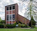
Church of St. Mary of the Assumption

Mühlenhaus in the center of the townscape

Old Rhine nature reserve


District winner in the competition "Our village has a future"
In 2011, after several participations, Ossenberg became the district winner in the competition “Our village has a future”, formerly known as “Our village should be more beautiful”, and represented the Wesel district in 2012 at state level.
Transport and economy

Road, rail and airport
Ossenberg is connected to the regional road traffic by the federal highway 57 (Aachen-Kleve). A NIAG bus line connects Ossenberg with Rheinberg and Kamp-Lintfort. The closest railway line is the Duisburg-Xanten line at the railway stations in Millingen , which guarantees a connection to the European rail network via the Duisburg railway station; the nearest airports are Düsseldorf international airport and Weeze regional airport .
Rhine port
The Ossenberger Rheinhafen is located at Rhine kilometer 806. There is salt on a large scale loaded that from 1906 by the German Solvay works founded Borther comes rock salt mine and the company's own rail connection is transported from Borth to Ossenberger harbor. The mine has been part of the European Salt Company since 2002 . The port is also used to deliver limestone that the Solvay works need for the production of soda in the Rheinberg plant, to which the port is also connected by an in-house railway line.
Solvay works
The branch of Deutsche Solvay-Werke , founded in 1906 on Xantener Straße, today's B 57, in Rheinberg area, but directly on the border to Ossenberg, is by far the largest industrial company in Rheinberg and the largest employer for the Ossenberg district. Seen from the federal road 57, the old village with its castle disappears almost entirely behind the large industrial plant.
Rheinberg Ossenberg was the second plant of Solvay plants in Germany, it was initially only for soda production built the salt came from their own rock salt mine in Borth and by pipeline from the caverns of 1924 Epe (Westfalen) , the lime from Wülfrath in Dusseldorf. The Rheinberger plant now produces both soda and various plastics. The main product is PVC and its derivatives. Another important product are chlorine-containing solvents , which are the basis for the production of varnishes , paints and wood preservatives .
societies
The most important clubs in Ossenberg are:
- Schützenverein Ossenberger Schützen from 1828 , which organizes the Ossenberger Schützenfeste
(the founding year 1828 is not documented) - Geselligkeitsverein Verein Gemütlichkeit Ossenberg from 1882; founded by Wilhelm Kausen, Wilhelm Hink, Johann Fonk, Johann Wardemann and Dietrich Wessels
- SV Concordia Ossenberg from 1946, re-established in 1982 with numerous branches today
- Fanfarenzug Ossenberg , founded in 1950
- Catholic labor movement St. Josef Ossenberg (KAB) from 1908
- Local and traditional association Herrlichkeit Ossenberg e. V. from 2004
- Carnival Committee Gemütlichkeit (KAG) from 2005 (a spin-off of the Gemütlichkeit association )
- St. Martin's Committee St. Josef Ossenberg
- Catholic Women's Community (KFD)
Ossenberg dialect
Main article Rheinberger Platt
The Ossenberger dialect, usually called Ossenberger Platt, belongs - together with the dialects of the neighboring towns of Millingen, Alpsray, Rheinberg, Budberg and Eversael to Rheinberger Platt . The Rheinberger Platt is a dialect within the Lower Franconian , which historically also includes Dutch .
The fact that even within the Rheinberger Platt there are subtle differences can be seen, for example, from the different implementation of West Germanic / u: / (Horster 1996).
Differences within the Rheinberg dialect
| Osbg. | Mill. | Alps. | Rhbg. | Budb. | Evers. | ||
|---|---|---|---|---|---|---|---|
| House | hüs / hus | ü | ü | ü | ü | ü | u |
| herb | krüt / krut | ü | ü | ü | ü / u | u | u |
| fence | do / do | ü | ü | ü / u | u | u | u |
The abbreviations mean: Osbg. = Ossenberg, Mill. = Millingen, Alps. = Alpsray, Rhbg. = Rheinberg, Budb. = Budberg and Evers. = Eversael.
In 1989 Josef Gormanns published a dictionary of Rheinberg dialect , Theodor Horster published a Rheinberg dictionary in 1996 , which is also based on sources from Ossenberg. In doing so, both have taken a decisive step towards preserving the Rheinberger Platt. While the oldest residents of Ossenberg still occasionally talk to each other in the Platt, the group of middle-aged local citizens can barely understand, the younger ones and children hardly come into contact with the Lower Rhine dialect.
As an example for the Rheinberg-Ossenberger dialect, a few sentences from a report about a flood with ice drift from 1929 from Gormanns 1989 (in simplified notation):
- In February neegentinhondertneegenontwentech, as man glöwne, de wenter trök af, as di Rinberkse six of da fastelowent froine, brook öwer nach 'äne strict wenter herin, Schlemmer as 1890, woerfan aale lüj dumols gärn vertellne. Öwer därtech grat onder null freeze et schteen on been. Nor wenech daach schtoon dä Rin.
- In February 1929, when it was believed that winter was about to depart (and) when the Rheinbergers were looking forward to Mardi Gras, a severe winter fell overnight, worse than 1890, which old people liked to talk about at the time. (At) over 30 degrees below zero it froze stone and leg. After a few days the Rhine was standing.
The following are some example sentences from Horster 1996 that refer directly to Ossenberg:
-
We have an oome, dä wont in Ossenbärch.
We have an uncle who lives in Ossenberg. (Beginning of a Rheinberg carnival song)
-
Fan-e schtat to op den Ossenbärch sind-et drijenhaf kilemeeters.
It is three and a half kilometers from the city (Rheinberg) to Ossenberg.
-
De Ossenbärchse möl schteet al sait seewentienhondertfiftech soo dor, wi se fandaach still to siin ös.
The Ossenberger Mühle has been there since 1750 as it can be seen today.
-
Sait de Solwai begteet, dor ömer weer ene gansen deel ossenbärchsen öer arbait.
Since Solvay existed, many ( lit. a whole part) Ossenbergers have had their work there.
literature
History book of the community of Borth
- Hofmann, Fritz and Pattscheck, Hans (Hrsg.): History book of the community Borth. Borth 1968.
This includes the following articles, among others:
- Fritz Hofmann: The early settlement of our community.
- Fritz Hofmann: The Rhine and the community of Borth.
- Hans Pattscheck: From the history of the mayor's office in Ossenberg.
- Richard Verhuven: The knight seat Ossenberg and its owners.
- Paul Mast: The Simultaneum in Ossenberg.
- Walter Pelzer: From the history of the Ossenberg elementary school.
Literature specifically on Ossenberg
- Martin Reiner (Ed.): 150 years of Ossenberger Schützen . Rheinberg-Ossenberg 1978.
- Hans Dewey (Ed.): 100 years of the Gemütlichkeit Ossenberg e. V. Rheinberg-Ossenberg 1982.
- Wolfgang Sommer (Hrsg.): Chronicle of the rebuilding of the Ossenberg castle chapel . Rheinberg-Ossenberg 2002.
- Willi Hücklekemkes (Ed.): Chronicle 1953-2003. 50 years of the parish church of St. Mary's Assumption in Ossenberg. Rheinberg-Ossenberg 2003.
- Carsten Kämmerer (Ed.): O how delicious - The Golddorf Ossenberg and its recipes . Rheinberg-Ossenberg 2012.
Literature on the Rheinberg-Ossenberger Platt
- Josef Gormanns: Dictionary of the Rheinberger dialect. Writings of the city of Rheinberg on history and local history,
volume 2. Stadt Rheinberg 1989. - Josef Gormanns (Ed.): Ons Modersprook in Rhinberk on Ömgägend. Two volumes. Michael Schiffer, Rheinberg 1980 and 1981.
- Theodor Horster: Rheinberger Dictionary. A documentation of the dialect in the lower Lower Rhine. Rheinland-Verlag, Cologne 1996.
Literature on dyke construction
- Josef Devers (Ed.): Flood protection on the Lower Rhine from past and present. Orsoy dyke association, Rheinberg-Orsoy 1985.
- Josef Devers (Ed.): Orsoyer Rheinbogen. Orsoy dyke association, Rheinberg-Orsoy 1997.
Literature on place names
- Hans Bahlow: Germany's geographical world of names. (= Suhrkamp Taschenbuch. 1221). Edition Suhrkamp, Frankfurt 1985.
- Dieter Berger: Geographical Names in Germany. (= Duden paperbacks. Volume 25). Dudenverlag, Mannheim 1999.
- Maurits Gysseling: Toponymically Wordenboek van Belgie, Nederland, Luxemburg, Noord-Frankrijk en West-Duitsland (vóór 1226). Tongeren 1960.
- Henning Kaufmann: West German place names with distinctive additions. Including the place names of the Germanic language area bordering to the west. Part I, Heidelberg 1958.
- Henning Kaufmann: The names of the cities in the Rhineland. Munich 1973.
- Richard Pick: The city and the former Rheinberg office. Bonn 1883.
- Heinrich Tiefenbach: Rheinberg. In: Manfred Niemeyer (Ed.) German book of place names. de Gruyter, Berlin / Boston 2012.
General literature
- Renate Pirling: The Merovingian period on the Lower Rhine. In: Kurt Böhner (Ed.): Left Lower Rhine: Krefeld, Xanten Kleve. (= Guide to prehistoric and early historical monuments. Volume 14). Philipp von Zabern, Mainz 1969, pp. 73-74, Gräberfeld Rill.
- Jacques Bolle: Solvay 1863–1963. Invention, man and company. Weissenbruch, Brussels 1963.
- Georg Cornelissen: On the language of the Lower Rhine in the 19th and 20th centuries. In: Dieter Geuenich (Ed.): The Lower Rhine cultural area in the 19th and 20th centuries. Peter Pomp, Bottrop / Essen 1997.
- Willehad Paul Eckert: The Lower Rhine. (= DuMont art travel guide ). Cologne 1978.
- Irmgard Hantsche: Atlas for the history of the Lower Rhine. Peter Pomp, Bottrop / Essen 2000.
- Heinrich Janssen, Udo Grote: Two millennia of history of the church on the Lower Rhine. Dialogverlag, Münster 1998.
- Gerhard Köbler : Historical lexicon of the German countries. The German territories from the Middle Ages to the present. 7th, completely revised edition. CH Beck, Munich 2007, ISBN 978-3-406-54986-1 .
- Franz Petri , Georg Droege , Friedrich von Klocke , Johannes Bauermann (eds.), Klaus Flink: Handbook of the historical sites of Germany . Volume 3: North Rhine-Westphalia (= Kröner's pocket edition . Volume 273). 2nd, revised edition. Kröner, Stuttgart 1970, DNB 456882855 .
- A. Steeger: The Franconian cemetery in Rill near Xanten. In: Bonner yearbooks of the Rheinisches Landesmuseum in Bonn. 148, Bonn 1948, pp. 249-298.
- Aloys Wittrup : From Rheinberg's past days. Michael Schiffer, Rheinberg 1955.
Web links
- Ernst Kausen: Ossenberg. A village on the Lower Rhine through the ages (DOC; 41 kB)
This text is the basis for the historical part of this article. It is based on the sources mentioned above. - Ernst Kausen: On the place name Rheinberg (DOC; 35 kB)
Basis for the section “On the place name” in this article - Johannes Kefferpütz 'private website on Ossenberg
Individual evidence
- ↑ Ossenberg district winner at "Our village has a future"
- ^ Federal Statistical Office (ed.): Historical municipality directory for the Federal Republic of Germany. Name, border and key number changes in municipalities, counties and administrative districts from May 27, 1970 to December 31, 1982 . W. Kohlhammer, Stuttgart / Mainz 1983, ISBN 3-17-003263-1 , p. 296 .
