Pfitscher Joch
| Pfitscher Joch | |||
|---|---|---|---|
|
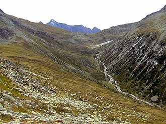
Pfitscher Joch from the Austrian side |
|||
| Compass direction | south | North | |
| Pass height | 2246 m above sea level A. | ||
| region | Province of South Tyrol Italy |
State of Tyrol Austria |
|
| Watershed | Bärenbach → Pfitscher Bach → Eisack → Etsch → Adriatic Sea | Zamser Bach → Zemmbach → Ziller → Inn → Danube → Black Sea | |
| Valley locations | St. Jakob im Pfitsch | Dornauberg | |
| expansion | Pass road | Footpath | |
| Lock | for motorized vehicles | ||
| Mountains | Zillertal Alps | ||
| profile | |||
| Denzel scale | SG 3 | ||
| Ø pitch | 5.8% (806 m / 14 km) | 6.3% (1261 m / 20 km) | |
| map | |||
|
|
|||
| Coordinates | 46 ° 59 '42 " N , 11 ° 39' 37" E | ||
The Pfitscher Joch ( Italian Passo di Vizze ) is 2246 m above sea level. A. high valley crossing over the main Alpine ridge from the North Tyrolean Zamser Grund in the rear Zillertal into the South Tyrolean Pfitscher valley , which is a side valley of the Wipptal . The Pfitscher Joch lies east of the Brenner Pass in the Zillertal Alps . Since the Treaty of Saint-Germain came into force in 1920, the border between Italy and Austria has been running over the Pfitscher Joch . The yoke is the third lowest crossing from North to South Tyrol.
location
On the Austrian side, a path leads from the Schlegeis reservoir through the Zamser Grund to the Lavitzalm and on to the Joch. The approximately six kilometer long path is passable for hikers and cyclists, whereby bicycles - especially uphill - have to be carried in sections.
The Pfitscher Joch is an important pass crossing for mountain bikers who are on a Transalp tour.
The Italian side can be reached via a driveway. This is closed to general road traffic from the fourth bend . From there the ascent on foot takes about an hour. At the third hairpin bend, the path branches off to the Hochfeiler . The road leads across the border to Lavitzalm on Austrian territory.
A little above the yoke is the Pfitscher-Joch-Haus ( 2276 m slm ) on the Italian side .
History, archeology
Archaeologists from the University of Innsbruck have been researching the Pfitscherjoch since 2012. There is evidence that the yoke has been used by people for around 9,000 years. The oldest finds (on both sides of the yoke) are three Mesolithic hunter camps from the 8th to 6th millennium BC. Chr .: Fireplaces and also rock crystal and flint tools. Mineral hunters have found a unique stone ax made of clear rock crystal at 2900 m above sea level, above the Olpererhütte near the Pfitscherjoch in the Zillertal , it is dated 4000 years old, the end of the Neolithic, the beginning of the Bronze Age and can be seen (as of August 2016) in the Vorarlberg Museum in Bregenz . In the 7th century AD Lavez (soapstone) was mined and processed on a large scale on the North Tyrolean side .
Height indication
The altitude information is inconsistent, on Austrian and South Tyrolean maps mostly 2246 m is given.
- www.austrianmap.at of the BEV
- tirisMaps
- South Tyrol map on www.sentres.com
- South Tyrol map of the province of Bolzano
Web links
Individual evidence
- ↑ beeline about 5½ km
- ↑ Cleaver made of rock crystal as a sensation , orf.at, August 16, 2016, accessed August 16, 2016.


