Rodach (Main)
| Rodach | ||
|
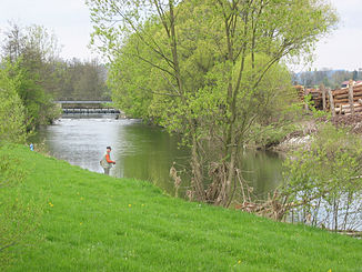
The Rodach am Zollwehr near Neuses ( Kronach ) |
||
| Data | ||
| Water code | EN : 2414 | |
| location |
Thuringian-Franconian low mountain range
Upper Palatinate-Upper Main hill country |
|
| River system | Rhine | |
| Drain over | Main → Rhine → North Sea | |
| source | near Rodacherbrunn am Rennsteig in the Thuringian border area 50 ° 25 ′ 13 ″ N , 11 ° 31 ′ 54 ″ E |
|
| Source height | 690 m above sea level NN | |
| muzzle | at Marktzeuln in the Main Coordinates: 50 ° 9 ′ 26 ″ N , 11 ° 9 ′ 12 ″ E 50 ° 9 ′ 26 ″ N , 11 ° 9 ′ 12 ″ E |
|
| Mouth height | approx. 270 m above sea level NN | |
| Height difference | approx. 420 m | |
| Bottom slope | approx. 7.9 ‰ | |
| length | 53 km | |
| Catchment area | 1,009.88 km² | |
| Discharge at the Unterlangenstadt gauge (70.6% of the catchment area) A Eo : 713.87 km² Location: 6.82 km above the mouth |
NNQ (1947) MNQ 1931-2009 MQ 1931-2009 Mq 1931-2009 MHQ 1931-2009 HHQ (1946) |
220 l / s 1.23 m³ / s 10.4 m³ / s 14.6 l / (s km²) 132 m³ / s 344 m³ / s |
| Discharge A Eo : 1,011.17 km² at the mouth |
MQ Mq |
13.39 m³ / s 13.2 l / (s km²) |
The Rodach , to distinguish it from its left tributary, the Wild Rodach , also known as the Zahme Rodach up to its confluence , is a 53 km long right tributary of the Main in the western Franconian Forest . Not far away there is a tributary of the same name of the Itz .
geography
course
The Rodach rises at about 690 m above sea level. NN near Rodacherbrunn am Rennsteig in the Thuringian border area, flows from there in a southerly direction and forms the 1.5 km border between Bavaria and Thuringia between the tributaries Fränkische Muschwitz and Titschengrundbach . In earlier times, the Titschendorfer raft pond was the starting point for the rafts with which wood was transported from the Franconian Forest to the Netherlands . Just below Nordhalben , the Rodach picks up the Ködel from the right, which shortly before feeds the Mauthaus drinking water reservoir .
In the further course it turns to the southwest, flows through the market communities Steinwiesen and Marktrodach , from the confluence of the Wilden Rodach near Erlabrück along the federal road 173 , and reaches the town of Kronach , where the Haßlach flows from the right . Other places on the Rodach are Küps and Redwitz , before they reach Marktzeuln at about 270 m above sea level. NN flows into the Main.
Tributaries
|
|
Rodach river system
freetime and recreation
Flößerweg
The whole of the Rodach is accompanied by the Rodach hiking trail run by the Franconian Forest Association , also known as the Flößerweg . The approximately 52 km long main route begins at Rodacherbrunn and ends at the confluence of the Rodach in the Main. There is also the approximately 25 km long secondary route along the Wild Rodach , which begins at the source at Rauhenberg and leads to the main path at Erlabrück to the Rodach estuary.
Rodach river educational trail
The river section between Unterlangenstadt and Redwitz an der Rodach was renatured by the Bamberg Water Management Office in 2000 to create a natural meadow landscape . A nature trail leads through the area with a total of 13 information pillars as well as a few additional ones for children, all of which provide information on aspects of the thematic focus on the river and floodplain . The educational trail was laid out as a permanent exhibition as part of the 2002 State Garden Show in Kronach . A bicycle path leads around the meadow landscape, but the nature trail itself is designed as a footpath. The most striking is the Rodachsteg , a steel pedestrian bridge over the Rodach, which is provided with an approximately 10 m high viewing platform.
See also
Individual evidence
- ↑ a b Directory of stream and river areas in Bavaria - Main river area, page 17 of the Bavarian State Office for the Environment, as of 2016 (PDF; 3.3 MB)
- ↑ Bavarian flood news service (as of July 27, 2013)
- ↑ Level data (MQ) from Unterlangenstadt an der Rodach and Fürth am Berg of the Rodach tributary Steinach, increased by the area discharge of the remaining catchment area (7.7 l / s.km²), area discharge determined from level data from Mainleus, Fürth am Berg, Unterlangenstadt, Weismain and Schwürbitz
- ↑ a b c Infobrochure River Landscape Rodach , Ed .: Water Management Office Bamberg, Bamberg 2004
Web links
- Rodach: flood risk management plan , water system , flood characteristics , flood events , government of Lower Franconia
- The Flößerweg - map and description , nordhalben.de
- Level at Rieblich, HND Bavaria
- Level near Erlabrück, HND Bavaria
- Level at Unterlangenstadt, HND Bavaria
- WTG: Rodach at Water Tourism Guide


