
Sense district
| Sense district | |
|---|---|
 |
|
| Basic data | |
| Country: |
|
| Canton : |
|
| Main town : | Tafers |
| FSO number : | 1006 |
| Area : | 265.26 km² |
| Height range : | 482–2238 m above sea level M. |
| Residents: | 43,990 (December 31, 2018) |
| Population density : | 166 inhabitants per km² |
| Website: | www.regionsense.ch |
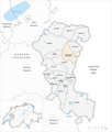
| map | |
 |
|
The Sense District ( French District de la Singine , Freiburg Patois ) is one of the seven districts in the canton of Friborg in Switzerland and the only purely German-speaking of these districts.
geography
It is named after the river Sense , which forms most of its eastern border with the canton of Bern . The Ärgera also flows through the Sense Land, its source is, like that of the Sense , in the Sense Oberland . This is located in the southern part of the district and belongs to the Freiburg Pre-Alps . The north and west, on the other hand, are densely populated and belong to the agglomerations of Bern or Freiburg .
history
Between the 7th and 8th centuries, the Alemanni began to settle the region and were responsible for Germanization and land development through clearing in the southeast of today's canton. In places they crossed the Saane .
The Sense region was first mentioned as Sensuna in 1076 and has been a separate district since the new division of the four former Stadtpanner. Until the Ancien Régime, the Sense district was largely part of the Aupanner and thus part of the territory of the Republic of Freiburg (Respublicas Friburgensis). The Grim district also has its own dialect, as Senslerdeutsch is called.
The head of the Sense district (governor) is Manfred Raemy. The Oberamtmann is elected by the people every five years. He is responsible for public order and has the tools “fire brigade” and “police” at his disposal. He also watches over the good functioning of the communities (appeal body for the decision of the community) and is the administrative body for hunting, fishing and the management of dogs. The Oberamtmann also issues penal orders (areas of traffic offenses and construction police).
population
The Sense District has 43,990 inhabitants (as of December 31, 2018). This makes it the third largest district in the canton. The population density of 166 inhabitants / km² is below the cantonal average.
| local community | 1900 | 1910 | 1920 | 1930 | 1940 | 1950 | 1960 | 1970 | 1980 | 1990 | 2000 | 2010 |
|---|---|---|---|---|---|---|---|---|---|---|---|---|
| Alterswil | 1365 | 1511 | 1592 | 1560 | 1664 | 1613 | 1607 | 1532 | 1538 | 1700 | 1881 | 1929 |
| Bösingen | 1438 | 1662 | 1791 | 1876 | 1887 | 2008 | 2091 | 1729 | 1808 | 2606 | 3117 | 3286 |
| Brünisried | 404 | 431 | 430 | 438 | 434 | 424 | 397 | 404 | 430 | 457 | 561 | 640 |
| Düdingen | 3453 | 3956 | 4160 | 3259 | 3634 | 4033 | 4248 | 4932 | 5572 | 6356 | 6712 | 7325 |
| Giffers | 683 | 661 | 650 | 690 | 768 | 770 | 812 | 1084 | 1185 | 1363 | 1393 | 1420 |
| Heitenried | 748 | 811 | 819 | 758 | 886 | 833 | 771 | 791 | 761 | 905 | 1101 | 1290 |
| Upper shot | 612 | 682 | 658 | 707 | 733 | 761 | 715 | 728 | 708 | 849 | 1006 | 1136 |
| Plaffeien | 1124 | 1315 | 1364 | 1367 | 1466 | 1449 | 1352 | 1448 | 1453 | 1650 | 1938 | 1911 |
| Plasselb | 467 | 509 | 508 | 518 | 560 | 676 | 671 | 648 | 732 | 913 | 980 | 1 013 |
| Keep right | 1088 | 1178 | 1206 | 1080 | 1118 | 1016 | 1015 | 878 | 862 | 958 | 1025 | 1085 |
| St. Antoni | 1523 | 1659 | 1705 | 1615 | 1628 | 1652 | 1574 | 1517 | 1570 | 1725 | 1924 | 1925 |
| St. New Years Eve | 596 | 604 | 654 | 660 | 766 | 761 | 639 | 681 | 796 | 830 | 955 | 922 |
| St. Ursen | 982 | 1067 | 1105 | 1073 | 1085 | 1139 | 1017 | 1027 | 1003 | 1066 | 1162 | 1251 |
| Schmitten | - | - | - | 1461 | 1378 | 1576 | 1694 | 2289 | 2515 | 2819 | 3280 | 3801 |
| Tafers | 964 | 1280 | 1267 | 1436 | 1463 | 1570 | 1621 | 2021 | 2263 | 2324 | 2627 | 2851 |
| Tentlingen | 416 | 402 | 418 | 376 | 407 | 469 | 498 | 598 | 747 | 899 | 1 147 | 1218 |
| Ueberstorf | 1515 | 1476 | 1638 | 1688 | 1642 | 1721 | 1536 | 1552 | 1656 | 1858 | 2115 | 2367 |
| Wünnewil-Flamatt | 1160 | 1542 | 1834 | 1964 | 1963 | 2153 | 2549 | 4016 | 3774 | 4211 | 4916 | 5322 |
| Zumholz | 230 | 246 | 259 | 275 | 303 | 268 | 253 | 259 | 240 | 316 | 459 | 421 |
| Sense district | 18,768 | 20,992 | 22'058 | 22,801 | 23,785 | 24,892 | 25,060 | 28,134 | 29,613 | 33,805 | 38,299 | 41,113 |
Communities
17 communities belong to the Sense District .
| coat of arms | Name of the parish | Population (December 31, 2018) |
Area in km² |
Inhabitants per km² |
|---|---|---|---|---|
|
|
Alterswil | 2028 | 16.14 | 126 |
|
|
Bösingen | 3408 | 14.32 | 238 |
|
|
Brünisried | 645 | 3.25 | 198 |
|
|
Düdingen | 7964 | 30.76 | 259 |
|
|
Giffers | 1634 | 5.22 | 313 |
|
|
Heitenried | 1403 | 9.13 | 154 |
|
|
Plaffeien | 3594 | 66.53 | 54 |
|
|
Plasselb | 1048 | 18.16 | 58 |
|
|
Keep right | 1103 | 7.30 | 151 |
|
|
Schmitten (FR) | 4035 | 13.49 | 299 |
|
|
St. Antoni | 2076 | 16.79 | 124 |
|
|
St. New Years Eve | 958 | 7.04 | 136 |
|
|
St. Ursen | 1345 | 15.72 | 86 |
|
|
Tafers | 3450 | 8.42 | 410 |
|
|
Tentlingen | 1345 | 3.61 | 373 |
|
|
Ueberstorf | 2375 | 16.11 | 147 |
|
|
Wünnewil-Flamatt | 5579 | 13.27 | 420} |
| Total (17) | 43,990 | 265.26 | 166 | |
Changes in the community
Parishes until 1859

Municipalities until 1921

Municipalities until 1952

Municipalities until 1961

Municipalities until 1970

Municipalities until 1973

Municipalities until 2016


- 1860: Name change from Schrickschrot → St. Antoni
- 1953: Change of name from Bösingen → Grossbösingen
- 1962: Change of name from Grossbösingen → Bösingen
- 1974: Name change from Wünnewil → Wünnewil-Flamatt
- 2017: Merger Oberschrot , Plaffeien and Zumholz → Plaffeien
See also
Web links
- Association of Sense Region municipalities
- Moritz Boschung: Scythe. In: Historical Lexicon of Switzerland .
Individual evidence
- ↑ Permanent and non-permanent resident population by year, canton, district, municipality, population type and gender (permanent resident population). In: bfs. admin.ch . Federal Statistical Office (FSO), August 31, 2019, accessed on December 22, 2019 .
- ↑ Statistical Yearbook of the Canton of Friborg - 2012 ( Memento of the original from June 17, 2012 in the Internet Archive ) Info: The archive link was inserted automatically and has not yet been checked. Please check the original and archive link according to the instructions and then remove this notice. (PDF document), from January 2012, Office for Statistics of the Canton of Friborg
- ↑ Federal Statistical Office Generalized Limits 2020.
Alterswil | Bösingen | Brünisried | Düdingen | Giffers | Heitenried | Plaffeien | Plasselb | Keep right | Schmitten | St. Antoni | St. New Years Eve * | St. Ursen | Tafers | Tentlingen | Ueberstorf | Wünnewil-Flamatt
* This municipality does not own any objects of the categories A or B, but can have (currently undocumented) C objects.