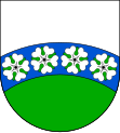
Slaná
| Slaná | ||||
|---|---|---|---|---|
|
||||
| Basic data | ||||
| State : |
|
|||
| Region : | Liberecký kraj | |||
| District : | Semily | |||
| Area : | 1026.3366 ha | |||
| Geographic location : | 50 ° 35 ' N , 15 ° 20' E | |||
| Height: | 358 m nm | |||
| Residents : | 683 (Jan. 1, 2019) | |||
| Postal code : | 512 01 | |||
| License plate : | L. | |||
| structure | ||||
| Status: | local community | |||
| Districts: | 6th | |||
| administration | ||||
| Mayor : | Vlastimil Schovánek (as of 2007) | |||
| Address: | Slaná 94 51201 Slaná u Semil |
|||
| Municipality number: | 577529 | |||
| Website : | www.obecslana.cz | |||
Slaná (German Slana ) is a municipality in the Czech Republic . It is located two kilometers south of Semily and belongs to the Okres Semily .
history
The first written mention of the village comes from 1430. From 1634 Slaná belonged to the Semily domain. In 1652 the place was divided: Slaná - like the neighboring Nedvězí - belonged partly to Semily and Lomnice nad Popelkou . In 1714 the village became part of the Bunzlauer Kreis. After the removal of patrimonial Slaná became an independent municipality in the Gitschin district in 1849 ; since 1868 the place belonged to the district Semil. In 1880 there was a merger with Bořkov, with the town council in Slaná holding its meetings and the mayor sitting in Bořkov. As early as 1882, the community was canceled again. In the same year the state road from Semily via Slaná and Zelený háj to Lomnice nad Popelkou was built. In 1923 Nedvězí received a train station on the railway from Reichenberg to Pardubice , after the trains had passed without stopping since 1858. In 1925 the villages of Nedvězí and Hořensko were separated from the Slaná municipality. The first bus from Semily to Lomnice passed through Slaná in 1930.
In 1953 Nedvězí and Hořensko were incorporated again. Since 1960 Bořkov has also been part of Slaná.
Community structure
The municipality Slaná consists of the districts Bořkov ( Borschkau ), Hořensko ( Horschensko ), Nedvězí ( Nedwies ), Slaná ( Slana ), Sutice ( Sutitz ) and Světlá ( Swietla ). Basic settlement units are Blaživky, Bořkov, Hořensko, Nedvězí, Poříčí and Slaná.
The municipality is divided into the cadastral districts Bořkov, Hořensko, Nedvězí u Semil and Slaná.
Individual evidence
- ↑ http://www.uir.cz/obec/577529/Slana
- ↑ Český statistický úřad - The population of the Czech municipalities as of January 1, 2019 (PDF; 7.4 MiB)
- ↑ http://www.uir.cz/casti-obce-obec/577529/Obec-Slana
- ↑ http://www.uir.cz/zsj-obec/577529/Obec-Slana
- ↑ http://www.uir.cz/katastralni-uzemi-obec/577529/Obec-Slana

