
Speyer city fortifications


Speyer city fortification in the narrower sense describes the Speyer city wall , the fortress system , today its remains, which the Speyer bishops as city lords and later the citizens of Speyer built from approx. 948 to protect the city from military attacks.
Based on the first Ottonian city wall built around 946 to 950 on behalf of Bishop Reginald as the new city lord, the fortifications consisted of walls, up to 71 towers, gates , gates and z. T. lined and z. Some of the irrigated trenches were built, maintained, reinforced, and later expanded by four suburbs and modernized again and again at great expense over centuries. In the course of time, a Landwehr with Landwehr trenches, ramparts, Landwehr hedges and waiting areas was built as a preliminary defense, see: Speyerer Landwehr .
Fundamental qualitative changes were the reconstruction of the fortifications in response to the advent of the crossbow in the 14th century and later reinforcements and extensions in response to the appearance of the first firearms in the 15th century, when berm walls , gun stands and kennels were added. This military system came to an end when Louis XIV ordered the destruction of the city and its fortifications in 1689.
The devastated and abandoned city for 11 years was rebuilt from 1698 and a city wall was built again from 1700 with the first gates until 1730, but it was no longer intended to allow military defense. Their purpose was only to offer protection against attacks, thieves, robbers, rabble and debauchery and to bundle the flow of goods at the gates. This wall had police functions until around 1814 (last expansion plan).
When the Bavarian administration moved in in 1816, this phase ended and the time for the demolition and utilization of the stones began. In 1819 the Land Commissioner allowed the inner structures to be torn down, the outer wall initially had to remain up to three meters high. Most of it was destroyed by 1826, but demolition continued until 1958 when a demolition permit was issued for the falcon tower.
Today, the remains of the Speyer city fortifications , which are modest apart from the old gate, are under monument protection .
Fortifications during Roman rule and the transition period
In a broader sense, Speyer city fortifications also mean the fortifications in the four centuries of Roman rule .
These were initially the three successive castles, the first A built under Drusus from approx. 10 BC, the second B built after the defeat of Varus in 9 AD and the third C under Tiberius approx. 30 AD The civil settlement of Noviomagus that was built around the forts was initially unsecured. For protection purposes, the Romans settled the Nemeter , as a Germanic federate tribe, in the area around Speyer and made their Noviomagus the capital of the Nemetergau as the Civitas Nemetum. Emperor Valentinian I secured Nemetum in 369 with a strong fortress with about 2.5 meters thick walls and a naval port. After the successful conquest of the Vandals and Alans at the turn of the year 406/407, the Romans first settled Burgundians , which in 430 were resettled in today's Burgundy . Every Roman administration ended in 454 with the murder of the Western Roman army master Etius . Ultimately, the Franks prevailed in Speyergau , who initially did not build fortifications, but lived in unfortified villages. In 946, the Sal-Franconian Duke Konrad the Red transferred the city, initially administered by a count, to the Speyer bishop Reginald, who had the first Ottonian city wall built between 946 and 950 in view of the Hungarian military campaigns .
Overview of chronology
- 946 to 950 erection of the Ottonian city wall under Speyer Bishop Reginald in the time of the Normans and Hungarian invasions , when it became clear that the use or expansion of old Roman walls for defense often meant salvation. The building was also a symbol of the unrestricted rule of the city by the bishop. At first the complex consisted only of walls and gates.
- 955 End of the Hungarian danger through the battle on the Lechfeld .
- Around 1050 a new wall ring was erected to secure the expansion of the city as part of the construction of the cathedral, the early Salian city wall. In the course of the course it roughly corresponded to the western end of the Civitaes Nemetum presumed today before the first Alamans invasion of 275.
- Presumably soon after 1080, the late Salian ramparts were extended to the northeast (Augustinian line) in order to secure the renewed urban expansion in the course of the cathedral building 2.
- The cathedral hill walling was also expanded in the late Salian period.
- Probably at the time of Bishop Johannes (1090–1104) the late Salian north walling ( Hirschgraben line) was built.
- In 1116, the siege by Archbishop Adalbert von Mainz failed on the Speyer city wall .
- 1128 besieged King Lothar III. with Archbishop Adalbert of Mainz and the Speyer bishop three months in vain.
- 1129 Lothar III closed. with his army the city again. After six months of successful defense, the city gave up because of starvation.
- In 1134 Duke Konrad von Schwaben besieged the city, but had to relieve Lothar III. give way.
- In 1201, the opposing king Otto IV besieged King Philip of Swabia in Speyer. Philipp escaped by ship, Otto IV had to break off the siege with losses.
- In 1206 King Otto IV besieged Speyer again, but after a failed siege had to give way to a relief lord from King Philip of Swabia.
- Around 1230 during the late Staufer gate tower campaign, the first four gate towers were erected, the old gate, the willow gate, the Rhine gate and the new gate.
- Around 1240 the stacking area at the new port on the north side of the city (fish market) was walled, with bricks instead of sandstone being used for the first time .
- Around 1250, Mr. Uto's corner tower on the Domhügelsporn , the Utenturm, was built.
- Around 1260 the wall was reinforced by blind arches.
- From 1278 the citizens strengthened the Salian wall from the cathedral hill and began to surround the area of the bishop with whom they were in dispute with extremely high towers. During the 1280 tower campaign:
- Corner towers: Red Tower, Judenturm, Schmiedturm
- Stream front: salt tower, wooden gate tower, watering tower
- Rhine front: Nikolauspfortenturm, Heidenturm, Zimmerleutturm, Metzgerturm, Armbrusterturm
The sight of the Uten, Zimmerleut, Armbrusterturm, Rheinpörtel, Schmiedturm, Neupörtel, Altpörtel and Red Tower impressed the English travel writer Coryate 300 years later. Coryate, who had traveled from London via France to northern Italy, visited Speyer on the return journey from Venice. He wrote about his impression of Speyer: It is surrounded by strong walls with towers that are as tall as our church towers, the tallest towers in a wall that I saw on my journey. A remarkable judgment after Coryate's long journey. Any idea of such a turreted wall conveys today almost the Museggmauer in Lucerne .
- In 1331, after the Severin storm, the half-roof tower (Schusterturm), the Maulbronn garden tower (powder tower) and probably the baker's tower were built.
- By the 14th century, four suburbs were formed, southwest the Gilgenvorstadt, northwest the suburb Altspeyer (the former village Altspeyer), northeast the suburb over the Hasenpfuhl and southeast the Marxenvorstadt (also fisher suburb).
- The Gilgenvorstadt were walled in the period between 1320 and 1334, probably 1324 to 1326.
- The suburb over the Hasenpfuhl was walled around 1335 and secured with the Lauerturm.
- In 1340 the Bachriegel buildings were erected, the Obere Bachriegel, the Untere Riegel (Gackturm) and the Untere Lauerpforte.
- In 1350 at the latest the Bäckerturm and the Eurichsturm, perhaps also the Judenturm, were built.
- The St. Marxen suburb was walled around 1365. Remnants of this wall are still standing on Karl-Leiling-Allee and next to the rescue station. There are also remains of the city wall under Markusstrasse. In addition, remnants of the wall came to light during construction work on the site of the former Melchior-Hess felt factory. A part of this wall remains forms the back wall of the Hofschlösschen, another part is underground. Since the maintenance of the underground remains can only be achieved with a great deal of effort due to the planned new buildings, these should be removed and the stones thus obtained used for the repair of other wall remains.
- The suburb of Altspeyer was walled around 1380. The village of Spire (later Altspeyer) north of Speyer had a wall around it since around 1080, as did the Jewish quarter created there.
- In 1410 the second windmill was built on the windmill tower (red tower).
- In 1602 the oldest powder mill in the Palatinate was built at Woogbach . In its prime, this was operated in shifts around the clock. The miller and councilor Kohn owned another mill there on Schießberg. The buildings went under, but the Pulvermühlenweg in Speyer still reminds of this production today . The black powder was stored in the powder tower of the Speyer city fortifications.
Towers and gates of the city fortifications of Speyer
Since 1469 the strongest towers were assigned to the guilds for defense. The defenders of the towers emerge from the weapons inventory of 1611:
- Salt tower - salt caster
- Lauerturm - Lauer
- Judenturm - Baker
- Grave digger tower - cobbler
- Weidentor - shopkeeper
- Red Tower - Weber
- Eurichsturm - Tucher
- Neupörtel - butcher
- Forge tower - forge
- Crossbow tower - Münzer
- Zimmermannsturm - carpenters
- Kürschnerturm - Kürschner
- Nikolausturm - tailor
- The city governor and his mercenaries were responsible for the old gate, and probably all the other towers.
Inner ring
- Altpörtel or Old Castle Gate
- Eurichsturm
- Round tower (also old mill tower or windmill tower, only demolished in 1891)
- Red Tower (demolished in 1819)
- The little gate at the Red Tower
- Willow Gate Tower
- Bäckerturm (also gravedigger tower)
- Judenturm
- Lauerturm (already demolished in 1772)
- Upper Lauerpförtchen
- Schusterturm (also Powder Tower, collapsed by itself in 1760, remains are still preserved - only rediscovered in 1990)
- Lower Lauertor
- Salt gate tower
- Holztorturm (also Mittelstegturm or Holzburgtor, on the Mittelsteg over the Speyerbach )
- Bar at the exit of the city stream
- Drinking tower (demolished before 1790)
- St. Nicholas Gate Tower (also Nikolausturm or Domstaffelturm, demolished in 1831)
- Uden or Kürschnerturm
- Heidenturm, today Heidentürmchen
- Zimmerleutturm (also Zimmermannsturm, demolished in 1771)
- Butcher tower
- Crossbow tower (demolished in 1819)
- Rheintorturm (also White Gate Gate Tower or Rheinburgtor)
- Forge tower (only a few remains)
- New mortar
Gilgenvorstadt
- Alexius Tower
- Tower of the Dragon (still mostly standing)
- Tower to the pigeon (still standing)
- Tower zum Bock (still mostly standing)
- Tower to the rooster
- Tower to the angel
- Kreuztorzwinger (inner wall)
- Streifertorturm
- Tower to the crane
- Nightingale tower
- Tower within reach
- Tower of the Falcon (only demolished in 1958)
- St. Gilgen Gate
- Kreuztorzwinger (outer wall)
- Holy Cross Gate
- Tower to the eagle
- Tower to the parrot
- Tower to the guard
- Tower to the bouquet
- Tower to the "Maiße" (titmouse)
- Mühltörlein
- Hatzelturm (Tower to Atzel, Elster)
- Turm zum Kauz
- Tower to the hawk
- Tower to the Schwalbe (partly still preserved, not accessible)
- Tower to the stork
- Klüpfelstor and -turm
Suburb Altspeyer
Western and northern flanks
- Tower to the linden tree
- Tower to the fir tree (at the Judenkirchhof)
- Tower to the oak
- Alder Tower
- Birch Tower (Siechenturm)
- Heiliggrabtor (also Wormser Tor)
- Theft gate and tower at the Diebsbrücke
- Woog Tower
Eastern flank
- Sentry box to the fox
- Guard house to the wolf
- Guard house to the peacock
Suburb above the Hasenpfuhl
- Upper Speyerbachriegel, the battlements crossed the stream with two large arches that were cordoned off with two wooden bars. A gap in the gate of the western arch allowed the passage for boats and driftwood .
- Allmendtörlein (passage, the "Almentorlin on Knoltzengasse")
- Tower of the Bear (remains are still preserved)
- Tower of the Lion (remains are still preserved)
- Tower of the Widder (remains are still preserved, in the garden of St. Magdalena )
- Farrenturm
- Kühtor or Rheintor (cow gate, demolished around 1860)
- Nebentörlein at the Gackturm
- Gackturm (lower bar)
- Gate to the Bachstaden
St. Mark's suburb
- Fischertorturm
- Outer fishing gate
- Stephansturm
- Euwenturm
- Schleicherturm (formerly the tower behind the Wasenmeister )
- St. Mark's Gate (Marxtorturm)
- Mutton Tower
- Pipe tower
- Inner St.-Germanstor (Germansturm to double hook)
- Outer St. Germanstor
Trench system
The trench system consisted of the
- Inner city ditch, u. a. Postgraben, Hirschgraben , Mühlbach, Karmelitergraben, Alexgraben,
- Vorstadtgraben in front of the Gilgentor, with Gilgengraben, Klüpfelsgraben,
- the city ditches in the lowlands: Germansgraben, Graben an der Steingasse (Old Harbor), the Froschau, the Marxengraben, the Graben am Spich, the Hasenpfehler Rheinarm, the Speyerbach, the Speyerbach before Altspeyer, the Eselsdamm, the ditch before the Hasenpfehler Wall.
Remaining stock today
The comparatively very modest remnants of the Speyer city fortifications are now protected as a monument zone . In addition to the old gate , the Heidentürmchen (in the eastern cathedral garden ), the lower part of the Schmiedturm (at the southern end of Zeppelinstrasse), the following towers also exist: From the fortification of Gilgenvorstadt, the three stumps of the wall of the round towers Zum Drachen , Zur Taube , Zum Bock and the remains of the Schwalbenturm with ditch. From the fortification of the suburb above the Hasenpfuhl two rectangular wall towers Zum Bären and Zum Löwen (near Bärengasse and Löwengasse) and the remains of the former arch bridge and lock bar . There are remains of the city wall in the area of the houses Am Hannelturm 1, Allerheiligenstraße 23, 24–31, Bahnhofstraße / Am Klipfelstor, Bahnhofstraße / Adenauerpark, Domgarten, Domplatz 6, Farrenturmstraße 9-19, Feuerbachstraße 1, Fischergasse 11–29, Große Pfaffengasse 1–5 , Gutenbergstrasse 1, Hasenpfuhlstrasse 37,38, Hirschgraben, Holzmarkt 4, Karl-Leiling-Allee 5, Lauergasse 2–7, 11–16, 21–37, Mühlturmstrasse 12–26, Neufferstrasse / Am Drachenturm, Petschengasse 4,6, Pistoreigasse 1,2,8-14, Rheintorstrasse 6-9, Roßmarktstrasse 11-23,26,27,35. St-Markus-Strasse 43, Schiffergasse 22, 23, Steingasse 17, Zeppelinstrasse. 1,3,5,7,9, 31,33,35,37,39
Parts of the former city fortifications that are accessible to the public are mostly well preserved or restored (e.g. Fischergasse 11–29 on the back), while other remnants of the city wall are in a rather desolate condition (e.g. on the back in Allerheiligenstrasse 24–31 or in Grosse Pfaffengasse 1–5).
- Remnants of the city wall

Remnants of the wall on the back at Allerheiligenstrasse 24–31
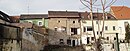
Remnants of the wall on the back in Grosse Pfaffengasse 1–5


literature
- Karl Rudolf Müller: The walls of the Free Imperial City of Speyer as a framework for the city's history. District group Speyer of the Historical Association of the Palatinate, Speyer 1994, DNB 941851907 .
Individual evidence
- ↑ Timeline ( memento of May 13, 2012 in the Internet Archive ) on the history of the city of Speyer on speyer.de
- ↑ The Imperial Cathedral of Speyer - History - Timeline ( Memento of the original dated November 16, 2012 in the Internet Archive ) Info: The archive link was inserted automatically and has not yet been checked. Please check the original and archive link according to the instructions and then remove this notice.
- ^ Herbert Dellwing : Cultural monuments in Rhineland-Palatinate. Volume 1: City of Speyer . Ed .: State Office for Monument Preservation. 2nd Edition. Schwann, Düsseldorf 1990, ISBN 3-88462-801-1 .
- ↑ Soil steeped in history. In: The Rheinpfalz - Speyrer Rundschau. June 6, 2014.
- ↑ Christoph Schennen: The powder mill was a dangerous workplace. In: Speyerer Morgenpost . June 7, 2014, p. 1.
- ↑ Informational directory of cultural monuments, district-free city of Speyer, p. 4. (PDF file; 1.1 MB)
- Karl Rudolf Müller: The walls of the Free Imperial City of Speyer as a framework for the city's history. District group Speyer of the Historical Association of the Palatinate, Speyer 1994, DNB 941851907 .
- ↑ p. 190.
- ↑ p. 94.
- ↑ p. 191ff.
- ↑ p. 197ff.
- ↑ p. 304ff.
- ↑ p. 313.
- ↑ p. 316.
- ↑ p. 94.
- ↑ pp. 321-323
- ↑ p. 324.
- ↑ p. 92.
- ↑ p. 93.
- ↑ p. 94.
- ↑ p. 95.
- ↑ p. 94.
- ↑ p. 102.
- ↑ pp. 102-108.
- ↑ pp. 109-113.
- ↑ p. 114.
- ↑ pp. 115-124.
- ↑ p. 116.
- ↑ p. 292.
- ↑ p. 292.
- ↑ p. 293.
- ↑ p. 292.
- ↑ p. 175.
- ↑ p. 293.
- ↑ p. 125.
- ↑ p. 178.
- ↑ p. 184.
- ↑ pp. 131-133.
- ↑ p. 174.
- ↑ pp. 24-41
- ↑ pp. 41-51
- ↑ pp. 51-56
- ↑ p. 56.
- ↑ P. 56–62 (for the list)
- ↑ pp. 62-64
- ↑ pp. 207-232
- Fritz Klotz: Speyer, a little city history. Contributions to the history of the city of Speyer, issue 2, Speyer district group of the Palatinate Historical Society, 1971, several editions.
See also
For the rural construction program for protective castles during the Hungarian invasions, see for example:
Web links
- Karl Rudolf Müller, The Imperial City of Speyer around 1525
- Side of the city of Speyer to the old gate
- Side to the Heidentürmchen
- Two historical postcards (can be enlarged) from the bolt, at speyerbach.info
- Side of the RGMZ for Roman fortifications
- A piece of the Speyer city wall that was built in
- Tower names of the city wall and their meaning