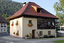
Steuerberg
|
Steuerberg
|
||
|---|---|---|
| coat of arms | Austria map | |
|
|
||
| Basic data | ||
| Country: | Austria | |
| State : | Carinthia | |
| Political District : | Feldkirchen | |
| License plate : | FE | |
| Surface: | 32.78 km² | |
| Coordinates : | 46 ° 47 ' N , 14 ° 7' E | |
| Height : | 782 m above sea level A. | |
| Residents : | 1,610 (January 1, 2020) | |
| Population density : | 49 inhabitants per km² | |
| Postal code : | 9560 | |
| Area code : | 04271 | |
| Community code : | 2 10 10 | |
| NUTS region | AT212 | |
| Address of the municipal administration: |
No. 40 9560 Steuerberg |
|
| Website: | ||
| politics | ||
| Mayor : | Karl Petritz ( ÖVP ) | |
|
Municipal Council : ( 2015 ) (15 members) |
||
| Location of Steuerberg in the Feldkirchen district | ||
| Source: Municipal data from Statistics Austria | ||
Steuerberg is a municipality with 1610 inhabitants (as of January 1, 2020) in the Feldkirchen district in Carinthia .
geography
Steuerberg is located in the Gurktal Alps between the Gurktal and the Wimitztal , about 10 km north of Feldkirchen .
Community structure
Steuerberg is divided into the four cadastral communities Altsteuerberg, Neusteuerberg, Wabl and Wachsenberg. The municipal area includes the following 31 localities (population in brackets as of January 1, 2020):
- Dolnitz (23)
- Eden (3)
- Edern (24)
- Edling (56)
- Felfern (38)
- Fuchsgruben (62)
- Glabegg (15)
- Goggau (20)
- Trench (34)
- Hard (149)
- Hinterwachsenberg (4)
- Jeinitz (28)
- Kerschdorf (126)
- Köttern (85)
- Kraßnitz (27)
- Niederwinklern (26)
- Polling (26)
- Prapra (10)
- Rain field (50)
- Rennweg (173)
- Red apple (48)
- Sallas (0)
- St. Martin (3)
- Sassl (5)
- Severgraben (0)
- Steuerberg (137)
- Thörl (3)
- Unterhof (57)
- Wabl (24)
- Wachsenberg (353)
- Wiggis (1)
Neighboring communities
| Albeck | Weitensfeld | |
| Gnesau |

|
Frauenstein |
| Himmelberg | Feldkirchen | Santa Urban |
history
"Touernich" (after Kranzmayer "village on the good brook"), the former name of Steuerberg, was mentioned in an undated donation note from the Admont monastery , the creation of which could be narrowed down to the years between 1130 and 1145. 1147 appears a donation of two Huben in Glödnitz and an inn "ad Touernich" from "Reginher de Touernich", son of Swiker von Hollenburg and probably a liegeman of Bernhard von Spanheim , to Admont. In 1169, a "Reginherus de Steyrberch" was mentioned in a document, which is considered the oldest mention of the current community name. The reason for the appearance of the place name "Steierberg" is the transfer of his possessions and his entourage to the Styrian margrave due to the battle death of Count Bernhard in November 1147.
From the 15th century, today's Wimitzer Landesstraße gained importance as a trade route.
After the French Wars, Upper Carinthia belonged to the Illyrian provinces of France from 1809. The border between France and the Austrian Empire ran through the middle of Steuerberg until 1814. A boundary stone (with the wrong year) on the Goggausee Landesstrasse still reminds of this fact today.
When political communities were formed, today's community area was initially incorporated into the large community of Feldkirchen . The cadastral communities of Wabl, Alt- and Neusteuerberg, however, spoke out in 1864 for the separation of Feldkirchen. In the following year, the Carinthian state parliament approved the request, so that in 1866 the municipality of “Steierberg” was constituted from the three named and the KG Wachsenberg. Since then, the municipality has changed little: in 1923 the southernmost part of Wachsenberg became part of the then independent municipality of Waiern, and in the course of the municipal structural reform in 1972/73, Steuerberg received smaller parts from the municipalities of Himmelberg and Weitensfeld.
population
At the time of the 2001 census, Steuerberg had 1,693 inhabitants, 97.4% of whom were Austrian and 1.7% German citizens. 78.4% of the population confessed to the Roman Catholic and 16.7% to the Protestant Church, 3.2% were without religious belief.
Culture and sights
“ Tavagnacco fountain” in Steuerberg
In Wachsenberg : the Catholic parish church of St. Andrew . Former sacristan's house, a two-storey wooden building from the 18th century.
From Wachsenberg, a footpath leads to the Kitzel ( 1091 m ) to the Catholic branch church of St. Egidius, the so-called Kitzelkapelle . From here you have a beautiful view to the south to the Karawanken and Julian Alps, to the northwest to the Gurktal Alps.
Economy and Infrastructure
Traditionally, the area is largely determined by agriculture and forestry, even if tourism has become more and more important in recent decades. However, the proportion of people commuting to the nearby town of Feldkirchen and to more distant workplaces has also risen sharply.
Steuerberg is one of the nine founding members of the Carinthian Wood Road Association. In 2001 a church day on the topic of Holzstrasse was held here. A wooden fountain trough decorated with flowers in front of the elementary school commemorates this event.
politics
The municipal council of Steuerberg has 15 members and has been composed as follows since the municipal council election in 2015 :
mayor
- since 1985 Karl Petritz (ÖVP).
coat of arms
The coat of arms, which was awarded to the municipality on March 8, 1966, refers to the eponymous castle in Steuerberg or to the first verifiable seal of the ministerials resident there (seal of Otto von Steierberg on a document dated June 15, 1305). The connected three shields depicted on it are apparently intended to strengthen the main shield and make it more resistant; the coat of arms has nothing to do with rudders.
The official blazon of the coat of arms reads: "In green three silver shields connected by black straps with a black hump ring in a three-pass."
The flag is green and white with an incorporated coat of arms.
Partner municipality
literature
- Wilhelm Wadl (Ed.): Steuerberg. Hidden paradise in the heart of Carinthia . Verlag Johannes Heyn, Klagenfurt 2001, ISBN 3-85366-975-1
Web links
- Municipality of Steuerberg
- 21010 - Steuerberg. Community data, Statistics Austria .
Individual evidence
- ↑ Statistics Austria: Population on January 1st, 2020 by locality (area status on January 1st, 2020) , ( CSV )
- ↑ How Steuerberg got its name ( Memento of the original from September 24, 2015 in the Internet Archive ) Info: The archive link was inserted automatically and has not yet been checked. Please check the original and archive link according to the instructions and then remove this notice.
- ^ Statistics Austria, population census, demographic data. May 15, 2001, accessed March 3, 2019 .
- ↑ freytag & berndt, hiking map 231: Hemmaland Gurktal Metnitztal Feldkirchen St. Veit an der Glan
- ^ Quoted from Wilhelm Deuer: The Carinthian municipal coat of arms . Publishing house of the Kärntner Landesarchiv, Klagenfurt 2006, ISBN 3-900531-64-1 , p. 274


