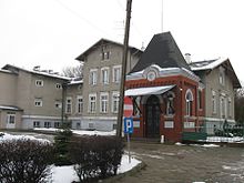
Tczew (rural community)
| Gmina Tczew | ||
|---|---|---|

|
|
|
| Basic data | ||
| State : | Poland | |
| Voivodeship : | Pomerania | |
| Powiat : | Tczew | |
| Geographic location : | 54 ° 6 ' N , 18 ° 47' E | |
| Height : | 25 m npm | |
| Residents : | see Gmina | |
| Telephone code : | (+48) 58 | |
| License plate : | GTC | |
| Economy and Transport | ||
| Street : | E 75 Toruń - Gdansk | |
| Next international airport : | Danzig | |
| Gmina | ||
| Gminatype: | Rural community | |
| Gmina structure: | 36 villages | |
| 26 school offices | ||
| Surface: | 170.61 km² | |
| Residents: | 14,798 (Jun. 30, 2019) |
|
| Population density : | 87 inhabitants / km² | |
| Community number ( GUS ): | 2214062 | |
| administration | ||
| Wójt : | Roman Rezmerowski | |
| Address: | ul.Lecha 12 83-110 Tczew |
|
| Website : | www.gmina-tczew.pl | |
The Gmina wiejska Tczew is a rural community in the Polish Pomeranian Voivodeship and Powiat Tczewski (district). The seat of the rural community is the city of Tczew ( German Dirschau ), which belongs to the district but not to the community. The Gmina has an area of 170.6 km² and 14,798 inhabitants (as of June 30, 2019).
geography
The rural community encloses the city of Tczew in the north, west and south. The Vistula forms part of the eastern border. Neighboring municipalities and places are: Lichnowy , Miłoradz , Pszczółki, Skarszewy, Starogard Gdański , Subkowy, Suchy Dąb , Trąbki Wielkie and Tczew.
Community structure
The following localities, which form 26 school district offices ( sołectwo ), belong to the municipality :
| Polish name | German name (until 1920 and 1939-1945) |
|---|---|
| Bałdowo | Baldau |
| Boyary | Bo years |
| Boroszewo | Borroschau (1942–1945 Borschau ) |
| Czarlin | Czarlin (1942–1945 Schedlin ) |
| Czatkowy | Czattkau (1942–1945 Schattkau ) |
| Dąbrówka Tczewska | Damerau |
| Dalwin | Dalwin |
| Damaszka | Damaschken |
| Gniszewo | Gnieschau |
| Goszyn | Goshin |
| Knybawa | Kniebau (1942–1945 Knieben ) |
| Koziary | Koziary (1942–1945 Zickental ) |
| lady | Wiesenau |
| Lineiewko | Liniewken (1942–1945 Leinfeld ) |
| Lubiszewo Tczewskie | Love show |
| Łukocin | Lukoschin (1942–1945 Lauken ) |
| Malenin | Mahlin |
| Małe Rokitki | |
| Małe Turze | Klein Turse |
| Małżewko | Little Malsau |
| Małżewo | Great Malsau |
| Mieścin | Mestin (1942–1945 Mesten ) |
| Miłobądz | Mühlbanz |
| Miłobądz Mały | Klein Mühlbanz |
| Młynki | |
| Owczarki | Owscharken (1942–1945 sheep farm ) |
| Piwnice | Piwnitz |
| Polesie | |
| Rokitki | Rokittken (1942–1945 Rokitten ) |
| Rucosine | Rukoschin (1942–1945 Hornwalde ) |
| Śliwiny | Schliewen |
| Stanislawie | Stenzlau |
| Swarożyn | Swaroschin (1942–1945 Paleskenhof ) |
| Świetlikowo | Klein Dalwin (1854–1945 Lichtenstein ) |
| Szczerbięcin | Czerbienschin (1906-1919, 1939-1945 Scherpingen ) |
| Szpęgawa | Spangau |
| Tczewskie Łąki | Dirschauerruh |
| Turze | Great Turse |
| Waćmierek | Klein Watzmirs (1942–1945 Kleinwatzdorf ) |
| Wędkowy | Wentkau |
| Zabagno | Sabagno |
| Zajączkowo | Liebenhoff (1942–1945 Liebenhof ) |
| Zajączkowo-Dworzec | |
| Zajączkowo-Wybudowanie | |
| Zwierzynek | Hirsenmühl (1828–1942 Ludwigsthal , 1942–1945 Ludwigstal ) |
Settlements and settlements without a Schulzenamt are: Bojary • Czarlin-Dworzec • Boroszewko • Damaszka • Knybawa • Koziary • Lądy • Liniewko • Małe Rokitki • Małe Turze • Mały Miłobądz • Młynki-Dworzec • Młynki • Zagnoów • Zagnołek • Zagnoów • Stagnice • Poland Zajączkowo-Dworzec • Zajączkowo-Wybudowanie • Zwierzynek.
traffic
The traffic conditions are very favorable, the north-south highway in Poland has several exits in the municipality, south of the district town the highways A1 and DK 22 intersect (corresponding to the former imperial roads R 2 and R 1 ), over which the nearby cities cross Danzig , Malbork (Marienburg) , Grudziądz (Graudenz) and Starogard Gdański (Prussian Stargard) can be reached.
As a junction station with the railway lines along the Vistula, Tczew is an important railway junction in northern Poland, with direct connections also to Gdansk, Warsaw , via Bydgoszcz (Bromberg) to Poznan and to Piła .
literature
- Franz Schultz : History of the Dirschau district , Dirschau 1907 ( digital version of the register )
Web links
- Rural Municipality Website (Polish)
Individual evidence
- ↑ population. Size and Structure by Territorial Division. As of June 30, 2019. Główny Urząd Statystyczny (GUS) (PDF files; 0.99 MiB), accessed December 24, 2019 .


