Temuco
| Temuco | ||
|---|---|---|
|
Coordinates: 38 ° 44 ′ S , 72 ° 36 ′ W Temuco on the map of Chile
|
||
| Basic data | ||
| Country | Chile | |
| region | Región de la Araucanía | |
| City foundation | February 24, 1881 | |
| Residents | 236,377 (2017) | |
| - in the metropolitan area | 278,513 | |
| City insignia | ||
| Detailed data | ||
| surface | 464 km 2 | |
| Population density | 530 people / km 2 | |
| height | 360 m | |
| Waters | Río Cautín | |
| Post Code | 4780000 | |
| prefix | 45 | |
| Time zone | UTC −4 | |
| Website | ||
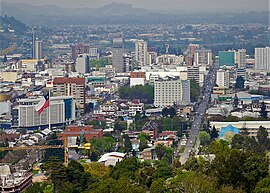
| Temuco from Cerro Ñielol mountain | ||
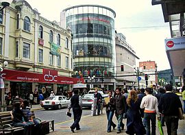
| City center | ||
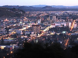
Temuco (from the Mapudungun : temu " myrtle species Blepharocalyx cruckshanksii" + ko "waters") is a city in southern Chile . It is a center of the Mapuche ( Araucans ), but also of the German-Chileans . The chessboard-like city has 236,377 inhabitants (as of 2017) and is the capital of the Región de la Araucanía in the Little South . The Temu is a medicinal plant of the myrtle family.
geography
Temuco is scenic about 670 km south of Santiago de Chile and 107 m above sea level. The Pacific is about 80 km further west.
The climate is comparable to that of Germany . Especially in winter there it rains a lot, snowfalls are rather rare. To the east and south of the city flows the Río Cautín , which is called the Río Imperial towards the sea . To the east of the city are several active large volcanoes , such as Villarrica at 2840 m and the Volcán Llaima at 3125 m. The Llaima volcano last erupted in January 2008.
| Temuco | ||||||||||||||||||||||||||||||||||||||||||||||||
|---|---|---|---|---|---|---|---|---|---|---|---|---|---|---|---|---|---|---|---|---|---|---|---|---|---|---|---|---|---|---|---|---|---|---|---|---|---|---|---|---|---|---|---|---|---|---|---|---|
| Climate diagram | ||||||||||||||||||||||||||||||||||||||||||||||||
| ||||||||||||||||||||||||||||||||||||||||||||||||
|
Average monthly temperatures and rainfall for Temuco
Source: wetterkontor.de
|
|||||||||||||||||||||||||||||||||||||||||||||||||||||||||||||||||||||||||||||||||||||||||||||||||||||||||||||||||||||||||||||||||||||||
history
In 1552 Pedro de Valdivia reached the area around Temuco, but the establishment of settlements in the Mapuche area turned out to be fatal. Many settlers and soldiers died as a result of the armed conflict; Pedro de Valdivia died in the Battle of Tucapel in 1553. When Pelantaro was elected the new Toqui of the Mapuche in 1597 , all settlements south of the river Biobio were destroyed. From 1602 the Spaniards withdrew from the area.
After Chilean independence, the Temuco fortress was officially founded on February 24, 1881 in order to better control the newly conquered Mapuche area.
A historic railway bridge with 11 arches of 35 m crosses the river Cautín to the south. It was supervised by the Belgian engineer Gustave Verniory (a pupil of Gustave Eiffel ). The bridge was passable for construction work from 1896, was completed in May 1898 and inaugurated and opened to traffic by President Federico Errázuriz Echaurren on November 13, 1898.
On May 22, 1960, Chile was hit by the world's worst known earthquake with a magnitude of 9.5. In the city of Temuco, the strength was 8.0.
Attractions
In the city of Temuco
The market with a large market hall in the center of the city is known for handicrafts .
The Mapuche culture is taught in the Mapuche Museum ( Araucanian Museum ).
The city has a small zoological garden with around 6 hectares and around 80 species of animals.
There are also traces of German-speaking residents. B. can still be recognized by company names. There is even a German school which was founded in 1887.
Railway Museum : In 2004 the National Railway Museum was set up in Temuco on the site of the former locomotive workshop (with a turntable ) , where old steam locomotives , wagons and the train compositions of the 1960s can be viewed. The locomotives and train compositions that were in service in Chile come mainly from the USA , Italy and Germany .
In the vicinity of Temuco
In the area around Temuco there are volcanoes, extensive lake landscapes further south and national parks that invite you to excursions. Temuco serves as a good starting point.
Around 1900, the Mapuche were forcibly relocated to the area between Temuco and the Pacific coast by the Spanish colonialists. Here - between Temuco and the places like Nueva Imperial or Chol Chol or at Lago Budi ("Budi Lake") on the Pacific - you can still find the old house shape ( Ruka ). In the larger towns there are also intercultural hospitals (bilingual hospitals with naturopathy , naturopaths and Mapuche spiritual healers ).
The Conguillío National Park is located in a beautiful landscape near the city . The national natural monument Cerro Ñielol with around 89 hectares of forest is ideal for picnics and hikes. It was handed over to the settlers by the Mapuche in La Patagua in 1881 in order to found Temuco.
economy
Modern shops can be found in the city, but there are also agriculture in the area around the city.
The city lies on the Panamericana . The La Araucania Airport is located 20 kilometers south of the city on Route 5 (Panamericana).
Since February 2014 there has been a daily connection again with passenger train services from Santiago to Temuco. The train takes around eleven and a half hours to cover the distance.
sons and daughters of the town
- Rudecindo Ortega Masson (1889–1962), politician and President of the General Assembly of the United Nations in 1956
- Dagoberto Godoy (1893–1960), pilot who was the first to fly over the Andes
- Raúl Rettig (1909–2000), politician
- Gustavo Becerra-Schmidt (1925–2010), composer and music teacher
- Orlando Letelier (1932–1976), diplomat and politician
- Pedro Messone (* 1939), singer and actor
- René Saffirio (* 1955), politician, Mayor of Temuco from 1992 to 2004
- Herbert Mertin (* 1958), Rhineland-Palatinate Minister of Justice
- Ena von Baer (* 1974), politician
- Daniel Barría Zuñiga (* 1974), chess player
- Marcelo Salas (* 1974), football player
- Jan Bluthardt (* 1978), German actor
- Carolina Ullrich (* 1982), soprano
- Manuel Iturra (* 1984), football player
- Carlos Alberto Morstadt Picasso (* 1990), show jumper
- Yanara Aedo (* 1993), soccer player
See also
Web links
- Tourist information office Temuco (Spanish)


