
Drum
| Drum | ||
|---|---|---|
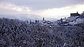
 Tromm mountain range from the Weschnitz valley |
||
| height | 576.8 m above sea level NHN | |
| location | Bergstrasse district , Hesse , Germany | |
| Mountains | Odenwald | |
| Dominance | 7.7 km → Hardberg | |
| Notch height | 154 m ↓ Kreidacher Höhe | |
| Coordinates | 49 ° 36 '16 " N , 8 ° 48' 10" E | |
| Topo map | LAGIS Hessen | |
|
||
| particularities | Ireneturm ( AT ) | |

The Tromm is 576.8 m above sea level. NHN is the sixth highest mountain in the Odenwald (after Katzenbuckel , Neunkircher Höhe , Hardberg , Stiefelhöhe and Hart ) and is located in the southeast of the Bergstrasse district in southern Hesse .
geography
location
The Tromm is located in the middle Odenwald between the Weschnitz Valley with the municipality of Rimbach in the west-northwest and the Ulfenbachtal with the municipality of Grasellenbach and the Wald-Michelbacher district of Affolterbach in the east. The summit of Tromm is on the district of Rimbach. The district of Tromm of the Grasellenbach community is located on the eastern slope of the Tromm ridge .
View over Lindenfels to Tromm

To the north via Schnorrenbach to Tromm and into the Weschnitz valley

View from the west from Bannelshöhe near Zotzenbach


geology
_03.jpg)
The wooded, north-south running Tromm mountain range consists of a crystalline mountain floe of the Vorderen Odenwald on the border with the Buntsandstein-Odenwald to the east and gives its name to one of its natural sub-units, the Tromm-Odenwald . The Tromm has numerous striking rock groups that are weathered primary rock (Tromm granite ). (For more see: Geology of the Odenwald )
Protected areas

The western slope of the Tromm is located in the Fauna-Flora-Habitat- Area Tromm (FFH No. 6318-304; 3.2167 km²), a Natura 2000 area. Its protective purpose is defined as: Section of the wooded low mountain range of the Vorderen Odenwald with the Tromm ridge running in a north-south direction and a finely branched network of water , whereby ravine and hillside mixed forests as well as grove beech forests are the distinctive habitat types .
Irish Tower

The striking Ireneturm (sometimes incorrectly called Irene n tower ) was initially built in 1890 at a height of 23 m west of the summit, but had to be demolished in 1907 due to its dilapidation. The 27 m high observation tower at the same location, newly built in 1910 , named after Princess Irene of Hessen-Darmstadt , is one of the landmarks of the Überwald region . It is located in the district of Zotzenbach , a district of Rimbach , while the actual summit height belongs to the district of Kocherbach , a district of Wald-Michelbach . For the 100th anniversary of the tower in 2010, ownership was transferred to the municipality of Rimbach. The Ireneturm has been closed for security reasons since May 2nd, 2013. It consists essentially of softwood elements that the bark beetle and rot have penetrated. After it had been certain since 2015 that the tower could no longer be renovated, it was decided in 2017 to build a new, slightly higher tower. It is planned to finance 80% of this with funding for the Geozentrum Tromm project . As of 2020 the old dilapidated tower is still standing.
Dreimärker stone
_01.jpg)
_02.jpg)
About 100 m northeast of the Ireneturm there is a so-called three - mark stone as a boundary stone, which represents the dominance relationships involved in the overland, which was characterized by a patchwork of medieval manors, primarily the Electoral Palatinate , Kurmainz and House Erbach . And one of the few remaining three coat of arms stones in the Odenwald is. Mainzer Rad , Kurpfälzer Raute and Erbacher three-star coats of arms with the year 1741 can still be seen on the approx. 50 cm high stone in the form of a prism with an equilateral triangle as a base on each side .
Camino Incluso pilgrimage route

The 84 km long pilgrimage route Camino Incluso leads over the ridge of the Tromm from Bensheim - Auerbach into the Odenwald and over its mountain ranges to Heidelberg . It is based on the Way of St. James and is intended as a feeder to the Way of St. James in Palatinate and Baden. His sign is a yellow pilgrim's bag , created by the students of the SRH Stephen Hawking School (a state-recognized special educational and advisory center with a focus on physical and motor development) in Neckargemünd .
The idea for the path is to create a pilgrimage for everyone, not only for different physical requirements, but also for different requirements regarding religion or spirituality . The focus should be on being on the move and jointly coping with the path across physical or mental barriers and the possibility of having spiritual experiences.
Transmission mast
There is a transmission mast on the northeastern branch of the ridge .
Winter sports

There is a flat, 600 meter long ski slope on the Tromm. The longest ski lift in the Odenwald, around 500 meters long , used to be on the Tromm . However, the valley station on the Tromm was completely destroyed by a lightning strike. The lift system itself has now been dismantled. There used to be 15 other backpack lifts on the Tromm ; but they were gradually dismantled and rebuilt in other ski areas. Today, the longest ski lift in the Odenwald is located on the 900 meter long Hardberg slope .
Web links
Individual evidence
- ↑ a b Map services of the Federal Agency for Nature Conservation ( information )
- ↑ Bergsträßer Anzeiger from May 2, 2013: Ireneturm closed with immediate effect , accessed on September 2, 2013
- ↑ Ireneturm: Financing of the new building on the Tromm secured on echo-online.de from May 17, 2017, accessed on October 25, 2017
- ^ Students from the SRH Stephen Hawking School create a pilgrimage on the school website, August 5, 2019; accessed on January 27, 2020
- ↑ camino incluso - pilgrimage for EVERYONE , on www.tourismus-odenwald.de ; accessed on January 27, 2020