
Camino Incluso


The Camino Incluso is an 84 km long pilgrimage route from Bensheim - Auerbach from the Bergstrasse over the ridges of the Vorderen Odenwald into the Odenwald to Heidelberg on the Neckar and is based on the Way of St. James . It is intended as a feeder to the Palatinate and Baden Way of St. James. His sign is a yellow pilgrim bag , created by the students of the SRH Stephen Hawking School(a state-approved special education and advice center with a focus on physical and motor development) in Neckargemünd .
The idea for the path was to create a pilgrimage Odenwald for everyone , not only for different physical requirements, but also for different requirements in terms of religion or spirituality . The focus should be on being on the move and jointly coping with the way across physical or mental barriers and the opportunity to gain spiritual experience. The path will be inaugurated in spring 2020.
prehistory
The original plan was to run the pilgrimage from Aschaffenburg to Heidelberg across the Odenwald. This plan was abandoned early on because the route seemed too long and the difficulties of leading the route through the three federal states of Bavaria , Baden-Württemberg and Hesse would have required too much organizational and approval effort.
description
The hiking and experience trail leads over six stages of 11–15 km each over a total length of 84 km. During the conception, the focus was on accessibility , especially the possibility of wheelchair or handbike access . Since the Way of St. James between Darmstadt and Heidelberg is not historically documented , an attempt was made to create a feeder to the Palatinate and Baden branches of the Way of St. James with the Camino Incluso .
The marking work was done by the Odenwaldklub . The path is easiest to tackle from the direction of Bensheim to the south with longer inclines. Barrier-free overnight accommodation was organized at the individual stage points. Disabled-accessible toilets should help on the way. There are restaurants along the way for catering. A documentation with a description of the individual stages by the students should conclude the project. Texts in easy language, simple symbols and pictures should help with orientation.
In nature , pilgrims can discover vast forests and springs , wide meadow valleys and views from the ridges of the Odenwald to the sea of rocks round off the low mountain range panorama. In addition to Christian churches and chapels along the pilgrimage route, the Auerbach synagogue , stumbling blocks , the Christian-Jewish Friedensmal, a Buddhist monastery can also be hiked or offer the opportunity to rest and meditate . Pilgrims can enter themselves in the pilgrimage book in the churches or in two pilgrim hostels and have their pilgrim passport stamped that they have reached the stage. Upon request, the pastors of the neighboring parishes give a pilgrimage blessing . For this pilgrimage project, the pupils received a prize from the German Hiking Association . In the area of the drum , installations by various artists can be hiked.
The "yellow bag" as a signpost is a little sack that the pilgrims of St. James used to carry under their cape instead of a rucksack.
Directions


The hiking trail , which can be walked all year round , is of medium difficulty. Without stages it takes about 25 hours to hike the full length of 84 kilometers. It has a height difference of 1778 meters in total . The lowest altitude is 102 m above sea level. NHN and its maximum is in the Odenwald at 605 m above sea level. NHN . The route starts from the Bensheim-Auerbach train station along the Fürstenlager state park on Bergstrasse via the Seegerhütte in an easterly direction into the Odenwald to Beedenkirchen , Brandau and Neunkirchen . Here it turns south into the ridges of the Vorderen Odenwald and reaches its highest point in a long bend on the Neunkircher Höhe . Parallel to the L 3399 downhill again, it reaches Winterkasten , branches off here south at the Waldhufenkirche to Litzelröder and Lindenfels , bypasses the village and Lindenfels Castle in an easterly direction along the Nibelungenstrasse between Knabenberg (327 m above sea level) and Knapp (347 m above sea level) in a southerly direction to Fürth in the Odenwald . Crossing the town to the east, it continues via the Steinbach district to Alt-Lechtern to Hammelbach . From here, ascending south-west to about 520 m above sea level on the Fahrenbacher Kopf , it goes gently up and down the ridge of the Tromm further south. Here you will be accompanied by numerous art installations along the way.
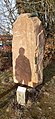
Beate Kuchs ' installation sandstone with glass and the title " Glück ist ..."

Sculpture by Stefanie Welk " In the Free Fall " (2005)
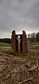
Alfred Wolf's installation : “I look into the world” made of sandstone and steel


By grazing the district of Stallenkandel , you walk past the summer toboggan run from Wald-Michelbach to Siedelsbrunn and you are now in the Überwald . Along the village's mountain church , it goes east to the Hardberg and all around the Stiefelhöhe in a north-westerly swing to Unter-Abtsteinach . The state border between Hesse and Baden-Württemberg was crossed several times. At the chapel of Unter-Abtsteinach, the pilgrimage route leads southwest into Badische to Hilsenhain in the Rhine-Neckar district . Via Galgenbusch it goes further west to Lampenhain and Wilhelmsfeld on the heights of the Schriesheimer head and the Dossenheimer head on the white stone back to heights over 500 m above sea level. A few kilometers to the southwest, along a high path, follows the Heiligenberg , one of Heidelberg's local mountains and known for its rich history of a settlement of the urnfield culture , a Celtic ring wall , the remains of the Mercurius sanctuary from Roman times and the ruins of the Michael monastery. Partly on the Philosophenweg , the Camino Incluso leads to the old town of Heidelberg.
Web links
- Students from the SRH Stephen Hawking School create a pilgrimage on www.stephenhawkingschule.de
- camino incluso - pilgrimage for EVERYONE on www.tourismus-odenwald.de
Individual evidence
- ^ Students from the SRH Stephen Hawking School create a pilgrimage on the school website, August 5, 2019; accessed on January 27, 2020
- ↑ Concert for a good cause . In: i-dot (information weekly newspaper), independent weekly newspaper for the Lindenfels, Fürth, Rimbach and Mörlenbach area , 21st year, January 9th, 2020 (KW 2, issue B), p. 2; accessed on January 28, 2020
- ↑ a b camino incluso - pilgrimage for EVERYONE , on www.tourismus-odenwald.de ; accessed on January 28, 2020
- ↑ Buddhas Weg - Buddhist monastery, seminar & guest house and health center ; accessed on January 29, 2020