Villanueva (Bolívar)
| Villanueva | ||
|---|---|---|
|
Coordinates: 10 ° 27 ′ N , 75 ° 16 ′ W Villanueva on the map of Colombia
|
||
|
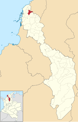
The location of the entire area of the municipality of Villanueva on the map of Bolívar
|
||
| Basic data | ||
| Country | Colombia | |
| Department | Bolívar | |
| City foundation | 1770 | |
| Residents | 20,624 (2019) | |
| - in the metropolitan area | 1,382,015 | |
| City insignia | ||
| Detailed data | ||
| surface | 225 km 2 | |
| Population density | 92 people / km 2 | |
| height | 150 m | |
| Time zone | UTC -5 | |
| City Presidency | Euripides Orlando Velasco Mendoza (2016-2019) | |
| Website | ||
Villanueva is a municipality ( municipio ) in the department of Bolivar in northern Colombia . Villanueva is part of the unofficial metropolitan area of Cartagena , the metropolitan area of Cartagena .
geography
Villanueva is located in the north of Bolívar in the sub-region of Montes de María , 35 km from Cartagena . The municipality is bordered by Clemencia , Santa Catalina and Repelón in the Departamento del Atlántico in the north, San Estanislao in the east, Turbaco in the south and Santa Rosa in the west .
Demographics
The municipality of Villanueva has 20,624 inhabitants, of which 19,206 live in the urban part (cabecera municipal) of the municipality. 1,382,015 people live in the metropolitan region (as of 2019).
history
Villanueva was founded in 1770 by indigenous people about five kilometers from the hill La Vieja . Two years later, the founding of Antonio de la Torre y Miranda was repeated. The economy initially functioned according to the encomienda system .
economy
The main industries in Villanueva are agriculture ( corn and cassava ) and animal husbandry .
Web links
- Alcaldía Mpal Villanueva Bol. Alcaldía del Municipio de Villanueva - Bolívar, accessed on January 29, 2019 (Spanish, website of the municipality).
Individual evidence
- ↑ a b c Nuestro Municipio. Alcaldía del Municipio de Villanueva - Bolívar, accessed January 29, 2019 (Spanish, information about the municipality).
- ↑ ESTIMACIONES DE POBLACIÓN 1985 - 2005 Y PROYECCIONES DE POBLACIÓN 2005 - 2020 TOTAL DEPARTAMENTAL POR ÁREA. DANE, May 11, 2011, accessed on January 29, 2019 (Spanish, extrapolation of the population of Colombia (Excel; 1.72 MB)).


