Arjona (Colombia)
| Arjona | ||
|---|---|---|
|
Coordinates: 10 ° 15 ′ N , 75 ° 21 ′ W Arjona on the map of Colombia
|
||
|
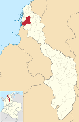
Location of the municipality of Arjona on the map of Bolívar
|
||
| Basic data | ||
| Country | Colombia | |
| Department | Bolívar | |
| City foundation | 1775 | |
| Residents | 78,070 (2019) | |
| - in the metropolitan area | 1,382,015 | |
| City insignia | ||
| Detailed data | ||
| surface | 566 km 2 | |
| Population density | 138 people / km 2 | |
| height | 63 m | |
| Waters | Canal del Dique | |
| Time zone | UTC -5 | |
| City Presidency | Esther María Jalilie García (2016-2019) | |
| Website | ||
Arjona is a municipality ( municipio ) in Colombia in the department of Bolívar . Arjona is part of the unofficial Cartagena Metropolitan Area , the metropolitan area of Cartagena .
geography
Arjona is located 30 km south of Cartagena near the Colombian Caribbean coast and has an average temperature of 32 ° C. Arjona is at an altitude of 63 m above sea level. NN . The municipality borders in the north on Turbaco , in the east on San Estanislao and Mahates , in the south on María La Baja and in the west on Turbaná and San Onofre in the Departamento de Sucre .
population
The municipality of Arjona has 78,070 inhabitants, of which 61,380 live in the urban part (cabecera municipal) of the municipality. 1,382,015 people live in the metropolitan region (as of 2019).
history
Arjona was founded on March 13, 1775 by Antonio de la Torre y Miranda . Arjona has had parish status since 1870.
economy
The main industry in Arjona is cattle production .
sons and daughters of the town
- Harold Gray (born 1971), boxer
Web links
- Arjona. Alcaldía de Arjona - Bolívar, accessed on May 16, 2019 (Spanish, website of the municipality of Arjona).
Individual evidence
- ↑ Information on geography on the official Arjona website ( page no longer available , search in web archives ) Info: The link was automatically marked as defective. Please check the link according to the instructions and then remove this notice.
- ↑ ESTIMACIONES DE POBLACIÓN 1985 - 2005 Y PROYECCIONES DE POBLACIÓN 2005 - 2020 TOTAL DEPARTAMENTAL POR ÁREA. (Excel; 1.72 MB) DANE, May 11, 2011, accessed on May 16, 2019 (Spanish, extrapolation of the population of Colombia).
- ↑ Information about the story on the official Arjona website ( page no longer available , search in web archives ) Info: The link was automatically marked as defective. Please check the link according to the instructions and then remove this notice.
- ↑ Information on the economy on the official Arjona website ( page no longer available , search in web archives ) Info: The link was automatically marked as defective. Please check the link according to the instructions and then remove this notice.


