World Heritage in Ireland
World Heritage Sites in Ireland |
The World Heritage in Ireland (as of 2016) includes two UNESCO World Heritage sites , both of which are world cultural heritage sites. Ireland ratified the World Heritage Convention in 1991 and the first World Heritage site was added to the World Heritage List in 1993. The last World Heritage Site to date in Ireland was registered in 1996.
World heritage sites
The following table lists the UNESCO World Heritage Sites in Ireland in chronological order according to the year of their inclusion on the World Heritage List (K - cultural heritage, N - natural heritage, K / N - mixed, (R) - on the Red List of World Heritage in Danger ).
![]() Map with all coordinates of World Heritage Sites: OSM
Map with all coordinates of World Heritage Sites: OSM
| image | designation | year | Type | Ref. | description |
|---|---|---|---|---|---|
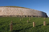
| Brú na Bóinne - Archaeological Ensemble of the Bend of the Boyne | 1993 | K | 659 | Bend of the Boyne (also Brú na Bóinne) is a large collection of prehistoric places of worship located in the Boyne Valley, dating from between 3500 and 2500 BC. BC originated. Some of them, including those with large megaliths enclosed grave mounds have been preserved. The world heritage site includes the megalithic tombs Newgrange ( Lage ), Knowth ( Lage ) and Dowth ( Lage ). | |
|
Skellig Michael ( location ) |
1996 | K | 757 | The rocky island of Skellig Michael off the west coast of Ireland is home to one of the most famous, but also the most inaccessible medieval monasteries in Ireland. |
Tentative list
The sites that are intended for nomination for inclusion in the World Heritage List are entered in the tentative list .
Current World Heritage candidates
There are currently (2016) seven sites on the tentative list of Ireland, the last entry was in 2010. The following table lists the sites in chronological order according to the year they were included in the tentative list.
![]() Map with all coordinates of current World Heritage candidates: OSM
Map with all coordinates of current World Heritage candidates: OSM
| image | designation | year | Type | Ref. | description |
|---|---|---|---|---|---|
| Early medieval monastery settlements | 2010 | K | 5527 | includes the ruins of various early medieval monastic settlements, namely Glendalough , Clonmacnoise , Inis Cealtra , Durrow , Kells and Monasterboice . | |
|
The Burren ( location ) |
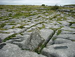
2010 | K / N | 5522 | The Burren is a karst landscape in northwest County Clare . The region has a long mining tradition . | |
| The Céide Fields and the Northwest Mayo Marshes | 2010 | K | 5524 | The Céide Fields are among the largest Neolithic field systems in the world. 5000 to 6000 years ago there was a settlement with fields. The Neolithic residents apparently lived on individual farmsteads that were separated from each other by straight walls. Presumably they formed a well-organized community of arable farmers and cattle herders who divided the land into even blocks and cleared large areas of forest | |
|
Old City of Dublin ( location ) |
2010 | K | 5523 | Dublin was the capital of the Kingdom of Ireland between 1541 and 1800 . The Temple Bar district in particular has retained its historic character with its narrow cobblestone streets. | |
|
Monastery town of Clonmacnoise and its cultural landscape ( location ) |
2010 | K | 5526 | Clonmacnoise is a unique ruined monastery in County Offaly , on the River Shannon . The history of the monastery goes back to the 6th century AD. | |
| The Royal Places of Ireland: Cashel, Dún Ailinne, Hill of Uisnech, Rathcroghan and Tara | 2010 | K | 5528 | The royal sites of Cashel , Dún Ailinne , Hill of Uisnech , Rathcroghan and Tara have all been the scene of major royal inaugurations, celebrations and gatherings. They represent the four Irish provinces of Ulster , Leinster , Munster and Connacht and the Meath region . | |
| The Western Stone Forts: Dún Aonghasa, Cahercommaun, Caherconree, Benagh and Staigue | 2010 | K | 5525 | The most common type of settlement in Ireland in the early Middle Ages was the so-called ringfort . The site includes the forts Dun Aengus , Cahercommaun , Caherconree , Binn na bPórt and Staigue . |
Former World Heritage candidates
These sites were previously on the tentative list, but were withdrawn or rejected by UNESCO. Sites that are included in other entries on the tentative list or that are part of world heritage sites are not taken into account here.
![]() Map with all coordinates of former World Heritage candidates: OSM
Map with all coordinates of former World Heritage candidates: OSM
| image | designation | year | Type | Ref. | description |
|---|---|---|---|---|---|
|
Killarney National Park ( location ) |
1992-2010 | N | 302 | The over 100 km² national park borders the city of Killarney and includes the three lakes Lough Leane, Muckross Lake and Upper Lake, which together make up an area of 22 km² of the park. The national park has been a UNESCO biosphere reserve since 1982 . | |
|
Clara Bog ( location ) |
1992-2010 | N | 307 | The Clara Bog nature reserve is a peat landscape east of Tullamore ; it is a wetland awarded by the Ramsar Convention |
Web links
- Ireland on the UNESCO World Heritage Center website.
Individual evidence
- ↑ Ireland. In: whc.unesco.org. UNESCO World Heritage Center, accessed June 16, 2017 .
- ^ Tentative list of Ireland. In: whc.unesco.org. UNESCO World Heritage Center, accessed June 16, 2017 .
- ^ Former Tentative Sites of Ireland. In: World Heritage Site. Retrieved June 16, 2017 .


