Itō line
| Itō line | |||||||||||||||||||||||||||||||||||||||||||||||||||||||||||||||||||||
|---|---|---|---|---|---|---|---|---|---|---|---|---|---|---|---|---|---|---|---|---|---|---|---|---|---|---|---|---|---|---|---|---|---|---|---|---|---|---|---|---|---|---|---|---|---|---|---|---|---|---|---|---|---|---|---|---|---|---|---|---|---|---|---|---|---|---|---|---|---|
|
Class 185 multiple unit between Kinomiya and Izu-Taga
| |||||||||||||||||||||||||||||||||||||||||||||||||||||||||||||||||||||
| Route length: | 16.9 km | ||||||||||||||||||||||||||||||||||||||||||||||||||||||||||||||||||||
| Gauge : | 1067 mm ( cape track ) | ||||||||||||||||||||||||||||||||||||||||||||||||||||||||||||||||||||
| Power system : | 1500 V = | ||||||||||||||||||||||||||||||||||||||||||||||||||||||||||||||||||||
| Maximum slope : | 25 ‰ | ||||||||||||||||||||||||||||||||||||||||||||||||||||||||||||||||||||
| Minimum radius : | 240 m | ||||||||||||||||||||||||||||||||||||||||||||||||||||||||||||||||||||
| Top speed: | 95 km / h | ||||||||||||||||||||||||||||||||||||||||||||||||||||||||||||||||||||
| Dual track : | Atami – Kinomiya | ||||||||||||||||||||||||||||||||||||||||||||||||||||||||||||||||||||
| Society: | JR East | ||||||||||||||||||||||||||||||||||||||||||||||||||||||||||||||||||||
|
|||||||||||||||||||||||||||||||||||||||||||||||||||||||||||||||||||||
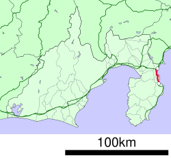
The Itō Line ( Japanese 伊 東線 , Itō-sen ) is a railway line on the Japanese island of Honshū , which is operated by the East Japan Railway Company (JR East). In Shizuoka Prefecture , it runs from Atami parallel to the east coast of the mountainous Izu Peninsula to Itō .
description
The Itō line, laid in Cape Gauge (1067 mm), is 16.9 km long, opens up six train stations and is electrified with 1500 V DC . The northern starting point is Atami train station . Up to the following Kinomiya station, the line runs parallel to the Tōkaidō main line and the Tōkaidō Shinkansen . While the trains on the Itō line stop in Kinomiya, the Tōkaidō local trains only use this station as a turning point. From there, the route is single-track (train crossings are possible at all intermediate stops) and leads south through mountainous terrain along the coast of Sagami Bay . Almost a third of the route runs through tunnels, the longest being the Shin Usami Tunnel (2941 m). The Izu-Kyūkō line connects seamlessly at Itō station .
Trains
Operationally, the Itō-Line and the Izu-Kyūkō-Line form a unit, the separation is only based on property law. Izu Kyūkō , a company of the Tokyu Group , operates the local trains from Atami via Itō to Shimoda. These run about every half hour during the day and are usually tied through in Itō so that there is no need to change trains. Since the Izu Peninsula is a popular destination for tourists from the capital region, JR East operates numerous direct connections from Tokyo to Shimoda without changing trains . This applies in particular to the Odoriko express trains, which run approximately every 30 to 60 minutes and always stop in Atami and Itō, and on weekends at all other stations on the Itō line. Three pairs of trains are run as Super View Odoriko with panorama cars .
The rolling stock used in local traffic consists of the multiple unit series 2100 and 8000 from Izu Kyūkō as well as the series 211 and E231 from JR East. The express trains are class 185 (Odoriko) and 251 (Super View Odoriko) multiple units .
history
When the new route of the Tōkaidō main line through the Tanna Tunnel (opened in 1934) was still under construction, the Ministry of Railways also planned a double-track branch line from Atami to Shimoda . Due to technical problems and the austerity policy of Prime Minister Hamaguchi Osachi at the beginning of the global economic crisis , the financial means were initially only enough for a single-track route to Ito . The mountainous terrain required numerous bridges and tunnels to be built. Underground hot water springs were a particular problem for the workers. The first section between Atami and Ajiro was opened on March 30, 1935, followed on December 15, 1938 by the section between Ajiro and the provisional terminus Itō.
The line was electrified from the start. Further work was delayed and had to be abandoned entirely after the outbreak of World War II . The subsequent route to Shimoda was only realized a quarter of a century later by the company Izu Kyūkō . The Japanese State Railways planned the double-track expansion of the entire Itō line. Ultimately, however, only the section running parallel to the Tōkaidō main line between Atami and Kinomiya received a second track, which went into operation on September 9, 1968. On February 1, 1984, the state railway stopped freight traffic. As part of the privatization of the state railway, the line went into the possession of the new company JR East on April 1, 1987 , while JR Freight resumed freight traffic.
photos
List of train stations
| Surname | km | Connecting lines | location | place | prefecture |
|---|---|---|---|---|---|
| Atami ( 熱 海 ) | 0.0 |
Tōkaidō Shinkansen Tōkaidō main line |
Coord. | Atami | Shizuoka |
| Kinomiya ( 来 宮 ) | 1.2 | Coord. | |||
| Izu-Taga ( 伊豆 多 賀 ) | 6.0 | Coord. | |||
| Ajiro ( 網 代 ) | 8.7 | Coord. | |||
| Usami ( 宇佐美 ) | 13.0 | Coord. | Itō | ||
| Itō ( 伊 東 ) | 16.9 | Izu-Kyūkō Line | Coord. |
Web links
- JR East route network (PDF, 1.2 MB)
- Itō Line Stations and Timetables (Japanese)
- Picture gallery and track plans of the stations on the Itō line (Japanese)
Individual evidence
- ↑ JR 時刻表 2018 年 3 月 号 (JR timetable March 2018). Kōtsū shinbunsha, Tokyo 2018.
- ↑ a b Tetsu Ishino (Ed.): 停車場 変 遷 大事 典 国 鉄 ・ JR 編 1 . JTB, Tokyo 1998, ISBN 4-533-02980-9 (station change directory JNR / JR).


