Sirník: Difference between revisions
Content deleted Content added
Plasticspork (talk | contribs) m Orphan template per Wikipedia:Templates for discussion |
m unapproved bot, blanking sections |
||
| (11 intermediate revisions by 10 users not shown) | |||
| Line 4: | Line 4: | ||
==History== |
==History== |
||
In [[history|historical records]] the village was first mentioned in |
In [[history|historical records]] the village was first mentioned in 1403. |
||
==Geography== |
==Geography== |
||
The [[village]] lies at an [[altitude]] of 128 |
The [[village]] lies at an [[altitude]] of 128 metres and covers an [[area]] of 5.822 km². |
||
It has a [[population]] of about 605 people. |
It has a [[population]] of about 605 people. |
||
| Line 18: | Line 18: | ||
==External links== |
==External links== |
||
* http://www.statistics.sk/mosmis/eng/run.html |
* http://www.statistics.sk/mosmis/eng/run.html |
||
* http://picasaweb.google.com/zfp.kch/SirnKSzRnyeg6102007 |
* http://picasaweb.google.com/zfp.kch/SirnKSzRnyeg6102007{{dead link|date=January 2018 |bot=InternetArchiveBot |fix-attempted=yes }} |
||
{{Trebišov District}} |
{{Trebišov District}} |
||
| ⚫ | |||
{{coord|48|31|N|21|49|E|region:SK_type:city|display=title}} |
{{coord|48|31|N|21|49|E|region:SK_type:city|display=title}} |
||
{{authority control}} |
|||
{{DEFAULTSORT:Sirnik}} |
|||
[[Category:Villages and municipalities in Trebišov District]] |
[[Category:Villages and municipalities in Trebišov District]] |
||
[[eo:Sirník]] |
|||
| ⚫ | |||
[[fr:Sirník]] |
|||
[[hu:Szürnyeg]] |
|||
[[sk:Sirník]] |
|||
Latest revision as of 10:22, 29 September 2022

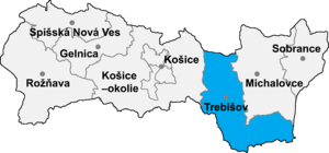
Sirník (Hungarian: Szürnyeg) is a village and municipality in the Trebišov District in the Košice Region of south-eastern Slovakia.
History[edit]
In historical records the village was first mentioned in 1403.
Geography[edit]
The village lies at an altitude of 128 metres and covers an area of 5.822 km². It has a population of about 605 people.
Ethnicity[edit]
The village is about 71% Slovak, 25% Hungarian and 4% Gypsy.
Facilities[edit]
The village has a public library.
External links[edit]
- http://www.statistics.sk/mosmis/eng/run.html
- http://picasaweb.google.com/zfp.kch/SirnKSzRnyeg6102007[permanent dead link]
48°31′N 21°49′E / 48.517°N 21.817°E
