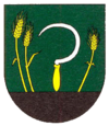
Michaľany
| Michaľany | ||
|---|---|---|
| coat of arms | map | |

|
|
|
| Basic data | ||
| State : | Slovakia | |
| Kraj : | Košický kraj | |
| Okres : | Trebišov | |
| Region : | Dolný Zemplín | |
| Area : | 8.152 km² | |
| Residents : | 1,905 (Dec. 31, 2019) | |
| Population density : | 234 inhabitants per km² | |
| Height : | 130 m nm | |
| Postal code : | 076 14 | |
| Telephone code : | 0 56 | |
| Geographic location : | 48 ° 30 ' N , 21 ° 37' E | |
| License plate : | TV | |
| Kód obce : | 528587 | |
| structure | ||
| Community type : | local community | |
| Administration (as of November 2018) | ||
| Mayor : | Zoltan Tarbaj | |
| Address: | Obecný úrad Michaľany Hlavná 108 07614 Michaľany |
|
| Website: | www.michalany.sk | |
| Statistics information on statistics.sk | ||
Michaľany (Slovak until 1927 also "Mihaľany"; Hungarian Alsómihályi - until 1902 Mihályi ) is a municipality in eastern Slovakia .
location
It is located in the south-eastern part of the Eastern Slovakia lowlands on the banks of the Roňava brook . The closest larger cities are the district town Trebišov (16 km away) and Košice (45 km away).
history
The place was first mentioned in 1252. Until 1919 he belonged to the Kingdom of Hungary in Semplin County . Then he came to the newly formed Czechoslovakia . Due to the First Vienna Arbitration , it belonged again to Hungary from 1938 to 1945 and has been part of today's Slovakia since 1993.
Since 1871 the place has been connected to the railway network, see the Michaľany – Medzilaborce mesto – Łupków railway line .
