Zemplín (place)
| Zemplín | ||
|---|---|---|
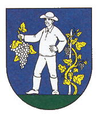
| coat of arms | map | |

|
|
|
| Basic data | ||
| State : | Slovakia | |
| Kraj : | Košický kraj | |
| Okres : | Trebišov | |
| Region : | Dolný Zemplín | |
| Area : | 14.667 km² | |
| Residents : | 368 (Dec. 31, 2019) | |
| Population density : | 25 inhabitants per km² | |
| Height : | 110 m nm | |
| Postal code : | 076 34 ( Ladmovce post office ) | |
| Telephone code : | 0 56 | |
| Geographic location : | 48 ° 26 ' N , 21 ° 49' E | |
| License plate : | TV | |
| Kód obce : | 543993 | |
| structure | ||
| Community type : | local community | |
| Administration (as of November 2018) | ||
| Mayor : | Mikuláš Takács | |
| Address: | Obecný úrad Zemplín 49 07634 Ladmovce |
|
| Website: | www.obeczemplin.sk | |
| Statistics information on statistics.sk | ||
Zemplín (German Semplin , Hungarian Zemplén , Ukrainian-Russian Цемно / Zemno , Latin Zemplinium ) is a municipality in Okres Trebišov , Košický kraj , eastern Slovakia . It is located at the foot of the Zemplínske vrchy Mountains on the Bodrog River , south of the confluence of the Latorica and Ondava rivers . The closest towns are Kráľovský Chlmec in the east and Trebišov in the north.
The history of the municipality is connected with the Zemplín castle (now in ruins). The castle was first mentioned in 1214 as comes curialis de Zemlu . The name comes from the Slavic word zem (soil). The castle or place was the seat of Semplin County from the 12th century until 1748 (but also in Sárospatak in the 13th century ) before the administration was transferred to Sátoraljaújhely . Until 1918 the municipality in Semplin County belonged to the Kingdom of Hungary and then came to the newly formed Czechoslovakia . She came back to Hungary for a short time from 1938 to 1945 through the First Vienna Arbitration .
Today around 400 inhabitants live in the village, of which 28.3% are Slovaks, 64.2% Magyars, 6.3% Roma and 1% Czech (2001 census).

