Bara (Slovakia)
| Bara | ||
|---|---|---|
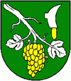
| coat of arms | map | |

|
|
|
| Basic data | ||
| State : | Slovakia | |
| Kraj : | Košický kraj | |
| Okres : | Trebišov | |
| Region : | Dolný Zemplín | |
| Area : | 6.25 km² | |
| Residents : | 279 (Dec. 31, 2019) | |
| Population density : | 45 inhabitants per km² | |
| Height : | 181 m nm | |
| Postal code : | 076 32 ( Borša post office ) | |
| Telephone code : | 0 56 | |
| Geographic location : | 48 ° 25 ' N , 21 ° 44' E | |
| License plate : | TV | |
| Kód obce : | 528129 | |
| structure | ||
| Community type : | local community | |
| Administration (as of November 2018) | ||
| Mayor : | Ľudovít Sütő | |
| Address: | Obecný úrad Bara Číslo 7 07632 Borša |
|
| Website: | www.bara.ocu.sk | |
| Statistics information on statistics.sk | ||
Bara (Hungarian Bari ) is a small town with about 350 inhabitants in southeastern Slovakia near the border town of Slovenské Nové Mesto with Hungary .
The community was created in 1960 through the merger of the two places Malá Bara (Hungarian Kisbári ) and Veľká Bara (Hungarian Nagybári ) and is located on the southern foothills of the Sempliner Mountains in the famous Tokaj wine region .
The places were mentioned for the first time in 1296 as bary (a Slovak plural form; the etymology of the root word is controversial, probably comes from the word for "swamp"). The predominantly Hungarian-speaking inhabitants today are mainly engaged in agriculture and viticulture.
Until 1918 the municipality in Semplin County belonged to the Kingdom of Hungary and then came to the newly formed Czechoslovakia . She came back to Hungary for a short time from 1938 to 1945 through the First Vienna Arbitration .
