Malá Tŕňa: Difference between revisions
Content deleted Content added
Hmainsbot1 (talk | contribs) m →History: AWB general fixes and delink dates per WP:DATELINK, WP:YEARLINK and MOS:UNLINKYEARS using AWB (8097) |
m Bot: Migrating 9 interwiki links, now provided by Wikidata on d:q525058 (Report Errors) |
||
| Line 23: | Line 23: | ||
[[Category:Villages and municipalities in Trebišov District]] |
[[Category:Villages and municipalities in Trebišov District]] |
||
{{Trebišov-geo-stub}} |
{{Trebišov-geo-stub}} |
||
[[eo:Malá Tŕňa]] |
|||
[[fr:Malá Tŕňa]] |
|||
[[hu:Kistoronya]] |
|||
[[it:Malá Tŕňa]] |
|||
[[nl:Malá Tŕňa]] |
|||
[[pl:Malá Tŕňa]] |
|||
[[rue:Мала Тырня]] |
|||
[[sk:Malá Tŕňa]] |
|||
[[war:Malá Tŕňa]] |
|||
Revision as of 11:10, 26 February 2013

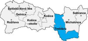
Malá Tŕňa (Hungarian: Kistoronya) is a village and municipality in the Trebišov District in the Košice Region of south-eastern Slovakia.
History
In historical records the village was first mentioned in 1392.
Geography
The village lies at an altitude of 186 metres and covers an area of 9.807 km². It has a population of about 450 people.
Ethnicity
The village is about 88% Slovak and 12% Hungarian.
Facilities
The village has a public library.
