Černochov: Difference between revisions
Content deleted Content added
IPA fix per Help:IPA/Slovak |
No edit summary |
||
| Line 34: | Line 34: | ||
{{DEFAULTSORT:Cernochov}} |
{{DEFAULTSORT:Cernochov}} |
||
[[Category:Villages and municipalities in Trebišov District]] |
[[Category:Villages and municipalities in Trebišov District]] |
||
[[Category:Zemplín (region)]] |
|||
{{Trebišov-geo-stub}} |
{{Trebišov-geo-stub}} |
||
Revision as of 15:37, 30 December 2019

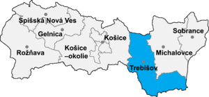
Černochov (Slovak pronunciation: [ˈtʃɛɾnɔxɔʊ̯]; Hungarian: Csarnahó) is a village and municipality in the Trebišov District in the Košice Region of south-eastern Slovakia.
History
In historical records the village was first mentioned in 1298.
Geography
The village lies at an altitude of 175 metres and covers an area of 6.156 km². It has a population of 215 people.
Ethnicity
The village is about 78% Hungarian and 22% Slovak in ethnic origin.
Facilities
The village has a public library and a football pitch.
Genealogical resources
The records for genealogical research are available at the state archive "Statny Archiv in Kosice, Slovakia"
- Reformated church records (births/marriages/deaths): 1854-1934 (parish A)
