Baião (Portugal)
| Baião | ||||||
|---|---|---|---|---|---|---|
|
||||||
| Basic data | ||||||
| Region : | Norte | |||||
| Sub-region : | Tâmega e Sousa | |||||
| District : | postage | |||||
| Concelho : | Baião | |||||
| Coordinates : | 41 ° 10 ′ N , 8 ° 2 ′ W | |||||
| Residents: | 20,522 (as of June 30, 2011) | |||||
| Surface: | 174.52 km² (as of January 1, 2010) | |||||
| Population density : | 118 inhabitants per km² | |||||
| Postal code : | 4640 | |||||
| Baião district | ||||||
|
||||||
| Residents: | 20,522 (as of June 30, 2011) | |||||
| Surface: | 174.52 km² (as of January 1, 2010) | |||||
| Population density : | 118 inhabitants per km² | |||||
| Number of municipalities : | 14th | |||||
| administration | ||||||
| Administration address: | Câmara Municipal de Baião Praça Heróis do Ultramar 4640-158 Campelo - Baião |
|||||
| President of the Câmara Municipal: | José Luís Pereira Carneiro ( PS ) | |||||
| Website: | www.cm-baiao.pt | |||||
Baião is a small town ( vila ) in Portugal .
history

Anta in the Aboboreira Archaeological Park
|
Finds show a settlement since the Neolithic Age , including megalithic systems , vessels, axes and blades. They can be viewed today at the archaeological site of Campo Arqueológico da Serra da Aboboreira . In the 5th or 4th century BC Chr. Created Celtic settlements of the Castro culture . The gold treasure, which is part of the extensive jewelry collection Tesouro de Baião (German: Treasure of Baião) in the Lisbon archeology museum, Museu Nacional de Arqueologia, dates from this time . From the time after the subsequent Roman conquest, tombs, tablets, remains of a Jupiter temple, a milestone and other parts of a Roman road have been preserved.
In 711 the Moors conquered the area. The crusader Dom Arnaldo distinguished himself in the campaigns of the Reconquista against the Arabs , for which the king of Castile gave him the local area in 985 . Not much is known about D.Arnaldo, possibly he was of Franconian, but more of Basque descent, probably from Bayonne . He was the founder of the aristocratic family of Bayãos, from which the current place name is derived. The place name may also come from an originally Latin name for brown-yellow coloring, baio , which became the place name Baian before the arrival of the Arabs , and which in turn later determined the naming of the noble family. As Egas Moniz, D.Arnaldo's great-great-grandson became the tutor of the first Portuguese king, D.Afonso Henriques .
King D. Manuel I gave the place city rights in 1513 .
administration
Baião district
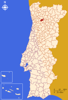
Baião is the seat of a district of the same name ( concelho ) in the Porto district . On June 30, 2011 the district had 20,522 inhabitants on an area of 174.5 km².
The neighboring areas are (starting clockwise in the north): Amarante , Peso da Régua , Mesão Frio , Resende , Cinfães and Marco de Canaveses .
With the regional reform in September 2013, several municipalities were merged into new municipalities, so that the number of municipalities decreased from 20 to 14.
The following municipalities ( Freguesias ) are in the Baião district:
| local community | Population (2011) |
Area km² |
Density of population / km² |
LAU code |
|---|---|---|---|---|
| Ancede e Ribadouro | 2,836 | 15.54 | 183 | 130221 |
| Baião e Mesquinhata | 855 | 7.76 | 110 | 130222 |
| Campelo e Ovil | 3,938 | 31.81 | 124 | 130223 |
| Frende | 656 | 2.90 | 226 | 130204 |
| Gestaçô | 1,263 | 14.43 | 88 | 130205 |
| Gove | 1,974 | 11.17 | 177 | 130206 |
| Grilo | 590 | 5.94 | 99 | 130207 |
| Loivos da Ribeira e Tresouras | 853 | 7.17 | 119 | 130224 |
| Loivos do Monte | 373 | 8.75 | 43 | 130208 |
| Santa Cruz do Douro e Sao Tome de Covelas | 2,085 | 16.11 | 129 | 130225 |
| Santa Marinha do Zezere | 2,789 | 10.69 | 261 | 130215 |
| Teixeira e Teixeiró | 946 | 26.09 | 36 | 130226 |
| Valadares | 844 | 9.93 | 85 | 130219 |
| Viariz | 520 | 6.23 | 83 | 130220 |
| Baião district | 20,522 | 174.52 | 118 | 1302 |
Population development
| Population in the Baião district (1801–2011) | |||||||||
|---|---|---|---|---|---|---|---|---|---|
| 1801 | 1849 | 1900 | 1930 | 1960 | 1981 | 1991 | 2001 | 2011 | |
| 9,939 | 17,944 | 23,139 | 26,886 | 28,864 | 24,438 | 22,456 | 22,355 | 20,525 | |
Municipal holiday
- August 24th
sons and daughters of the town
- Soeiro Pereira Gomes (1909–1949), neo-realistic writer and communist politician
- Luís Maria Teixeira Pinto (1927–2012), economist and politician, Minister of Economics in the Salazar dictatorship
Web links
Individual evidence
- ↑ a b c www.ine.pt - indicator resident population by place of residence and sex; Decennial in the database of the Instituto Nacional de Estatística
- ↑ a b Overview of code assignments from Freguesias on epp.eurostat.ec.europa.eu
- ^ João Fonseca: Dicionário do Nome das Terras. 2nd edition, Casa das Letras, Cruz Quebrada 2007, p. 47 ( ISBN 978-9724617305 )
- ↑ www.verportugal.net , accessed December 3, 2013
- ^ Publication of the administrative reorganization in the Diário da República gazette of January 28, 2013, accessed on March 16, 2014


