Dovolnoye
| Village
Dowolnoje
Довольное
|
||||||||||||||||||||||||||||||
|
||||||||||||||||||||||||||||||
|
||||||||||||||||||||||||||||||
Dowolnoje ( Russian Дово́льное ) is a village (selo) in the Novosibirsk Oblast in Russia with 6,774 inhabitants (as of October 14, 2010).
geography
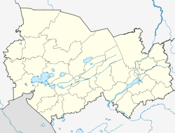
The place is about 220 km as the crow flies west-southwest of the Novosibirsk Oblast Administrative Center in the Barabasteppe . It is located on the upper reaches of the endorheic Bagan River a few kilometers below (west) the Indian Lake through which it flows.
Dowolnoje is the administrative center Rajons Dowolenski and seat of the rural community selsowet (selskoje posselenije) Dowolenski, (15 km south-east) are among the also the settlement Bagan (8 km east) and the village of Pokrovka.
history
The year the village was founded by resettlers from the European part of Russia is 1703. In 1925 the village was part of the newly formed Inderski rajon, based in the village of Indians 20 km to the east . On June 20, 1930, its administrative seat was moved to Dovolnoye and the Rajon was renamed accordingly.
Population development
| year | Residents |
|---|---|
| 1897 | 1856 |
| 1939 | 5297 |
| 1959 | 5835 |
| 1970 | 6694 |
| 1979 | 7236 |
| 1989 | 7865 |
| 2002 | 7314 |
| 2010 | 6774 |
Note: census data
traffic
Dovolnoye is located on the regional road 50K-07, which branches off about 50 km east of the 50K-09 and leads in a westerly direction to the neighboring district center of Sdvinsk . The 50K-08 runs in a northerly direction, which later also joins the 50K-09 and connects to Kargat on the federal trunk road R254 Irtysh (formerly M51) from Chelyabinsk - Omsk - Novosibirsk. The closest train station to the Trans-Siberian Railway is in Kargat, about 100 km away . The 50K-27 runs from Dovolnoye to the south and reaches the 50K-17 (formerly R382) Novosibirsk - Karassuk - Kazakh border in Krasnosjorskoje, a good 60 km away .
Web links
Individual evidence
- ↑ a b Itogi Vserossijskoj perepisi naselenija 2010 goda. Tom 1. Čislennostʹ i razmeščenie naselenija (Results of the All-Russian Census 2010. Volume 1. Number and distribution of the population). Tables 5 , pp. 12-209; 11 , pp. 312–979 (download from the website of the Federal Service for State Statistics of the Russian Federation)

