Cargat
| city
Kargat
Каргат
|
||||||||||||||||||||||||||||||||||||||||
|
||||||||||||||||||||||||||||||||||||||||
|
||||||||||||||||||||||||||||||||||||||||
| List of cities in Russia | ||||||||||||||||||||||||||||||||||||||||
Kargat ( Russian Каргат ) is a city in Novosibirsk Oblast ( Russia ) with 10,042 inhabitants (as of October 14, 2010).
geography
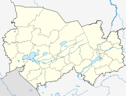
The city is located in the southeastern part of the West Siberian lowlands , about 180 km west of the oblast capital Novosibirsk , on the Kargat River , a right tributary of the Chulym . The climate is continental.
The city of Kargat is the administrative center of the Rajon of the same name .
history
Kargat was built as a fortress in the middle of the 18th century. In 1957 the place received urban-type settlement status and in 1965 city rights.
Trans-Siberian station Kargat
Population development
| year | Residents |
|---|---|
| 1939 | 11,138 |
| 1959 | 12,760 |
| 1970 | 12,896 |
| 1979 | 12,585 |
| 1989 | 12,561 |
| 2002 | 11,184 |
| 2010 | 10,042 |
Note: census data
Individual evidence
- ↑ a b Itogi Vserossijskoj perepisi naselenija 2010 goda. Tom 1. Čislennostʹ i razmeščenie naselenija (Results of the All-Russian Census 2010. Volume 1. Number and distribution of the population). Tables 5 , pp. 12-209; 11 , pp. 312–979 (download from the website of the Federal Service for State Statistics of the Russian Federation)
Web links
Commons : Kargat - collection of images, videos and audio files
- City administration website (Russian)
- Kargat on mojgorod.ru (Russian)


