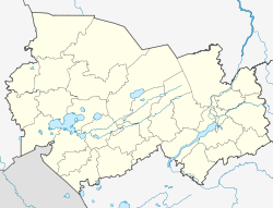
Krasnosjorskoye
| Urban-type settlement
Krasnosjorskoye
Краснозёрское
|
||||||||||||||||||||||||||||||||||
|
||||||||||||||||||||||||||||||||||
|
||||||||||||||||||||||||||||||||||
Krasnosjorskoje ( Russian Краснозёрское ) is an urban-type settlement in Novosibirsk Oblast ( Russia ) with 9,524 inhabitants (as of October 14, 2010).
geography
The settlement is located in the southern part of the Barabasteppe , about 270 km as the crow flies southwest of the regional capital Novosibirsk on the right bank of the Karassuk River .
Krasnosjorskoye is the administrative center of the Krasnosjorskoye Raion of the same name .
history
The place was founded under the name Karassuk, named after the river, in 1773 (according to other sources as early as 1763) and subsequently belonged to the Tomsk Governorate .
In 1917 the village became part of the Ujesd Slavgorod of the newly founded Altai Governorate. In 1925, following an administrative reform, it became the center of a Rajon which from 1937 belonged to the Altai Region .
On July 7, 1933, place and Rajon were given the name Krasnoosjorskoye in order to avoid confusion with Karassuk , 80 km to the south-west . The name comes from the Russian Krasnoye Ozero for Red Lake derived - the many small lakes in the area have been through a variety of freshwater shrimp (Russian mormysch colored) occasionally reddish. Around 1937–1938, today's spelling - without two consecutive o - became official, as the local population associated the second part of the place name with the word serno , grain . On July 13, 1944, Rajon (along with two others) and Krasnosjorskoje were given to the Novosibirsk Oblast.
In 1977 Krasnozjorskoye received urban-type settlement status.
Population development
| year | Residents |
|---|---|
| 1939 | 3,988 |
| 1959 | 4,963 |
| 1970 | 5,605 |
| 1979 | 8,010 |
| 1989 | 9,954 |
| 2002 | 10,473 |
| 2010 | 9,524 |
Note: census data
Culture and sights
Since 1975 there has been an art and local history museum in Krasnosjorskoye .
Economy and Infrastructure
In Krasnosjorskoye as the center of an agricultural area (mainly wheat cultivation and cattle breeding) there are mainly companies in the food industry (large dairy, "meat combine", brewery ).
The Krasnosjorskoye railway station is located a good 30 km south of the village near the Polovinnoye settlement on the Omsk - Karassuk - Srednesibirskaya route (also called Central Siberian Railway ; route km 456). The regional road R 382 runs through the village, which connects Ordynskoje on the R 380 Novosibirsk - Kamen am Ob - Barnaul with Karassuk and the border with Kazakhstan , where it continues in the direction of Pavlodar .
Individual evidence
- ↑ a b Itogi Vserossijskoj perepisi naselenija 2010 goda. Tom 1. Čislennostʹ i razmeščenie naselenija (Results of the All-Russian Census 2010. Volume 1. Number and distribution of the population). Tables 5 , pp. 12-209; 11 , pp. 312–979 (download from the website of the Federal Service for State Statistics of the Russian Federation)
- ↑ Local history ( page no longer available , search in web archives ) Info: The link was automatically marked as defective. Please check the link according to the instructions and then remove this notice. on the Rajon's website (in Russian)
- ↑ a b Krasnosjorskoje on the website Geographical names of Russia (Russian)
- ↑ Information about the museum at museum.ru (Russian)
Web links
- Rajon Administration website (Russian)
- Krasnozjorskoye Raion on the Oblast Administration website (Russian)

