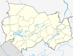
Dorogino (Novosibirsk)
| Urban-type settlement
Dorogino
Dorogino
|
||||||||||||||||||||||||||||||
|
||||||||||||||||||||||||||||||
|
||||||||||||||||||||||||||||||
Dorogino ( Russian Доро́гино ) is an urban-type settlement in the Novosibirsk Oblast in Russia with 3829 inhabitants (as of October 14, 2010).
geography
The place is about 75 km as the crow flies south of the Novosibirsk Oblast Administrative Center .
Dorogino belongs to the Cherepanovsky Rajon and is located a good 15 km north of its administrative center Cherepanowo . The settlement is the seat and only locality of the municipality (gorodskoje posselenije) Rabotschi possjolok Dorogino (literally "Dorogino workers' settlement").
history
The place goes to a station located by the turnout (Russian rasjesd ) no. 8 on the 1913 built and opened in 1915, later known as Turkestan-Siberian Altai Railway from Novo-Nikolaevsk (now Novosibirsk) to Semipalatinsk with branch after Bijsk back . The station was later renamed Dorogino , with reference to the village Dorogina Saimka ( Dorogin is a family name), which is located almost 10 km to the south-west and is now part of the neighboring municipality of Posevnaja to the south .
In a factory for ceramic products (today also bricks) built in the 1960s not far from the station, a prefabricated housing estate was built , which in 1969 received the status of an urban-type settlement.
Population development
| year | Residents |
|---|---|
| 1970 | 2725 |
| 1979 | 3488 |
| 1989 | 4132 |
| 2002 | 3811 |
| 2010 | 3829 |
Note: census data
traffic
In Dorogino there is a train station at km 90 of the Novosibirsk - Barnaul - Semei ( Kazakhstan ) railway line . The federal trunk road R256 Tschuiski trakt runs from Novosibirsk via Barnaul to the border with Mongolia a little to the west of the settlement .
A siding to a quarry 13 km east of the settlement (for gravel and crushed stone made of diabase and basalt porphyrites ) was dismantled in 2016 and replaced by truck traffic.
Web links
- Municipal administration website (Russian)
Individual evidence
- ↑ a b Itogi Vserossijskoj perepisi naselenija 2010 goda. Tom 1. Čislennostʹ i razmeščenie naselenija (Results of the All-Russian Census 2010. Volume 1. Number and distribution of the population). Tables 5 , pp. 12-209; 11 , pp. 312–979 (download from the website of the Federal Service for State Statistics of the Russian Federation)

