Tatarsk
| city
Tatarsk
Татарск
|
||||||||||||||||||||||||||||||||||||||
|
||||||||||||||||||||||||||||||||||||||
|
||||||||||||||||||||||||||||||||||||||
| List of cities in Russia | ||||||||||||||||||||||||||||||||||||||
Tatarsk ( Russian Тата́рск ) is a city in the western Siberian Oblast Novosibirsk ( Russia ) with 24,217 inhabitants (as of October 14, 2010).
geography
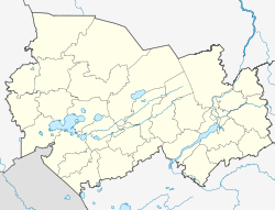
The city is located in the south of the West Siberian lowlands south of the Wassjuganje and on the northwestern edge of the Barabasteppe about 450 km west of the oblast capital Novosibirsk .
The city of Tatarsk is administratively directly subordinate to the Oblast and at the same time the administrative center of the raion of the same name .
history
In the area of today's city there has existed since around 1790 a village, which was later called Staraya Tatarka , after the Siberian Tatars ("Baraba Tatars") who lived here .
In the 1890s the Trans-Siberian Railway ran through the area and opened in 1896 on this western Siberian section Omsk –Nowonikolajewsk (now Novosibirsk). A settlement called Stanzionny , which simply means station settlement, was built around the station built here .
In 1911 the village and settlement were united and, like the train station, were given the name Tatarskaya . From here, the construction of a branch line for the development of the Kulunda steppe in the direction of the newly founded place (from 1917 city) Slavgorod , which went into operation in 1914 and was extended in the following years.
In 1925 the town charter was granted under its current name.
Population development
| year | Residents |
|---|---|
| 1926 | 9,200 |
| 1939 | 21,403 |
| 1959 | 30,786 |
| 1970 | 29,589 |
| 1979 | 30,893 |
| 1989 | 30,355 |
| 2002 | 26.051 |
| 2010 | 24,217 |
Note: census data (1926 rounded)
Culture and sights
The city has a local museum.
Economy and Infrastructure
In Tatarsk there are engineering factories and railway workshops.
Tatarsk is on the Trans-Siberian Railway (station name Tatarskaja ; route km 2879 from Moscow ), from which a cross connection to the Central Siberian Railway , which is crossed in Karassuk , branches off to Slavgorod and to the western continuation of the South Siberian Railway , which is crossed in Kulunda . The continuation of this line to the former Turksib , which is reached near Rubzowsk , has now been shut down after only a few years of operation.
While the previous M51 Chelyabinsk –Novosibirsk – Novosibirsk highway passed Tatarsk about 25 kilometers north, a few years ago a completely new route between Omsk and Novosibirsk was opened, which bypasses Tatarsk only a few kilometers south.
Individual evidence
- ↑ a b Itogi Vserossijskoj perepisi naselenija 2010 goda. Tom 1. Čislennostʹ i razmeščenie naselenija (Results of the All-Russian Census 2010. Volume 1. Number and distribution of the population). Tables 5 , pp. 12-209; 11 , pp. 312–979 (download from the website of the Federal Service for State Statistics of the Russian Federation)
Web links
- Tatarsk unofficial website (Russian)


