
Eberstalzell
|
Eberstalzell
|
||
|---|---|---|
| coat of arms | Austria map | |
 |
|
|
| Basic data | ||
| Country: | Austria | |
| State : | Upper Austria | |
| Political District : | Catfish Land | |
| License plate : | WL | |
| Surface: | 27.55 km² | |
| Coordinates : | 48 ° 3 ' N , 13 ° 59' E | |
| Height : | 400 m above sea level A. | |
| Residents : | 2,706 (January 1, 2020) | |
| Population density : | 98 inhabitants per km² | |
| Postal code : | 4653 | |
| Area code : | 0 72 41 | |
| Community code : | 4 18 05 | |
| NUTS region | AT312 | |
| UN / LOCODE | AT EBZ | |
| Address of the municipal administration: |
Hauptstrasse 15 4653 Eberstalzell |
|
| Website: | ||
| politics | ||
| Mayor : | Günther See ( ÖVP ) | |
|
Municipal Council : (2015) (25 members) |
||
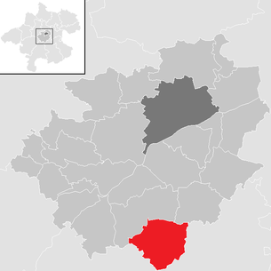
| Location of Eberstalzell in the Wels-Land district | ||
  |
||
 Eberstalzell volunteer fire department |
||
| Source: Municipal data from Statistics Austria | ||

Eberstalzell is a municipality in Upper Austria in the Wels-Land district with 2706 inhabitants (as of January 1, 2020).
geography
The community area is at an altitude of 400 m and geographically belongs to the Traunviertel. The community belonged to the judicial district of Lambach until 2012 and has been part of the judicial district of Wels since January 1, 2013 .
The extension is 7.2 km from north to south and 6.3 km from west to east. The total area is 27.6 km². 8.3% of the area is forested and 83% of the area is used for agriculture.
Community structure
The municipality includes the following seven localities (population in brackets as of January 1, 2020):
- Eberstalzell (1111)
- Hallwang (147) with Radt and Schöngrub
- Ittensam (164)
- Littring (132)
- Mayersdorf (203)
- Play Village (208)
- Wipfing (741)
The community consists of the cadastral communities Eberstalzell, Mayrsdorf and Wipfing.
Neighboring municipalities:
| Steinerkirchen | Sattledt | |
.svg)
|
||
| Vorchdorf | Pettenbach | Ried in the Traunkreis |
history
Parts of Eberstalzell were already inhabited in Roman times. This is proven by the finds of Roman mosaics on the Roman road near Albersdorf. During excavations in Albersdorf, a stone sacrificial stone (before 777) was discovered, which has now found a place of honor in the Maria-Hilf Chapel.
Eberstalzell is first mentioned in a document in the year 777 in the founding deed of Kremsmünster Abbey (as "Eporestal"):
- In addition, we are giving them a district in the village of Eporestal, which has been delimited from Saluso, Wenilo and Garweth and provided with stamps, where they can recreate the inurable and arable land from the forest around the aforementioned Eporestal without any hindrance, however they want.

Originally located in the eastern part of the Duchy of Bavaria , the place belonged to the Duchy of Austria since the 12th century. Since 1490 it has been assigned to the Principality of Austria ob der Enns .
During the Napoleonic Wars , the place was occupied several times.
Since 1918 the place belongs to the federal state of Upper Austria. After the annexation of Austria to the German Reich on March 13, 1938, the place belonged to the Gau Oberdonau . After 1945 the restoration of Upper Austria took place.
church
The monks of Kremsmünster Abbey built the first church, which was probably destroyed around 900 during the Hungarian invasions. Towards the end of the 10th century, a new, wooden church was consecrated to St. Ulrich. In 1494 the stone church that still exists today was finally opened. It got its final appearance in the 18th century and was extensively renovated in the 19th century.
coat of arms

Official description of the municipal coat of arms: In silver on a red, continuous bridge with three arched passages, a black, growing boar.
The community colors are red-white-black.
The boar is the talking symbol for the community name and at the same time, as Kremsmünster's heraldic animal, a special reference to the close historical connection between the monastery and the parish, which was founded as an early mission station (monk's cell ). The bridge stands for the natural stone masonry bridge of the Westautobahn (A1) located in the municipality .
The coat of arms was awarded on May 2, 1977. At the same time, the place name was changed from Ebersta ll zell to Ebersta l zell .
politics
The municipal council consists of 25 members and has been composed of mandates from the following parties since the 2015 municipal council election: 14 ÖVP , 3 SPÖ , 8 FPÖ
- mayor
- 2002–2020 Franz Gimplinger (ÖVP)
- since 2020 Günther See (ÖVP)
Culture and sights
- Parish church Eberstalzell : built in 1490 in Gothic style; during the major church renovations 1866–1882, discovery of late Gothic frescoes in the ribbed vault above the high altar (1881); neo-Gothic furnishings .
economy
- In the municipality of Eberstalzell, crude oil is produced by the Rohöl-Aufslassung AG (RAG).
- Energie AG has built Austria's largest photovoltaic power plant in Eberstalzell directly on the western motorway. In addition to the largest photovoltaic power plant, Energie AG is starting the Smart Gird project (intelligent power grid).
Personalities
- Gunther Philipp (1918-2003); Doctor and actor, ran a local doctor's office
- Simon Heilig-Hofbauer (* 1987), politician
Web links
- Page Eberstalzell
- 41805 - Eberstalzell. Community data, Statistics Austria .
- More information about the municipality of Eberstalzell on the geographic information system of the federal state of Upper Austria .
Individual evidence
- ↑ Statistics Austria: Population on January 1st, 2020 by locality (area status on January 1st, 2020) , ( CSV )
- ↑ a b Günther See is the new mayor of Eberstalzell. May 25, 2020, accessed May 26, 2020 .

Aichkirchen | Bachmanning | Bad Wimsbach-Neydharting | Buchkirchen | Eberstalzell | Edt at Lambach | Fischlham | Gunskirchen | Holzhausen | Krenglbach | Lambach | Marchtrenk | Neukirchen bei Lambach | Offenhausen | Pennewang | Pichl near Wels | Sattledt | Schleissheim | Sipbachzell | Stadl-Paura | Steinerkirchen an der Traun | Stone house | Thalheim near Wels | Weißkirchen an der Traun