
Thalheim near Wels
|
market community Thalheim near Wels
|
||
|---|---|---|
| coat of arms | Austria map | |
 |
|
|
| Basic data | ||
| Country: | Austria | |
| State : | Upper Austria | |
| Political District : | Catfish Land | |
| License plate : | WL | |
| Surface: | 16.32 km² | |
| Coordinates : | 48 ° 9 ' N , 14 ° 2' E | |
| Height : | 369 m above sea level A. | |
| Residents : | 5,530 (January 1, 2020) | |
| Population density : | 339 inhabitants per km² | |
| Postal code : | 4600 | |
| Area code : | 07242 | |
| Community code : | 4 18 23 | |
| NUTS region | AT312 | |
| Address of the municipal administration: |
Market town of Thalheim near Wels, community square 1 4600 Thalheim near Wels |
|
| Website: | ||
| politics | ||
| Mayor : | Andreas Stockinger ( ÖVP ) | |
|
Municipal Council : (2015) (31 members) |
||
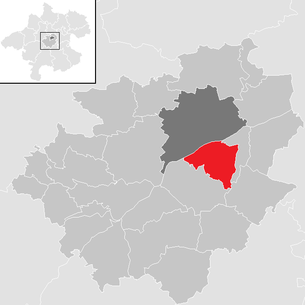
| Location of Thalheim bei Wels in the Wels-Land district | ||
  |
||
| Source: Municipal data from Statistics Austria | ||


Thalheim bei Wels is a market town in Upper Austria in the Wels-Land district with 5530 inhabitants (as of January 1, 2020).
The municipality is geographically in the Traunviertel . The responsible judicial district is Wels .
geography
Thalheim near Wels is at an altitude of 369 m above sea level. A. in the Traunviertel. The extension is 5.2 km from north to south and 5.9 km from west to east. The total area is 16.4 km². 11.6% are forested, 69.5% are used for agriculture.
Community structure
The municipality includes the following six localities (population in brackets as of January 1, 2020):
- Bergerndorf (147)
- Hardwood (129)
- Ottstorf (452)
- Schauersberg (390)
- Thalheim near Wels (4361)
- Unterschauersberg (51)
The community consists of the cadastral communities Aschet, Ottsdorf and Thalheim.
Altitude levels
The modern town center is located near the right bank of the Traun at an altitude of around 320 m. This elevation level is very narrow at the west and north-east end of the municipality and only widens to 300 m near the center of the village around the stream and at the east tangent (at the Thalbach). The ancient Roman road (parallel to the Traun) ran above the marsh and the risk of flooding on the slope of the Reinberg, later a densely built-up section of the very narrow former Pyhrn-Bundesstraße, for example at the castle where the Bruckhofstraße branches off. Both the Reinberg in the southwest up to the Bruckhof and a zone of the gravel terrace behind it were settled from around 1960 until today, as well as the Kirchberg in the southeast, from whose church the elevation 369 m probably originates.
The wooded, steeply sloping elevation on the western part of the Reinberg was the location of several hydraulic rams until 1990 . Sources escaping halfway up the slope were captured and fed in a frost-proof pressure pipe to the lower lying ram, which with a "clack" that could be heard from far and wide at night delivered a small amount of water to the upper edge of the slope to supply farms at their places the groundwater in the gravel was particularly deep.
history
The loess layers of a clay pit near Aschet document in detail the climate development during the ice ages and have been scientifically examined.
The place name suggests a foundation as part of the Franconian conquest . After that, the municipality was part of the Duchy of Bavaria and the 12th century to the Duchy of Austria. It was first mentioned in 927 ("Thalham"). Since 1490 it has been assigned to the Duchy of Austria ob der Enns .
During the Napoleonic Wars , the place was occupied several times.
After the annexation of Austria to the German Reich on March 13, 1938, the place belonged to the Gau Oberdonau .
Population development
In 1991, according to the census, the municipality had 4525 inhabitants, and in 2001 the census that was carried out found a population of 4958 inhabitants.
Culture and sights

Parish church Thalheim
The late Gothic three-nave staggered church to St. Stephen was inaugurated in 1070 by Bishop Altmann of Passau . The high altar made of Carrara marble from 1897 is remarkable. Above the south gate in a niche there is a late baroque statue of St. Christophorus. On the outside of the church is the grave of members of the Franckenstein family .

Pilgrimage Church of Maria Schauersberg
Another attraction is the pilgrimage church Maria Schauersberg in Schauersberg. According to a legend, the church was built because of a miraculous healing that freed Count Sigmund von Pollheim from gout. The late Gothic pilgrimage church was consecrated around 1490. The high altar with larger than life altar figures by the Passau sculptor Johann Seitz was erected in 1665. “Maister Simon Hadinger, Carpenter zu Cremsminster” was entrusted with the carpentry work. In 1777 the miraculous image was transferred from the right side altar to the high altar. The late Gothic Madonna (approx. 1470–1480) was covered with wood in Josephinism . The crowned statue of Mary is surrounded by rays and stands on a crescent moon. The naked Jesus child blesses the viewer with her right hand.
Filial church of St. Aegydi in Aigen
The Sankt-Aegydi-Church can be seen from afar from the old Traun Bridge. The Gothic church is dedicated to St. Aigidios and was handed over to its destination on April 11, 1189. It used to be a popular place of worship and many passing merchants immortalized themselves in the church (near the sacristy door inside). It contains statues of St. Lambert , Isidor and Rochus and on the south wall a statue of St. Sebastian . On the northern outer wall there is a St. Christophorus figure.

Traunegg Castle
The castle was first mentioned in a document as Hof zu Thalheim in 1283. In 1577 the farm was converted into today's castle. Today the castle houses private apartments.

Marienwarte
The Marienwarte observation tower on the Reinberg from the late 19th century can be reached from the old Traun Bridge via the serpentine footpaths of the "Reinberganlage", the wooded park on the shady slope. The viewing platform of the 23 meter high tower offers a panoramic view of the village and the city of Wels as well as of the Alps in the south and to the north in the Mühlviertel . Alternatively, two paths lead from Bruckhofstrasse and the Bruckhof up on the plateau to the control room.
Economy and Infrastructure
Established companies:
- ALCE Anlagentechnik Ges.mbH
- RICO Elastomere Projecting GmbH: silicone processing
- ECM - Bergauer GmbH
- Eska glove factory (formerly Eska & Dutka, SK)
- Fronius : welding machines, converters, chargers
- AHZ Components Produktions GmbH: sheet metal processing, welded constructions
- TechnikArt: sound and lighting systems
traffic
- Street
Already in Roman times, a street ran parallel to the Traun on the Reinberghang, through the old town center, about 20 m above the Traun.
As a bottleneck with inclines, it passed the relatively busy Pyhrnpass federal road B138 (Wels - Sattledt (A1) - Pyhrnpass - Liezen) coming from the old Traunbrücke until around 1980 , which is located in today's Aigenstraße (1.5 km along the Aigenbach) - Seestrasse - Kremsmuellerstrasse continued.
1 to 2 km east of this axis, exactly following the cut of the 5 km long Thalbach and on to Steinhaus through the green, the comfortable new route "Osttangente" was laid around 1980, a little east of the centers of Wels and Thalheim. Only in the Traunniederung does this run through Thalheim with traffic lights, four lanes and structurally separate lanes. Their “new Traunbrücke” has a footpath and cycle path that has been adapted on the upstream side.
Around the end of the 1990s, on the "old Traun Bridge" (riveted iron arch construction from 1901 with a very narrow two-lane carriageway and, until around 1990, an iron gauge house on the left bank), the sidewalks outside the arches were widened to become cycle paths. Until around 1990 there was an iron gauge house on the left bridgehead on the underwater side outside the sidewalk railing, where passers-by could illuminate the recording roller at the push of a button and thus read the water level through a window. Since the Marchtrenk power station was built in 1977, the traffic jam has reached a little above this bridge and the water level hardly fluctuates any more.
The landscape notch of the Aiterbach valley west of Thalheim was built around 2002 with the "Westspange" (Pyhrnautobahn A9). With green bridges for landscape and animal migration. The Innkreisautobahn A8 is continued eastwards by the Welser Autobahn A25 to the Westautobahn A1, so that Wels and Thalheim are within a triangle with a side length of 15 km.
With a substantial contribution from the Trodat stamp company Just and other sponsors, a strikingly curved footbridge for pedestrians and cyclists was built around 2005 from the “lower” town center of Thalheim (Raiffeisenstrasse, Aigenbach) over the Traun to Wels.
A good 400 m above the old road bridge, the railway bridge of the Almtalbahn from Grünau, built in 1892, runs through the Wels exhibition grounds to the main station and is also open to foot traffic on the upstream side.
The privately financed Angerlehner footbridge for foot and bike has been leading from the Angerlehner museum over to the Welldorado swimming pool in Wels, almost 400 m above .
Formerly, towpaths ran here on both banks of the Traun, most of which are still preserved here in various functions.
At the Traunleiten power station above, the river cannot be crossed on foot. It will be heavily rebuilt in 2018/2019.
- railroad
The Almtalbahn from Wels to Grünau im Almtal via Sattledt touches the western Thalheim municipality. The Aschet stop , which was closed in 1989, was located directly in front of the Würzburger brickworks. As a replacement for the less frequented stop, the Schauersberg stop was opened in 1991 near the municipal border with Steinhaus bei Wels. This stop is conveniently located for the districts of Schauersberg and Unterschauersberg.
- Public transport (bus)
The Wels bus lines connect Thalheim with the city line 15 on weekdays and Saturday until noon.
Other bus lines of the Upper Austrian Transport Association pass through Thalheim, such as line 455 Rohr-Sattledt-Thalheim-Wels from Wilhelm Welser Verkehrsbetriebe Traun (WWT).
- The river Traun
The Traun was used early on for rafting wood and salt. The old Traunleiten power station is located above Thalheim. The Marchtrenker power station (below) dams the Traun from around 1980 up to the railway bridge. With the injection of atmospheric oxygen into the traffic jam around 1990, attempts were made to avoid the formation of odor caused by putrefactive bacteria. The situation only improved with the reduction in wastewater pollution from the paper mills above. The reservoir area was sealed off from the groundwater with diaphragm walls, and a cycle route was developed on the left bank (and thus through Wels) on the Traun.
- Footpath
The Friends of the Reinberg Association preserved the steep NW slope of the Reinberg from being built up and achieved (1920?) The establishment of the Reinberg facilities, a network of walking paths through which the settlement on the back of the Reinberg can be easily reached on foot.
Air raid tunnels were built for the population in the Reinberg during World War 1939–1945, the entrances of which were walled up around 1990.
Vegetable gardeners and merchants have gradually closed in the higher-lying - still growing - Thalheim settlements. Branches of retail chains are now (2006) in the lower town center, which has a new roundabout to cope with car traffic.
- Mail and phone
Today Thalheim has a postal partner with the gas station at PBRodlbergerstraße 39. The former post office in the former cinema and community building had the same postcode 4609 at house number 12. At least since 1970, mail for Thalheim has been delivered from Wels, which is expressed in the postcode 4600 for most of the Thalheim addresses.
Likewise, landline connections in Thalheim essentially have the area code 07242, the same as Wels.
politics
Community representation
After the municipal council and mayoral elections in 2015, the municipal council is composed as follows:
- 16 mandates of the Austrian People's Party (ÖVP)
- 7 mandates for the Freedom Party of Austria (FPÖ)
- 4 mandates for the Social Democratic Party of Austria (SPÖ)
- 4 mandates Green (Green)
Mayor is Andreas Stockinger (ÖVP), Vice Mayors are Klaus Mitterhauser (ÖVP) and Norbert Mayer (FPÖ).
coat of arms
Official description of the municipal coat of arms awarded in 1982: Divided by green and blue by a silver bridge (flat curved beam) with two pillars seen from above. The municipality colors are green-white-blue.
The simple coat of arms symbolizes the crossing of the Traun, which was important in Roman times along the Pyhrnstrasse . The colors green and blue underline the considerable agricultural area in the municipality and the location on the Traun River , which was still very rich in fish until a few decades ago and forms the northern border to the district town of Wels.
Personalities
Honorary citizen
- 2019: Leo Jachs, head of the Thalheim community near Wels 1987–2019
Sons and daughters of the church
- Joseph Freiherr von und zu Franckenstein (1910–1963), classical philologist and Nazi opponent
- Franz Kalchmair (* 1939), opera and lieder singer
Personalities associated with the community
- Heinz Josef Angerlehner (* 1943), industrialist, art collector
- Sabrina Filzmoser (* 1980), judoka, Olympic participant
- Günter Fronius (1907–2015), founder of the Fronius International company
Others
In 1993, the municipality joined the Climate Alliance and, as a member municipality, has committed itself to continuously reducing its greenhouse gas emissions.
Web links
- 41823 - Thalheim near Wels. Community data, Statistics Austria .
Further information about the municipality of Thalheim bei Wels can be found on the geographic information system of the federal state of Upper Austria .
Individual evidence
- ^ Market town of Thalheim near Wels: Stockinger Andreas (Mayor). Retrieved April 8, 2020 .
- ↑ Statistics Austria: Population on January 1st, 2020 by locality (area status on January 1st, 2020) , ( CSV )
- ↑ Dirk van Husen, Jürgen Reitner (eds.): The loess sequence Wels / Aschet (former Würzburger loam pit): A reference profile for the Central and Young Pleistocene in the northern Alpine foothills ( MIS 16 to MIS 2). Austrian Academy of Sciences - OeAW. Announcements of the Commission for Quaternary Research Volume 19. Verlag der ÖAW. Vienna 2011. ISBN 978-3-7001-6992-5 . MIS = Oxygen Isotope Stage (Marine Isotopic Stage) .
- ^ Market town of Thalheim near Wels: Worth knowing> General. Retrieved April 8, 2020 .
- ↑ http://www.liniewels.at/de/stadtlinien/ Stadtlinien, Linie Wels, accessed December 27, 2015.
- ↑ http://www.welser-traun.at Wilhelm Welser Traun, bus company, accessed December 27, 2015
- ^ Market town of Thalheim near Wels: Stockinger Andreas (Mayor). Retrieved April 8, 2020 .
- ↑ Market town of Thalheim near Wels: Service. Municipal coat of arms. Retrieved April 8, 2020 .
- ^ State of Upper Austria - State history: Community coat of arms Thalheim b. catfish
- ↑ https://www.mein Bezirk.at/wels-wels-land/c- Menschen / thalheim-waere-ohne-leo-nicht- vorbaren_a3493632 , accessed on June 1, 2020.
- ↑ Climate alliance: Thalheim b. catfish

Aichkirchen | Bachmanning | Bad Wimsbach-Neydharting | Buchkirchen | Eberstalzell | Edt at Lambach | Fischlham | Gunskirchen | Holzhausen | Krenglbach | Lambach | Marchtrenk | Neukirchen bei Lambach | Offenhausen | Pennewang | Pichl near Wels | Sattledt | Schleissheim | Sipbachzell | Stadl-Paura | Steinerkirchen an der Traun | Stone house | Thalheim near Wels | Weißkirchen an der Traun