Ellerbach (Altenau)
| Ellerbach | ||
|
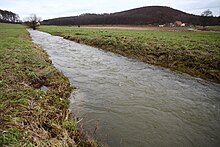
The Ellerbach in Kirchborchen after the Biske has taken up, shortly before it flows into the Altenau |
||
| Data | ||
| Water code | DE : 278286 | |
| location | North Rhine-Westphalia , Germany | |
| River system | Rhine | |
| Drain over | Altenau → Alme → Lippe → Rhine → North Sea | |
| source | South of Schwaney 51 ° 41 ′ 16 ″ N , 8 ° 56 ′ 14 ″ E |
|
| Source height | approx. 317 m above sea level NN | |
| muzzle | In Kirchborchen in Altenau, coordinates: 51 ° 39 '33 " N , 8 ° 43' 29" E 51 ° 39 '33 " N , 8 ° 43' 29" E |
|
| Mouth height | approx. 134 m above sea level NN | |
| Height difference | approx. 183 m | |
| Bottom slope | approx. 6.5 ‰ | |
| length | 28.1 km | |
| Catchment area | 91.104 km² | |

The Ellerbach (also called the Eller ) is a 28.1 km long right or eastern tributary of the Altenau in the Paderborn district ( North Rhine-Westphalia , Germany ).
course
The Ellerbach rises in the southern part of the Eggegebirge and Teutoburg Forest / Eggegebirge Nature Park . Its source is in the Emden forest about 4 km (as the crow flies ) south of Schwaney , a part of the municipality of Altenbeken .
Initially, the stream flows north in the Teutoburg Forest / Eggegebirge nature park, then turns west in Schwaney and then turns south-west along county road 38 - passing the Urenberg ( 331.6 m above sea level ). Then he reaches Dahl , located on the western edge of the nature park , a district away from or 7 km (as the crow flies) east-southeast of the city of Paderborn .
Below Dahl and thus outside the nature park, where the Ellerbach partially seeps into the ground not only in summer, it flows through the 42 hectare Ellerbachtal nature reserve (NSG no. 318339) and the Haxtergrund settlement, founded in 1999 . There he crosses the federal highway 68 . Then it passes the winding Haxterberg ( 248.2 m above sea level ) with the Paderborn-Haxterberg airfield located not far to the northeast and Hamborn Castle a little further down the river , which is 188.6 m above sea level. NN stands on the limestone ridge of the Schoßberg about 20 to 30 m above a loop of the Ellerbach.
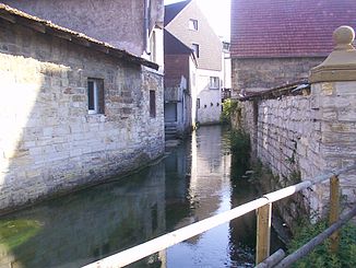
Below this castle, the Ellerbach turns west to flow in Kirchborchen for about 650 m underground roughly along the course of the Bachstraße and then squeeze openly for a short distance between the houses in the village.
After taking up the small stream Biske , which flows from the karst spring Storchenkolk and flows into it from the southeast, and crossing a mill ditch , the Ellerbach flows within Kirchborchen into the very water-rich Altenau , which comes from the south .
Hydrology
Water flow
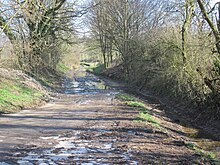
In summer , large sections of the Ellerbach lie dry below Dahl because it seeps into the karst subsoil - here limestone - so that it does not carry any water at least above ground until it flows into the Altenau.
After heavy or long-lasting rainfall and during the snowmelt, the Ellerbach repeatedly leads to extremely strong floods ; There were particularly devastating ones in the last days of May of 1931 and during the Heinrich flood in July 1965, when the masses of water rolled through Dahl and caused great damage not only there but also in Kirchborchen. Also on New Year's Day 2003 there was a strong flood, after which the local county road had to be closed for several days.
For flood protection for Kirchborchen and the villages further downstream, the Borchen flood retention basin (built 1978 to 1980; 1.94 million m³ of storage space ) was set up on the Ellerbach below Hamborn Castle , the dam (crown 167.5 m above sea level , length approx 200 m, max. Dam height 16.5 m) not far northeast of the Dahlberghof ( manor ).
Watershed
The headwaters of the Ellerbach are located on the Rhine-Weser watershed : This means that the Ellerbach, which flows in western directions, drains into the Rhine via the Altenau , Alme and Lippe , while the Nethe , east of the Egge main ridge rises, flows in a northeasterly direction into the Weser .
Tributaries and catchment areas
The tributaries of the Ellerbach, whose catchment area covers 91.104 km², include with orographic allocation (l = left-hand side, r = right-hand side) , water length , etc. a. Estuary with Eller stream kilometers and - if known - catchment area size (viewed downstream) /:
- Rotenbach (r; 3.2 km), in Schwaney (near km 24)
- Finkenpuhl (1; 0.9 km), below Haxtergrund (near km 7.95)
- Biske (1; 1.1 km), flowing from the karst spring Storchenkolk (or: Vodes Kolk ), flowing into Kirchborchen (at km 0.1)
Localities
The localities on the Ellerbach include:
- Schwaney - district of Altenbeken
- Dahl - district of Paderborn
- Haxtergrund - settlement southeast of Paderborn
- Hamborn Castle - Location of the Borchen district of Kirchborchen with Hamborn Castle
- Kirchborchen - district of Borchen
Individual evidence
- ↑ a b c German basic map 1: 5000
- ↑ a b c d Topographical Information Management, Cologne District Government, Department GEObasis NRW ( information )
- ↑ a b Map services of the Federal Agency for Nature Conservation ( information )
- ↑ a b Map service of the water association Obere Lippe

