Kirchborchen
|
Kirchborchen
Borchen municipality
Coordinates: 51 ° 40 ′ 0 ″ N , 8 ° 43 ′ 0 ″ E
|
|
|---|---|
| Height : | 154 m above sea level NN |
| Area : | 20.58 km² |
| Residents : | 4286 (December 31, 2013) |
| Population density : | 208 inhabitants / km² |
| Incorporation : | 1st July 1969 |
| Postal code : | 33178 |
| Area code : | 05251 |
|
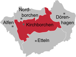
Location of the Kirchborchen district in the Borchen municipality
|
|
Kirchborchen is the central town and at the same time the seat of the Borchen municipality in the Paderborn district in North Rhine-Westphalia ( Germany ).
geography
Geographical location
Kirchborchen is located on the Paderborn plateau at the confluence of the Ellerbach and Altenau . The Almetal on the western edge of the village is the landscape boundary to the Hellweg area . To flood the village's east-northeast of Kirchborchen towards Schloss Hamborn the detention basin Borchen established on Ellerbach.
Neighborhoods
Starting clockwise in the east, Kirchborchen borders the Borchen districts of Dörenhagen , Etteln , Alfen and Nordborchen and the city of Paderborn .
In addition to the village of Kirchborchen, Hamborn Castle also belongs to the village of Kirchborchen.
history
Before the Kirchborchen office moved into a newly constructed building in Nordborchen on today's Paderborner Strasse on March 10, 1880 , Kirchborchen was the seat of this office .
On July 1, 1969, the municipalities of Alfen, Nordborchen and Kirchborchen of the Kirchborchen office merge to form the municipality of Borchen, which is based in Nordborchen. On January 1, 1975, the Borchen community was expanded to include Dörenhagen and Etteln under the Sauerland / Paderborn Act and the Kirchborchen office was dissolved. The legal successor is the Borchen municipality.
The building of the previous administrative office in Nordborchen serves the community as a community administration until it moves into the newly built town hall in Kirchborchen in 1984.
In 1950 the former community of Kirchborchen had 2,203 inhabitants, a number that had increased to 4,192 by the end of 2007.
politics
Mayor
- 1975 to 1979 Adolf-Herbert Staffen
- 1979 to 1999 Johannes Sander
- 1999 to 2014 Hans-Josef Fromme
- 2014 to 2015 Jens Meschede
- since 2015 Manfred Melcher
The mayor of Kirchborchen is Manfred Melcher (CDU). In the last municipal election in 2014, the citizens of Kirchborchen cast their votes in the election for Borchen municipal council as follows:
- CDU 39.90%
- SPD 33.08%
- Alliance 90 / The Greens 17.72%
- Free Voting Community Borchen (FWB) 4.85%
- Others 4.46%
Economy and Infrastructure
Kirchborchen is located at the Borchen junction of the A33 motorway , the connecting motorway between the A2 Oberhausen-Berlin and the A44 Dortmund-Kassel. In the foreseeable future, the A33 will be extended beyond Bielefeld in a north-westerly direction to Osnabrück .
Regular bus routes connect the town with the other localities of the municipality (although Dörenhagen is better connected to Paderborn and Lichtenau (Westphalia) than to Kirchborchen) and in particular the district town of Paderborn , whose main train station is the closest (long-distance) train station, but also the airport Paderborn-Lippstadt in the Ahden district of Bürener .
At the time of the office of Kirchborchen, the seat of the administration for the surrounding villages was Nordborchen. Today the district of Kirchborchen houses the town hall of Borchen. The Kirchborchen community center is located right next to the town hall.
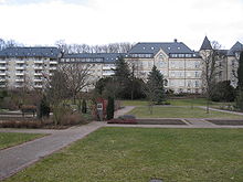
The merciful sisters of Saint Vincent von Paul, who have their mother house in Paderborn, maintain a sister house in Kirchborchen.
Kirchborchen has a primary school and a secondary school , the old age school and secondary school Borchen. In the district of Hamborn Castle there is a Rudolf Steiner School with a country school home .
The postal code of Kirchborchen is 33178 (formerly 4799 and before that 4791).
religion
About 60 percent of the population of Kirchborn are Catholic and belong to the parish of St. Michael in the Paderborn deanery of the pastoral care region of Hochstift in the Archdiocese of Paderborn . With the other Catholic parishes of the Borchen political community, this forms the Borchen Pastoral Association.
The approximately 19 percent Evangelical Lutheran residents belong to the Stephanus parish Borchen in the Paderborn parish of the Evangelical Church of Westphalia .
Culture and sights
The landmark church is the Catholic parish church of St. Michael . The Galli Chapel is a gem, built in 1663 on the site and in memory of the St. Gallus Church in the deserted village of Südborchen , built by Bishop Rotho in 1043 .
Personalities who have worked on site
- Hermann von Mallinckrodt (1821–1874), Cath. Politician ( center ), landowner of Hamborn Castle
- Carl Caspar von Droste zu Hülshoff (1843–1922), landowner of Hamborn Castle
- Heinrich von Droste zu Hülshoff (author) (1875–1934), landlord of Hamborn Castle
Web links
- borchen.de
- Kirchborchen in the Westphalia Culture Atlas
Individual evidence
- ^ Geographical Commission for Westphalia (ed.): Geographisch-Landeskundlicher Atlas von Westfalen, Topic X Administration and Management, double sheet state and municipal administrative structure , Münster 1990.
- ↑ Martin Bünermann: The communities of the first reorganization program in North Rhine-Westphalia . Deutscher Gemeindeverlag, Cologne 1970, p. 77 .
- ^ Federal Statistical Office (ed.): Historical municipality directory for the Federal Republic of Germany. Name, border and key number changes in municipalities, counties and administrative districts from May 27, 1970 to December 31, 1982 . W. Kohlhammer, Stuttgart / Mainz 1983, ISBN 3-17-003263-1 , p. 327 .
- ↑ Archived copy ( Memento of the original from April 11, 2012 in the Internet Archive ) Info: The archive link was inserted automatically and has not yet been checked. Please check the original and archive link according to the instructions and then remove this notice.
- ↑ [1]


