Gmina Choczewo
| Gmina Choczewo | ||
|---|---|---|

|
|
|
| Basic data | ||
| State : | Poland | |
| Voivodeship : | Pomerania | |
| Powiat : | Wejherowski | |
| Geographic location : | 54 ° 44 ' N , 17 ° 54' E | |
| Residents : | see Gmina | |
| Postal code : | 84-210 | |
| Telephone code : | (+48) 58 | |
| License plate : | GWE | |
| Economy and Transport | ||
| Street : | Ext. 213 : Celbowo– Słupsk | |
| Lubiatowo– Wejherowo | ||
| Rail route : | no rail connection | |
| Next international airport : | Danzig | |
| Gmina | ||
| Gminatype: | Rural community | |
| Gmina structure: | 27 localities | |
| 14 school offices | ||
| Surface: | 183.23 km² | |
| Residents: | 5497 (Jun. 30, 2019) |
|
| Population density : | 30 inhabitants / km² | |
| Community number ( GUS ): | 2215042 | |
| Administration (as of 2012) | ||
| Community leader : | Wiesław Gębka | |
| Address: | ul.Pierwszych Osadników 17 84-210 Choczewo |
|
| Website : | www.choczewo.com.pl | |
The Gmina Choczewo is a rural community in the powiat Wejherowski of the Pomeranian Voivodeship in Poland . Its seat is the village of the same name ( German Chottschow , 1938–1945 Gotendorf , Kashubian Chòczewò ) with 1310 inhabitants.
geography
The municipality is located in Western Pomerania on the Baltic Sea coast and twenty kilometers from Lębork . The Jezioro Choczewskie (formerly Chottschower See ) belongs to the waters .
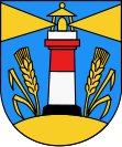
The northern border of the municipality is the Baltic Sea coast with the lighthouse at Osetnik (Latarnia Morska Stilo) , which was included in the Gmina coat of arms. Neighboring communities are:
- in the powiat Wejherowski: Gniewino (Gnewin) and Łęczyce (Lanz) ,
- in Powiat Pucki : Krokowa (Krockow) and
- in the powiat Lęborski : Łeba (Leba) and Nowa Wieś Lęborska (Neuendorf) .
structure
The rural community of Choczewo covers an area of 183.23 km² (14.29% of the total area of the powiat). More than 5500 people live in Gmina, 1310 of them in the village of Choczewo. Gmina Choczewo includes 41 localities, which are assigned to 14 villages with school offices:
- Schulzenämter :
Other places : Biebrowo ( Bebbrow ), Borkow Male ( Klein Borkow ) Brachówko, Cegielnia, Ciekocinko, Gardkowice ( Gartkewitz ) Jabłonowice ( Julienhof ) Karczemka Gardowska ( Johanneshof ) Karczemka Kierzkowska ( Karczemka ) Kierzkowo Male ( Klein Kerschkow ) Krzesiniec ( Bellealliancestraße ), Kurowo ( Kurow ) Łętówko ( Lantow lake ), Lubiatowo ( Lübtow ) Lublewko ( small Lüblow ) Lublewo Lęborskie ( Lüblow ) Osetnik ( Stilo ), Osieki Lęborskie ( Ossecken ) Przebędowo ( Prebendow ) Przebędówko, Sasinko ( Neu Sassin ), Sasino-Kolonia ( Sassin, colony ), Szklana Huta ( glassworks ), Słajszewko, Żelazno (until 1937 Zelasen , 1938–45 Hohenwaldheim ), Zwarcienko ( Schwartower Waldhof ) and Zwartowo ( Schwartow ).
traffic
Streets
The DW 213 voivodship road leads to Choczewo and connects Celbowo (Celbau) via Krokowa (Krockow) with Wicko (Vietzig) , Główczyce (Glowitz) and Słupsk (Stolp) .
The former district town of Lębork (Lauenburg in Pomerania) and today's seat of the Powiat Wejherowo (Neustadt in West Prussia) can be reached via well-developed side streets.
rails
A train connection has not existed since 2004. In 2001 and 2004 passenger and freight traffic was stopped by the Polish State Railways .
In 1905 Chottschow was the end point of a newly built line of the Neustadt – Prüssau small railway from Neustadt in West Prussia (today Wejherowo) via Prüssau (Prusewo). This route was continued in 1910 by the Chottschow – Garzigar small railway from Chottschow to Garzigar (Garczegorze) on the Lauenburg – Leba railway line. The present area of the Gmina Choszewo was connected to this small train line with nine train stations: Lüblow (Lublewo Lęborskie), Ossecken (Osieki Lęborskie), Chottschow (Choczewo), Goten (Choczewko), Kurow (Kurowo), Prebendow (Przebowędowo), Schwartowo ), Klein Schwartow (Zwartówko) and Gossentin (Gościęcino). Between 1919 and 1939 the railway line through the Polish Corridor between the West Prussian Gohra (1939–45 Überbrück , Polish Zamostne) and the Pomeranian Rieben (Rybno) was interrupted.
Web links
- Website of Gmina Choczewo (Polish)
Individual evidence
- ↑ population. Size and Structure by Territorial Division. As of June 30, 2019. Główny Urząd Statystyczny (GUS) (PDF files; 0.99 MiB), accessed December 24, 2019 .

