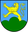
Gmina Lewin Brzeski
| Gmina Lewin Brzeski | ||
|---|---|---|

|
|
|
| Basic data | ||
| State : | Poland | |
| Voivodeship : | Opole | |
| Powiat : | Brzeski | |
| Geographic location : | 50 ° 45 ' N , 17 ° 37' E | |
| Height : | 152 m npm | |
| Residents : | s. Gmina | |
| Postal code : | 49-340 | |
| Telephone code : | (+48) 77 | |
| License plate : | IF | |
| Economy and Transport | ||
| Street : | Brzeg - Opole / A4 motorway | |
| Rail route : | Opole – Brzeg | |
| Next international airport : | Wroclaw | |
| Gmina | ||
| Gminatype: | Urban-and-rural parish | |
| Gmina structure: | 20 school offices | |
| Surface: | 159.70 km² | |
| Residents: | 12,968 (Jun. 30, 2019) |
|
| Population density : | 81 inhabitants / km² | |
| Community number ( GUS ): | 1601043 | |
| Administration (as of 2010) | ||
| Mayor : | Artur Kotara | |
| Address: | Rynek 1 49-340 Lewin Brzeski |
|
| Website : | www.lewin-brzeski.pl | |
The Gmina Lewin Brzeski is an urban-and-rural municipality in the powiat Brzeski of the Opole Voivodeship in Poland . Your seat is the city of the same name ( German lion ) with about 5900 inhabitants.
geography
The municipality is located in the west of the Opole Voivodeship, about ten kilometers northwest of Opole (Oppeln) and ten kilometers southeast of Brzeg (Brieg) . In the north the municipality borders on the Oder , other bodies of water are the Nysa Kłodzka (Glatzer Neisse) and the Ścinawa Niemodlińska (Steinau) .
All neighboring municipalities are part of the Opole Voivodeship. In the north, the community of Lewin Brzeski borders the communities of Skarbimierz (Hermsdorf) and Poppelau (Popielów), in the east on Groß Döbern and Dąbrowa (Dambrau), in the south on Niemodlin (Falkenberg O / S) and in the west on Olszanka (Alzenau) .
history
The municipality came to the Opole Voivodeship in 1950, which changed its layout several times until 1999. The powiat Brzeski was re-established in 1999.
Artur Kotara replaced Anna Twardowska as mayor in 2010.
Partnerships
The community maintains community partnerships since 1997 with Szegvár in Hungary and since 2006 with Senieji Trakai in Lithuania .
structure
The urban and rural community of Lewin Brzeski covers an area of 159.7 km² and, in addition to the city that gives it its name, is divided into the following 20 school authorities:
|
|
traffic
Three important east-west connections run through the municipality:
The A4 motorway , the main east-west transit route in Poland, runs along the southern border of the municipality. A junction only exists outside of the municipality. The municipality has a share in the national road DK94 , which connects Wroclaw with Katowice .
Lewin Brzeski station is on the Bytom – Wrocław railway line , which was opened in this section in 1843.
Individual evidence
- ↑ population. Size and Structure by Territorial Division. As of June 30, 2019. Główny Urząd Statystyczny (GUS) (PDF files; 0.99 MiB), accessed December 24, 2019 .


