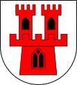
Gmina Grodków
| Gmina Grodków | ||
|---|---|---|

|
|
|
| Basic data | ||
| State : | Poland | |
| Voivodeship : | Opole | |
| Powiat : | Brzeg | |
| Geographic location : | 50 ° 42 ' N , 17 ° 23' E | |
| Height : | 173 m npm | |
| Residents : | s. Gmina | |
| Postal code : | 49-200 | |
| Telephone code : | (+48) 77 | |
| License plate : | IF | |
| Economy and Transport | ||
| Street : | A 4 | |
| Rail route : | Nysa – Brzeg | |
| Next international airport : | Katowice Airport | |
| Gmina | ||
| Gminatype: | Urban-and-rural parish | |
| Gmina structure: | 35 school offices | |
| Surface: | 286.39 km² | |
| Residents: | 19,149 (Jun. 30, 2019) |
|
| Population density : | 67 inhabitants / km² | |
| Community number ( GUS ): | 1601033 | |
| Administration (as of 2015) | ||
| Mayor : | Marek Antoniewicz | |
| Address: | ul.Warszawska 29 49-200 Grodków |
|
| Website : | www.grodkow.pl | |
The Gmina Grodków [ˈɡrɔtkuf] is an urban-and-rural municipality in the powiat Brzeski of the Opole Voivodeship in Poland . Its seat is the city of the same name Grodków (German Grottkau, Silesian Gruttke ) with about 8,700 inhabitants.
geography
The municipality is located about 15 km south of the district town of Brzeg and 40 km west of Opole .
history
From 1945 to 1975 the city was the seat of Powiat Grodkowski. From 1975 to 1998 the places belonged to the former Opole Voivodeship .
City and community partnerships
- Heringsdorf , Germany
- Beckum , Germany
structure
The urban and rural community of Grodków includes the following school authorities :
- Bąków (Bankau)
- Bogdanów (Boitmannsdorf)
- Gałązczyce (Giersdorf)
- Gierów (Gührau)
- Głębocko ( Deep Lake )
- Gnojna (Olbendorf)
- Gola Grodkowska (Guhlau)
- Jaszów (Seiffersdorf near Ottmachau)
- Jeszkotle (Jäschkittel)
- Jędrzejów (Endersdorf)
- Kobiela (Kühschmalz)
- Kolnica (Lichtenberg)
- Kopice (Koppitz, 1936–1945 Schwarzengrund)
- Lipowa (German Leippe)
- Lubcz (Leuppusch)
- Mikołajowa (Niklasdorf)
- Młodoszowice (Zindel)
- Nowa Wieś Mała (Klein Neudorf)
- Osiek Grodkowski (Osseg, 1936 Auwaldau, later Auenrode)
- Polana (Ebenau)
- Przylesie Dolne (Niederseiffersdorf)
- Rogów (Rogau)
- Starowice Dolne (Hönigsdorf)
- Strzegów (Striegendorf)
- Sulisław (Zülzhof)
- Tarnów Grodkowski (Tharnau near Grottkau)
- Wierzbna (Würben)
- Wierzbnik (Herzogswalde)
- Więcmierzyce (Winzenberg)
- Wojsław (Woisselsdorf)
- Wojnowiczki (Klein Zindel)
- Wójtowice (Voigtsdorf)
- Zielonkowice (Grünheide)
- Żarów (Sorgau)
- Żelazna (March Village)
traffic
At the Grodków Śląski stop, the Grodków Śląski – Głęboka Śląska railway branched off from the Nysa – Brzeg railway . The Szydłów – Lipowa Śląska railway used to end at the stop in the Lipowa district .
Web links
Individual evidence
- ↑ population. Size and Structure by Territorial Division. As of June 30, 2019. Główny Urząd Statystyczny (GUS) (PDF files; 0.99 MiB), accessed December 24, 2019 .
- ↑ Burmistrz Grodkowa Marek Antoniewicz. ( Memento from January 10, 2015 in the Internet Archive ). In: grodkow.pl, accessed on August 11, 2017 (Polish).

