Green Island, Massachusetts
| Green Island | ||
|---|---|---|
| Waters | Boston Harbor , Atlantic Ocean | |
| Geographical location | 42 ° 21 '8 " N , 70 ° 53' 30" W | |
|
|
||
| surface | 7 ha | |
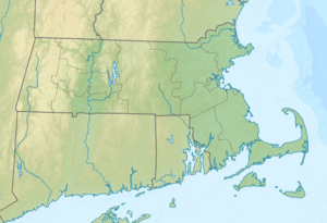
Green Island (also North Brewster Island ) is an island in Boston Harbor . It is located 9.5 mi (15.3 km ) from downtown Boston in the state of Massachusetts in the United States . Green Iceland has a permanent area of 2.5 acres (1 ha ) defined by a Watts , depending on the tidal range is temporarily increased by up to 14.7 acres (5.95 ha). It is administered by the Massachusetts Department of Conservation and Recreation (DCR) and is part of the Boston Harbor Islands National Recreation Area .
geography
geology
The island is made up of a single rock that protrudes up to 45 ft (13.7 m ) from the water.
Flora and fauna
Many birds nest on the island, such as American herring gulls , black-backed gulls , cormorants , barn swallows and red-shouldered blackbirds . The low vegetation consists of Rhus and salt-tolerant herbs. The island's fauna is also the subject of scientific research.
history
The island is named after the merchant Joseph Green , who owned the island during the colonial days in the 1600s.
Attractions
The island offers no special sights. On the contrary, the authorities do not advise approaching it, especially during the breeding season of the birds that live there.
Individual evidence
- ↑ a b c d e Island Facts: Green Island. National Park Service , accessed June 4, 2013 .
Web links
- Boston Harbor Islands. Massachusetts Department of Conservation and Recreation, accessed June 4, 2013 (DCR basic information on the sanctuary, travel preparations and behavior).
