Gallops Island
| Gallops Island | ||
|---|---|---|
|
Gallops Island (center) as seen from Georges Island (foreground) |
||
| Waters | Quincy Bay , Boston Harbor , Atlantic Ocean | |
| Geographical location | 42 ° 19 ′ 31 ″ N , 70 ° 56 ′ 24 ″ W | |
|
|
||
| surface | 20 ha | |
| Highest elevation |
Drumlin 24.1 m |
|
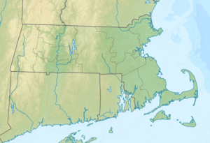
Gallops Island (also Gallups Island ) is an island in Quincy Bay in Boston Harbor . It is 6.5 mi (10.5 km ) from downtown Boston on the territory of the state of Massachusetts in the United States . Gallops Iceland has a permanent area of approximately 22.5 acres (0.09 square kilometers), which through a watt , depending on the tidal range is temporarily increased by up to 28 acres (0.11 square kilometers).
The island is currently closed to the public due to exposure to asbestos . It is administered by the Massachusetts Department of Conservation and Recreation (DCR) and is part of the Boston Harbor Islands National Recreation Area .
geography
geology
The island is more or less a single large drumlin rising 79 ft (24.1 m ) out of the water on its north side . From there you have a good view of the ship canal "The Narrows", which most ships choose when approaching Boston. In the early 1800s, the east end of the drumlin was removed. In the north and west of the island there is a sea wall made of granite blocks , in the south and east there are pebble beaches .
Flora and fauna
Ornamental plants , shrubs and herbs that point to the island's past thrive on the island. In 1927 alone, around 2,500 plants were planted and a large number of trees were planted again in the 1930s. Historical photographs from the 1940s show the tree-lined "Main Street" that stretched the entire length of the island. Even today you can see the paths near which are privet , fruit and shade trees and conifers . Lilacs , pipe bushes , snowberries and forsythias also grow on the island. The cultivated plants are in direct competition with naturally grown rhus , poplar , poison ivy and myrica .
There is an overpopulation of rabbits on Gallops Island , and the island's wildlife is still the subject of scientific research.
history
The island was already used by the Indians . Due to its location in the center of the harbor basin, Gallops Island served as one of the first bases for harbor pilots . One of them was John Gallop , after whom the island is named to this day. Later, a restaurant and inn , a military base , a radio technology school and a quarantine station were built on the island . During the Civil War , more than 3,000 soldiers from the Northern States lived there , while in World War II 325 soldiers attended the radio technology school there and another 150 bakers and cooks learned their craft in a cooking school.
Attractions
building
- Harbor pavilion
- Granite foundation wall (approx. 1860)
- Concrete pillars of the canteen of the radio school
- The cornerstone of the officers' mess
- Foundation walls of the barracks
- Foundation walls of the doctor's house
- Foundation walls of the pharmacy
- Ruins of the incinerator
- Composting toilet
Other structures
- pier
- Navigation buoy at Peggy's Point
- United States of America border marker
- Stone wall around the parade ground and steps to the highest point on the island
- Bank reinforcement made of granite blocks and jetty
- Benches
- Picnic areas
- Display boards with explanations
Individual evidence
- ↑ Lawrence Harmon: Gallops Island: Paradise lost. In: The Boston Globe . August 15, 2010, accessed June 2, 2013 (English, paid article).
- ↑ a b c d Island Facts: Gallops Island. National Park Service , accessed June 2, 2013 .
Web links
- Boston Harbor Islands. Massachusetts Department of Conservation and Recreation, accessed June 2, 2013 (DCR basic information on the sanctuary, travel preparations and behavior).

