Georges Island (Massachusetts)
| Georges Island | ||
|---|---|---|
| Map of the island | ||
| Waters | Quincy Bay , Boston Harbor , Atlantic Ocean | |
| Geographical location | 42 ° 19 '1 " N , 70 ° 55' 43" W | |
|
|
||
| surface | 16 ha | |
| Highest elevation | 15 m | |
| The island seen from the water | ||
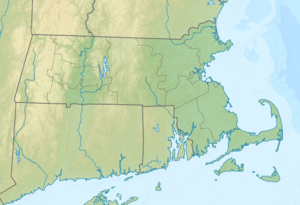
Georges Island is one of the islands in Boston Harbor . It is 7.3 mi (11.7 km ) from downtown Boston on the territory of the state of Massachusetts in the United States . Georges Iceland has a permanent area of approximately 39 acres (0.16 square kilometers) defined by a Watts , depending on the tidal range is temporarily enlarged by up to 14 acres (0.06 square kilometers). The highest point is 50 ft (15.2 m ) above the waterline. Historic Fort Warren is on the island .
The island is connected to the mainland via ferries and, as one of the easy and quick to reach islands in the Boston Harbor Islands National Recreation Area, is a popular tourist attraction.
geography
Flora and fauna
The island's wildlife is still the subject of scientific research. The island consists largely of lawns and is mowed regularly. In steep areas that are not mowed, tall grass, wildflowers and rhus settle . The chestnuts , elms and maples inside the fort are around 100 years old. More chestnuts have recently been planted by the DCR. There are also many apple trees on the island , some of which have been planted and some of which have settled themselves. Pine and maple trees in the picnic areas offer protection from wind and sun.
history
Colonial times
At the time of the colonization of the North American continent by the Europeans, Georges Island consisted of no more than two 48 ft (14.6 m) and 64 ft (19.5 m) high drumlins , which protruded from the water similar to the neighboring islands. The island was used for agriculture for over 200 years until it was purchased by the federal government of the United States in 1825 to establish a base for coastal defense. In the course of this, the shape and appearance of the island were changed in extreme ways, so that there was enough space available to build Fort Warren . This served as a military facility for more than 100 years and also as a prison for members of the Confederate States of America during the Civil War . It was decommissioned in 1947 and acquired by the Massachusetts Department of Conservation and Recreation (DCR) in 1958 .
The legend of the “ Lady in Black ”, the “woman in black” who is said to wander around the island, has survived to this day. The myth goes back to Mrs. Andrew Lanier , the wife of a Confederate soldier imprisoned at Fort Warren in 1861 , who was sentenced to death for aiding and abetting escape and was hanged in a black robe.
Situation today
Today, the island serves exclusively as a recreational area for the greater Boston area. In summer as well as in early autumn ferries connect the island with Boston and Quincy , on weekends and during the summer also on weekdays there is an additional shuttle boat to the neighboring islands.
The DCR owns and manages the island, which is open to visitors from May to October.
Attractions
building
- Fort Warren
- Granite powder magazine
- Ravelin
- Searchlight station
- Generator house
- Communication building
- Warehouse for sea mines (today the park administration office building)
- Anchor rope workshop (next to the warehouse)
- Fuel storage on the pier
Fortifications
- Fort Warren: side walls I to V, bastions A to E.
- Jack Adams gun battery (a 10-in (254-mm) cannon)
- Barlett gun battery (four 10-in (254-mm) cannons)
- Stevenson gun battery (two 12-in (304.8-mm) cannons)
- Two towers on the side wall II
- Ravelin and searchlight station
- Demilune
- Guard house
Other structures
- cistern
- Tunnel to Sallyport
- Walkways and steps to the former hospital
- pier
- Sea wall
See also
Web links
Individual evidence
- ↑ Explore Georges Island. (No longer available online.) Boston Harbor Islands Partnership, archived from the original on May 5, 2013 ; accessed on May 31, 2013 . Info: The archive link was inserted automatically and has not yet been checked. Please check the original and archive link according to the instructions and then remove this notice.
- ↑ a b c Island Facts: Georges Island. National Park Service , accessed May 31, 2013 .
- ↑ Lady In Black Ghost - George's Island Folklore. Celebrate Boston, accessed May 31, 2013 .


