Sarah Island (Massachusetts)
| Sarah Island | ||
|---|---|---|
| Waters | Boston Harbor , Atlantic Ocean | |
| Geographical location | 42 ° 15 '52 " N , 70 ° 53' 14.5" W | |
|
|
||
| surface | 1.86 ha | |
| Highest elevation | 9.14 m | |
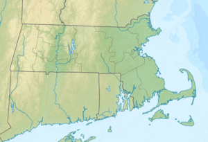
Sarah Island is an island in Hingham Bay in Boston Harbor . It is located 12 mi (19.3 km ) from downtown Boston in the state of Massachusetts in the United States . Sarah Iceland has an area of about 4.6 acres (1.9 hectares ), is from the town of Hingham managed and is part of the Boston Harbor Islands National Recreation Area .
geography
geology
The island consists largely of the locally occurring rock conglomerate Roxbury Puddingstone and glacial till and rises up to 30 ft (9.1 m ) from the water.
Flora and fauna
Large trees such as maples , oaks , lime trees , elms , cedars , hackberry trees , late-blooming bird cherries , buckthorns and rhus grow on the island . Dead trees are used by birds such as cormorants , egrets and gulls as a hide.
history
The island was already used seasonally by the Indians . The European colonists cut down the trees on the island for firewood. Before John Langlee acquired the island in 1686, it was also known as Sailor's Island or Sayles's . It later became the property of John R. Brewer and one of his descendants eventually transferred it to the City of Hingham.
Attractions
The island offers no special sights. On the contrary, the authorities do not advise approaching it, especially during the breeding season of the birds that live there.
Individual evidence
- ↑ a b c d e Island Facts: Sarah Island. National Park Service , accessed August 6, 2013 .
Web links
- Boston Harbor Islands. Massachusetts Department of Conservation and Recreation , accessed August 6, 2013 (DCR basic information on the sanctuary, travel preparations and behavior).
