Outer Brewster Island
| Outer Brewster Island | ||
|---|---|---|
| Battery Jewell's cannon foundation on the island | ||
| Waters | Boston Harbor , Atlantic Ocean | |
| Geographical location | 42 ° 20 '24 " N , 70 ° 52' 36" W | |
|
|
||
| surface | 8.1 ha | |
| Highest elevation | 23.77 m | |
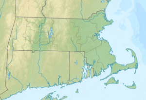
Outer Brewster Island (also Outward Island ) is an island in Boston Harbor . It is 10 mi (16.1 km ) from downtown Boston in the state of Massachusetts in the United States and has an area of approximately 20.1 acres (8.1 hectares ). It is administered by the Massachusetts Department of Conservation and Recreation (DCR) and is part of the Boston Harbor Islands National Recreation Area .
geography
geology
The island consists of exposed bedrock on which there is a thin layer of earth. Outer Brewster Island is surrounded by a rocky coastline with sheer cliffs. A rock formation in the western part of the island is called " Pulpit Rock " (German: " Pulpit Rock "). Remains of the quarries from the 19th century can still be seen today.
Flora and fauna
The rocky subsoil of the island offers mainly low, dense bushes and shrubs as well as grasses a habitat. The vinegar tree is the most common ; roses also thrive in lower areas near the coastline . There is also a small population of American quaking poplars, as well as a single specimen of an apple tree , a late blooming bird cherry and a Siberian elm . Endemic to the reserve on Outer Brewster Island is an occurrence of fine-leaved goldenrod .
Since the island is one of the islands in the protected area that are further away from the coast, it is typically more tidally adapted to the flora and fauna. It is a popular breeding ground for cormorants , waders , water fowl and gulls . At the southern end of their range in the western Atlantic, eider ducks also breed on the island, and brown ibis have also been sighted . The brown-coat oystercatchers, classified as an endangered species by the Partners in Flight organization , also breed on the island, which is also used as a resting place by seals . The flora and fauna of the island are also the subject of scientific research.
history
The island was named after William Brewster , the first preacher and teacher of the Plymouth Colony . Since the island consists exclusively of rock, it served exclusively as a quarry in the 18th and 19th centuries and as a coastal defense in the 20th century. In 1798, Nathaniel Austin , lawmaker in the Massachusetts House of Representatives and resident of Charlestown , bought the island for $ 400 (the equivalent of around $ 10,000 today) and continued to operate the quarry there. Among other things, he used the stones to build houses in his hometown. During the Second World War , a gun battery was installed there, which had two radar-controlled 6-in (152.4 mm) cannons. Three concrete barracks housed 125 soldiers.
Attractions
The island is open from 9:00 a.m. to sunset. However, authorities do not recommend approaching her during the breeding season of the birds that live there. The sights on the island include in particular:
- Ruins of the abandoned Jewell gun battery with concrete buildings
- Ruins of a seawater desalination plant
- Foundation walls of a former 100 ft (30.5 m ) high radar tower
- Remains of a former quarry
Web links
- Boston Harbor Islands. Massachusetts Department of Conservation and Recreation, accessed June 25, 2013 (DCR basic information on the sanctuary, travel preparations and behavior).
Individual evidence
- ↑ a b c d e Island Facts: Outer Brewster Island. National Park Service , accessed June 25, 2013 .
- ↑ Helen O'Neil: Long, Long Before MGH In Charlestown: 27 Harvard Square. In: CharlestownPatch. June 28, 2012, accessed June 26, 2013 .

