Bern-Inner City
|
Inner city district of Bern |
|
|---|---|
| Coordinates | 600663 / 199 691 |
| height | 496- 560 m |
| surface | 0.842 km² |
| Residents | 4688 (2019) |
| Population density | 5568 inhabitants / km² |
| Proportion of foreigners | 20.3% (2019) |
| Unemployment rate | 2.1% (2016) |
| structure | |
| district | I. |
| Statistical districts | |
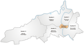
The inner city , district I, is one of the six districts of the city of Bern . The old town of Bern coincides geographically with the inner city. It comprises five statistical districts, which are also known colloquially as quarters, which in turn are grouped into three common quarters:
- Schwarzes Quartier, as identical Common Quartier Matte (quartier)
- The White Quarter and the Green Quarter together as the Common Quarter of the Lower Old Town
- Yellow Quarter and Red Quarter together as the common Upper Old Town quarter
The division and color names go back to the year 1798, when Napoleon's troops divided the city into differently colored quarters for better orientation because there were no street names or the majority of the soldiers were illiterate. That is why bilingual signs were made in the appropriate colors and these names and colors for signs are still used today.
In 2019, the inner city had a resident population of 4688, of which 3736 were Swiss and 952 were foreigners. The following table differentiates according to statistical districts:
history
In the Middle Ages, the old town was divided into four quarters. This happened in 1294 on the occasion of the constitutional reform. The Märitgasse and Kreuzgasse were defined as the district boundaries. These four quarters were named after the four Venner societies (Venner guilds) that were responsible for their quarters: Pfistern quarter, smith quarter, butcher quarter and tanner quarter. The first quarter (Pfistern quarter) was south of the main axis and west of Kreuzgasse . The second quarter (Schmieden quarter) was north of the main axis and west of Kreuzgasse. The third quarter (butcher's quarter) was south of the main axis and east of Kreuzgasse. The fourth quarter (Gerber quarter) was north of the main axis and east of Kreuzgasse. There were two affiliation changes. Once between the third and fourth quarter. The area between Nydeggstalden and today's Nydeggbrücke (and thus the Nydeggkirche) belonged to the fourth quarter until the end of the 15th century, and from the 16th century to the third quarter. In the middle of the 16th century the imbalance of the individual quarters was corrected. This was created by the city's growth, which was almost exclusively westward. Therefore, the border between the quarters was moved from Kreuzgasse to the axis Schaal- and Münstergasse. This new quarter axis also forms the border between the Obern and Unterst municipality, which was eliminated at the same time. With this distinction, the use of the city spaces in front of the gates was also reorganized. The city fields to the east were only intended for use by the residents of the lower community and the western city fields were only intended for use by the upper community.
The church division still valid today goes back to the year 1721. Because at that time the parish of Bern was divided. Until then, the Bern Minster was the only parish church. The Nydegg and Heiliggeistkirche were elevated to parish churches in 1721. The parish of Heiliggeist stretches from Obertor to the Käfigturm , thus encompassing the outer Neustadt. The parish of Münster covers the area from the Käfigturm to the beginning of Gerechtigkeitsgasse . The parish of Nydegg is the rest of the lower parish, Stalden with Altenberg and Schosshalde, Matte and Mattenegg.
Attractions
literature
- Paul Hofer : The art monuments of the canton of Bern. Volume 1: The city of Bern (= Swiss art monuments . Volume 28 ). Birkhäuser, 1952.
- Society for Swiss Art History (Ed.): Inventory of the newer Swiss architecture . INSA 1850-1921 . tape 2 : Basel, Bellinzona, Bern. Orell Füssli, Zurich 1986, ISBN 3-280-01716-5 .
Web links
Individual evidence
- ↑ Interactive city map of the city of Bern (selection under "Topics")
- ↑ Bern's colored street signs. The clever solution on altstadt.be
- ↑ Resident population 2019 report p. 5 on bern.ch
- ↑ KdKB Volume 1: City of Bern. Pp. 4-7.
- ↑ KdKB Volume 1: City of Bern. Pp. 4-5.


