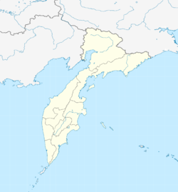
Klyuchi (Kamchatka)
| Village
Klyuchi
Ключи
|
||||||||||||||||||||||||||||||
|
||||||||||||||||||||||||||||||
|
||||||||||||||||||||||||||||||

Klyuchi ( Russian Ключи ) is a village in the Kamchatka Region ( Russia ) with 5726 inhabitants (as of October 14, 2010).
geography
The village is located in the central depression of the Kamchatka Peninsula on the right bank of the Kamchatka River of the same name . On the far north bank of the Kamchatka rises the 1,400 meter high, extinct volcano Chertschanskaja . 30 kilometers south of the village lies the highest volcano in Eurasia at 4750 meters, the Klyuchevskaya Sopka , whose foot reaches as far as Klyuchi, while 40 kilometers northeast of the 3000 meter high Schiwelutsch , which has been extremely active again since December 2006 and whose last strong eruption was on, rises 40 kilometers to the northeast September 14, 2008, when he threw smoke and ash up to 6.5 kilometers high and collapsed part of the crater.
Klyuchi is located about 450 kilometers north of the regional capital Petropavlovsk-Kamchatsky . The place belongs to the Ust-Kamchatsk Rajon , the administrative center of which, the urban-type Ust-Kamchatsk settlement , is located about 100 kilometers to the east at the confluence of the Kamchatka in the Pacific Ocean .
history
The village of Klyuchi (a Russian word for sources ) was re-established in 1741 after one of the first Russian settlements on Kamchatka had existed in the area under the name Nizhne-Kamchatka since around 1701 . Vitus Bering started his first Kamchatka expedition from here in 1728 . In 1731 this settlement was burned down during an uprising by the indigenous people ("Kamschadalen"), abandoned by the Russians and rebuilt not far from the Kamchatka estuary (today uninhabited again).
The Klyuchi settlement remained insignificant until the 20th century when a forestry and wood processing plant was established here in 1932. In 1951 the status of an urban-type settlement was given, and in 1979 town charter. As a result of the economic crisis of the 1990s, the population dropped rapidly and Klyuchi lost its city status in 2004.
Population development
| year | Residents |
|---|---|
| 1959 | 6,949 |
| 1970 | 7,809 |
| 1979 | 9,317 |
| 1989 | 11,251 |
| 2002 | 7,073 |
| 2010 | 5,726 |
Note: census data
Culture and sights
Since 1935 there has been a volcanological station of the Institute of Volcanology and Seismology of the Far Eastern Section of the Russian Academy of Sciences in Klyuchi .
Klyuchi is one of the starting points for visiting Klyuchevskaya Sopka.
Economy and Infrastructure
In Klyuchi there are smaller forestry and wood processing companies as well as those for processing agricultural products and fish.
The place is the end of a road that runs from Petropavlovsk-Kamchatsky through the central depression of the peninsula to the north. There is a small airport to the southwest.
Individual evidence
- ↑ a b Itogi VPN-2010. Administrativno-territorialʹnoe delenie kraja. (Results of the 2010 census. Administrative-territorial division of the region.) Table 2 (Download from the website of the Territorial Organ of the Kamchatka Region of the Federal Service of State Statistics of the Russian Federation)
- ↑ Report at RIA Novosti (Russian)
Web links
- Unofficial website of the place (Russian)
- Website of the Kamchatka branch of the RAN Geophysical Service (Russian, English; with webcam view of the Klyuchevskaya Sopka and Shiwelutsch volcanoes from Klyuchi)

