Lincoln County (Maine)
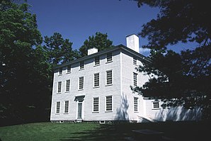
 Pownalborough Courthouse in Dresden |
|
| administration | |
|---|---|
| US state : | Maine |
| Administrative headquarters : | Wiscasset |
| Foundation : | |
| Demographics | |
| Residents : | 34,457 (2010) |
| Population density : | 29.2 inhabitants / km 2 |
| geography | |
| Total area : | 1812 km² |
| Water surface : | 631 km² |
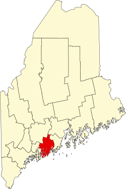
| map | |
| Website : co.lincoln.me.us | |
Lincoln County is a county in the state of Maine in the United States . The seat of the county government, the ( Shire Town ) is in Wiscasset .
geography
According to the US Census Bureau , the county has a total area of 1,812 square kilometers. Of these, 631 square kilometers, or 34.84 percent, are water areas. The county is bordered clockwise by the counties: Kennebec County , Waldo County , Knox County, and Sagadahoc Counties .
history
Lincoln County was part of the state of Massachusetts until 1820 . By the Missouri Compromise , Lincoln County was separated from Massachusetts and became part of Maine, which became the 23rd state on March 15, along with the rest of Maine.
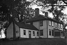
Due to their historical significance, three of the county's sites have the status of a National Historic Landmark , the Nickels-Sortwell House , the Pemaquid Archeological Site and the Perkins Homestead . A total of 104 buildings and sites in the county are registered in the National Register of Historic Places (as of November 11, 2017).
Demographic data
| growth of population | |||
|---|---|---|---|
| Census | Residents | ± in% | |
| 1790 | 29,236 | - | |
| 1800 | 30,225 | 3.4% | |
| 1810 | 42,992 | 42.2% | |
| 1820 | 53,180 | 23.7% | |
| 1830 | 57.192 | 7.5% | |
| 1840 | 63,517 | 11.1% | |
| 1850 | 74,875 | 17.9% | |
| 1860 | 27,860 | -62.8% | |
| 1870 | 25,597 | -8.1% | |
| 1880 | 24,821 | -3% | |
| 1890 | 21,996 | -11.4% | |
| 1900 | 19,669 | -10.6% | |
| 1910 | 18,216 | -7.4% | |
| 1920 | 15,976 | -12.3% | |
| 1930 | 15,498 | -3% | |
| 1940 | 16,294 | 5.1% | |
| 1950 | 18.004 | 10.5% | |
| 1960 | 18,497 | 2.7% | |
| 1970 | 20,537 | 11% | |
| 1980 | 25,691 | 25.1% | |
| 1990 | 30,357 | 18.2% | |
| 2000 | 33,616 | 10.7% | |
| 2010 | 34,457 | 2.5% | |
| Before 1900
1900–1990 2000 + 2010 |
|||

The county had a population of 33,616 as of the 2000 census . There were 14,158 households and 9,542 families. The population density was 28 people per square kilometer. The racial the population was composed of 98.46% White, 0.17% African American, 0.26% Native American, 0.37% Asian, 0.02% Pacific Islander, and 0.10% other races Groups; 0.61% were from two or more races. Hispanic or Latino of any race was 0.46% of the population.
Of the 14,158 households, 28.20% had children and young people under the age of 18 living with them. 56.10% were married couples living together, 7.70% were single mothers. 32.60% were not families. 26.70% were single households and 12.10% had someone who was 65 years of age or older. The average household size was 2.35 and the average family size was 2.82 people.
For the entire county, the population was composed of 22.70% of residents under 18 years of age, 5.50% between 18 and 24 years of age, 25.60% between 25 and 44 years of age, and 28.10% between 45 and 64 years of age 18.20% were 65 years of age or over. The median age was 43 years. For every 100 females there were 95.10 males, and for every 100 females aged 18 and over there were 92.00 males.
The median income for a household in the 38,686 USD , and the median income for a family was 45,427 USD. Males had a median income of $ 31,209 versus $ 23,161 for females. The per capita income was $ 20,760. 10.10% of the population and 6.60% of families are below the poverty line. 12.80% of them were under 18 years of age and 9.50% were 65 years of age or older.
cities and communes
Lincoln County is divided into 20 administrative units; one as Plantation , the other in the form of a Towns organized. Two settlements, Hibberts Gore , originally organized as a plantation, and the former Plantation Louds Island, have since lost their independent rights. There are also 2 villages without independent rights that are part of a town.
| Locality | status | Population (2010) |
Total area [km²] |
Land area [km²] |
Population density [inhabitants / km²] |
founding | Specialty |
|---|---|---|---|---|---|---|---|
| Alna | Town | 709 | 55.2 | 54.1 | 13.1 | June 25, 1794 | |
| Boothbay Harbor | Town | 2.165 | 23.9 | 14.8 | 146.3 | February 16, 1889 | |
| Boothbay | Town | 3,120 | 186.0 | 56.8 | 54.9 | November 3, 1764 | |
| Bremen | Town | 806 | 70.9 | 42.7 | 18.9 | February 19, 1828 | |
| Bristol | Town | 2,755 | 202.6 | 88.0 | 31.3 | June 21, 1765 | |
| Damariscotta | Town | 2,218 | 38.1 | 32.2 | 69.0 | March 15, 1848 | |
| Dresden | Town | 1,672 | 85.9 | 79.4 | 21.1 | June 25, 1792 | |
| Edgecomb | Town | 1,249 | 53.8 | 46.8 | 26.7 | March 3, 1774 | |
| Jefferson | Town | 2,427 | 58.6 | 52.6 | 17.8 | February 24, 1807 | |
| Monhegan | Plantation | 69 | 11.7 | 2.2 | 33.8 | September 4, 1839 | |
| Newcastle | Town | 1,758 | 84.4 | 75.2 | 23.3 | June 19, 1753 | |
| Nobleboro | Town | 1,643 | 60.4 | 49.3 | 33.3 | November 20, 1788 | |
| Somerville | Town | 548 | 59.1 | 56.8 | 9.7 | March 25, 1858 | |
| South Bristol | Town | 892 | 76.9 | 33.9 | 26.3 | March 26, 1915 | |
| Southport | Town | 606 | 60.0 | 14.0 | 43.5 | February 12, 1842 | |
| Waldoboro | Town | 5,575 | 204.3 | 185.2 | 27.4 | June 29, 1773 | |
| Westport Island | Town | 718 | 36.9 | 22.8 | 31.5 | February 5, 1828 | |
| Whitefield | Town | 718 | 123.1 | 121.3 | 19.0 | June 19, 1809 | |
| Wiscasset | Town | 3,732 | 71.6 | 63.8 | 58.5 | February 13, 1760 | Shire Town of the County |
- For statistical purposes 5 census-designated places are set up, these are
- Boothbay Harbor (CDP) (1237)
- Damariscotta (CDP) (1142)
- Newcastle (CDP) (667)
- Waldoboro (CDP) (1291)
- Wiscasset (CDP) (1203)
- Other villages without independent rights
Individual evidence
- ↑ GNIS-ID: 581293. Retrieved on February 22, 2011 (English).
- ↑ Listing of National Historic Landmarks by State: Maine . National Park Service , accessed November 11, 2017.
- ↑ Search mask database in the National Register Information System. National Park Service , accessed November 11, 2017.
- ↑ US Census Bureau - Census of Population and Housing . Retrieved March 15, 2011
- ↑ Extract from Census.gov . Retrieved February 28, 2011
- ↑ Extract from census.gov (2000 + 2010) ( Memento from July 13, 2011 on WebCite ) Retrieved on April 2, 2012
- ^ Extract from the National Register of Historic Places . Retrieved March 13, 2011
- ^ Extract from the National Register of Historic Places . Retrieved March 13, 2011
- ↑ Population data from the 2010 US Census in the American Factfinder
- ^ Official website of the Maine administration
Web links
Coordinates: 44 ° 0 ′ N , 69 ° 32 ′ W


