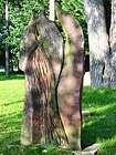
List of streets and squares in Lubmin
The list of streets and squares in Lubmin describes the street system of the municipality of Lubmin in the northeast of Mecklenburg-Western Pomerania . The history of Lubmin is not dealt with separately here.
Legend
The following table gives an overview of the existing streets and squares in the municipality as well as some related information. In detail these are:
- Name / location : current name of the street or square. The location (geoposition) indicates roughly the middle of the street or the square
- No longer valid street names are in italics set
- Length / dimensions : rounded length of the street or dimensions of the square in meters. The latter are given in the form a × b for rectangular systems or a × b × c for triangular systems with a as the longest edge. The addition 'in the village' indicates the length of the road within the municipality of Lubmin, provided it runs through several municipalities
- Name origin : origin of the name
- Notes : further information on local institutions, the history of the street or historical names
- Image : Image of the street or an adjacent object
Overview of streets and squares
| Surname | Length / dimensions (in meters) |
Origin of name | Remarks | image |
|---|---|---|---|---|
|
Ahornweg
( Location ) |
50 | after the first planting with maple trees | The Ahornweg is the shortest route in the community. It connects a single piece of land with the Apfelweg. |

|
| Old village
( Location ) |
690 | the oldest houses in the community are in this district. There was a village pond here, which marked the center of the village. | The street branches off from Freester and Wusterhusener Straße and ends in two turnarounds . |

|
| At the old train station
( Location ) |
80 × 50 | here was until 1945 the engraving station of a narrow-gauge railway Greifswald - Wolgast | The seaside resort center with the seat of the mayor, the spa administration and the library have been located in the building of the former train station since 2004. The municipality's bus station with a connection to the Usedomer Bäderbahn is also located here . The street is not officially dedicated and has the shape of a square. |

|
| At the port
( Location ) |
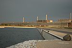
200 | The road leads to the extension of the free villages walk on the Marina Lubmin to | At the end of the street you can see the decommissioned Greifswald nuclear power plant . The outlet channel of this power plant separates the road. A federal police station is located at number 1 on the eastern bank of the canal . |
 |
| At the Teufelstein
( Location ) |
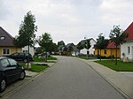
730 | after the "Teufelstein", a boulder that is located at this point near the beach in the Baltic Sea | According to legend, the devil tried to hit the church in Wusterhusen with this stone from the island of Rügen . The boulder has a volume of 32 cubic meters and a circumference of 16.8 meters. The street is branched and opens up a new development area from the 1990s. |
 |
| At the forest
( Location ) |
520 | to the adjacent Lubminer Heide, a mixed forest | Here is a sports and leisure center as well as the Vieneta forest settlement. Part of the forest should be cleared in favor of an industrial area . |

|
| At the Waldwinkel
( Location ) |
470 | the road runs from Freester Strasse at a right angle to Lubminer Heide | The road is unpaved. It is extended by the not dedicated street Zum Knirk and borders on the Lubminer Heide. |

|
| Apple path
( Location ) |
320 | after the initial planting with apple trees | The apple path runs parallel to Wusterhusener Straße and connects the plum avenue, the birch path and the poplar avenue. |

|
|
Birch path
( Location ) |
140 | after the first birch planting | The Birkenweg runs parallel to the plum and poplar avenue and connects the apple path with the Wusterhusener Straße. |

|
|
Cäcilienstraße
( Location ) |
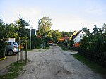
155 | The road is unpaved and connects Dünenstrasse with Neptunstrasse. This is also where the Kattenstieg ends, which starts from the west on Langen Strasse. |
|
|
| Caspar-David-Friedrich-Strasse
( Location ) |
445 | Caspar David Friedrich (1774–1840), painter and draftsman of the German early romantic period | The road is unpaved. It runs from the beach promenade to Freester Strasse. |

|
|
Diesterwegplatz
( Location ) |
115 × 70 | This place is not officially dedicated . It is occasionally used for a flea market and as a festival ground. At the north end is a playground that was created from donations. A notice board shows which members of the community are participating in the project. The plan is to build a hotel and a holiday complex on the site. |

|
|
| Dune road
( Location ) |
1370 | the street runs parallel to and above the beach promenade like a dune | The sports club “Sturmvogel Lubmin e. V. ”has its headquarters. The villa“ Heideschloss ”from 1926, a former bakery building, is located on the corner of Dünenstrasse and Cäcilienstraße. Dünenstraße turns west into Turmstraße. In an easterly direction it ends at the Lubminer Heide. |

|
|
Home development
( Location ) |
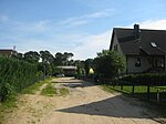
790 | after the homes that were built here | The Wusterhusen rifle club has its headquarters in this street . The street is unpaved and branches out several times. |
|
|
Freesendorfer way
( Location ) |
1450 | after Freesendorfer See , at the output of the Peenestrom is only through a narrow passage from the Greifswald is separated | The road connects the Lubmin marina via Am Hafen with the L262 Kemnitz – Wolgast road. The former Greifswald nuclear power plant is located here . |

|
| Freester Street
( Location ) |
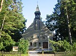
1000 | to the neighboring district of Freest in the municipality of Kröslin | The volunteer fire brigade, the police station, the Landfrauenverband Greifswald e. V., the Lubminer Computerclub e. V., the Heimatstube, a school café and the senior citizens' council. There is also the only church in the community, the Petrikirche . |
|
| Fritz-Reuter-Weg
( Location ) |
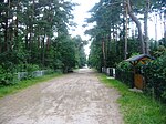
395 | Fritz Reuter (1810–1874), poet and writer in Low German | The road is unpaved and connects the beach promenade with Freester Strasse. It runs parallel to Caspar-David-Friedrich-Strasse. |
|
|
Garden path
( Location ) |
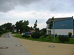
800 | to the adjacent allotment gardens | The Heimvolkshochschule and the social station of the German Red Cross are located in this street . |
|
| Geschwister-Scholl-Weg
( Location ) |
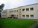
340 | Siblings Scholl ( Hans , 1918–1943 and Sophie , 1921–1943), members of the White Rose , a resistance group during World War II | This street connects the Wusterhusener Straße with the Seestraße. This is where the municipal administration , the Lubmin office and a daycare center are located. |
|
| Gorse path
( Location ) |
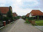
200 | The Gorse Path runs between Birkenweg and Pappelallee, parallel to the Apple Path. |
|
|
| Goetheweg
( Location ) |
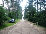
510 | Johann Wolfgang von Goethe (1749–1832), poet | The road is unpaved and, like Fritz-Reuter-Weg, connects the beach promenade with Freester Straße. At the southern end of the two streets is the cemetery of the community on Freesendorfer Strasse . |
|
|
Hafenstrasse
( Location ) |
670 | The Hafenstraße runs from the Altes Dorf road in the direction of Greifswalder Bodden. At the northern end there is a parking lot that is also approved for caravans. |

|
|
|
Kattenstieg
( Location ) |
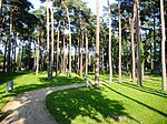
380 | Low German name for a path that is so narrow that it can only be used by a cat ("Katte") (translated: "Katzensteig") | The community's spa gardens are located between Kattenstieg, Villen- and Waldstraße . Spa concerts take place here at irregular intervals . The road is not officially dedicated and is unpaved. |
|
| Paddock
( Location ) |
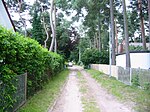
380 | The road is unpaved and connects Freester Strasse with Spandowerhagener Weg. |
|
|
| Short way
( Location ) |
260 | The short way connects the "old village" with the new building area "Am Teufelsstein". |

|
|
|
Long street
( Location ) |
780 | The spelling is sometimes also "Lange Straße". It runs from the spa administration in the direction of Greifswalder Bodden to Turmstrasse. In a half-timbered barn (house number 29) there is a private collection of tools used by the Lubmin fishermen, which can be viewed by prior arrangement. |

|
|
| Lindenstrasse
( Location ) |
560 | after the first planting with linden trees | At number 13 is the only old people's and nursing home in the community, the Villa “Meeresblick”. After the end of the Second World War, the building was used as a tuberculosis sanatorium until 1965 . |

|
|
Neptunstrasse
( Location ) |
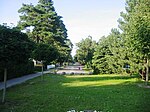
700 | Neptune , Roman god | The road became a dead end by redesigning the intersection of Freester Straße, Straße zum Meer and Neptunstraße in the southwestern part. At the end of the street there has been a mini golf course since May 15, 2011 . |
|
| Netzeplatz
( Location ) |
170 | the Lubmin fishermen used this space to dry their nets and carry out repairs | It is a U-shaped street that begins and ends at Hafenstraße and thus encloses an area that corresponds to a square. The road is unpaved. |

|
|
Poplar Avenue
( Location ) |
140 | This street is not officially dedicated and connects the Apfelweg with the Wusterhusener Straße. |

|
|
| Avenue of plums
( Location ) |
620 | after the initial planting with plum trees | At the east end there is a children's playground. |

|
| Philosophers' Way
( Location ) |
525 | In house number 10 there is a sports and leisure hotel for young people, a recreation center for railway children founded in 1920 as the Elisabeth Children's Home . The path is unpaved. Like the Goetheweg, the Philosophenweg connects the beach promenade with Freester Straße. |

|
|
|
Schulstrasse
( Location ) |
460 | after the new elementary school built here in 1930 , which was replaced by the Polytechnic Oberschule in Seestrasse in 1978 |

|
|
| Seestrasse
( Location ) |
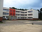
570 | the road runs straight towards the Baltic Sea | The Lubmin Regional School is located at house number 11, where the vocational qualification can be acquired after class 9 and the secondary school leaving certificate after class 10 . It was established in September 1978 as a polytechnic high school. There is also a sports field and a tennis court in the street, which is used by the sports club “SV Sturmvogel Lubmin”. |
|
| Spandowerhagener Weg
( Location ) |
1180 | to a bay of the Peenestromes , the Spandowerhagener Wiek , which is located between the north end of Usedom , the (half) island of Struck and the north German mainland | The path leads through the Lubmin Heath to the Lubmin Marina. At the corner of Freester and Spandowerhagener Weg is the sculpture "Flammen" by Grazyna Matuszewska from 2000 and a memorial stone for the Day of German Unity . | |
| Promenade
( Location ) |
1280 | the street runs parallel to the Greifswalder Bodden in the form of a promenade. It was laid out in 1934 and completely renovated in 2005 and 2006 . | The promenade begins at the level of Villenstrasse and ends at the level of Caspar-David-Friedrich-Strasse. There is a children's playground at Diesterwegplatz. On the beach promenade between Lindenstrasse and Goetheweg, the two sculptures "Bank object" by Eckard Labs and "Fischobjekt" by Ela Sawicka (both from the year 2000) are set up. The promenade is not officially dedicated. |

|
| Road to the sea
( Location ) |
360 | the road runs straight towards the Baltic Sea | The street connects the beach promenade with the Am Alten Bahnhof square . |

|
| Südring
( Location ) |
1300 | the street runs in a ring in the southern section of the industrial park | Part of the street runs parallel to Freesendorfer Weg. |

|
|
Turmstrasse
( Location ) |
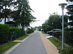
150 | Turmstraße is an extension of Dünenstraße with Hafenstraße. |
|
|
|
Villa street
( Location ) |
430 | after the villas located there in the old resort architecture | This is where the "Hope" villa from 1906 is located, one of the oldest preserved buildings in town. The villa housed a savings bank branch and later the Waterstraat shoe store . |

|
| Forest heather
( Location ) |
750 | to the adjacent Lubmin forest | The road branches off from Freesendorfer Weg in the direction of Bodden. Most of the street is on the premises of the Energiewerke Nord and is not open to the public. |

|
| Forest road
( Location ) |
430 | to the adjacent spa park, in which Scots pines are | The road ends in a northerly direction at the beach promenade and merges into the 350 meter long pier, which was newly built in 1992. Shortly before the pier there is the “Meeresgruß” villa from 1928 and a children's playground. Here is also the only pharmacy in the community, a former drug dispensing point of the rural outpatient clinic, which was privatized in 1991. | |
| Wellnitzstrasse
( Location ) |
240 | Karl Wellnitz (1913–?), Professor of mathematics | The road connects Dünenstrasse with Freester Strasse. |

|
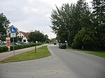
| Wusterhusener Strasse
( Location ) |
670 | to the municipality of Wusterhusen , which belongs to the Lubmin office | The road serves as an arterial road and connection with the L262 Kemnitz – Wolgast road. |
|
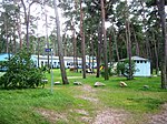
| To the knack
( Location ) |
225 | after the juniper bushes located there (also called "Knirk") | The road is unpaved. It is an extension of the street Am Waldwinkel and is partially written "Am Knirk". It appears on street maps of the Lubmin Office with the spelling "Zum Knirk". |
|
Web links
- Lubmin street directory , accessed April 9, 2011
- Clubs in Lubmin , accessed on April 9, 2011
Individual evidence
- ↑ a b c d e f g h Heimatverein Bodden coast Seebad Lubmin e. V .: Seebad Lubmin - A gem on the Greifswalder Bodden , Druckhaus Panzig, Greifswald
- ^ Ministry of Transport, Building and State Development Mecklenburg-Western Pomerania: Stately! City views from 20 years , Schwerin March 2011, page 33
- ↑ Info letter No. 9 of the citizens' initiative "Future Lubminer Heide" e. V. ( Memento of the original from October 28, 2007 in the Internet Archive ) Info: The archive link was automatically inserted and not yet checked. Please check the original and archive link according to the instructions and then remove this notice. , accessed April 9, 2011
- ↑ Seebad Lubmin: "Local Agenda 21: Model for a sustainable economic, ecological and tourist development in the Seebad Lubmin", focus 2 and 3 ( Memento of the original from October 29, 2014 in the Internet Archive ) Info: The archive link was automatically inserted and still Not checked. Please check the original and archive link according to the instructions and then remove this notice. , Page 11, PDF, 706 kB accessed on September 21, 2011.
- ↑ MV Publishing and Marketing: VorpommernMagazin , July 2011, page 42.
- ↑ BVG-Verlagsgesellschaft mbH i. V. with the Lubmin Office: Municipal InfoPlan , edition 2009.


