List of listed objects in Kilb
The list of listed objects in Kilb contains the 15 listed , immovable objects of the municipality of Kilb in Lower Austria .
Monuments
| photo | monument | Location | description | Metadata |
|---|---|---|---|---|

|
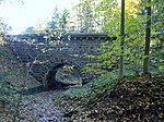
Chain riding aqueduct ObjectID : 129603 since 2012 |
KG location : Kettenreith |
The second Viennese spring water pipeline is a 183 km long drinking water supply pipeline for the city of Vienna . It was built at the instigation of Karl Lueger and, after a ten-year construction period, opened on December 2, 1910 as the 2nd Kaiser-Franz-Josef Spring Pipeline . |
ObjektID : 129603 Status : Notification Status of the BDA list: 2020-02-29 Name: Kettenreithaquedukt GstNr .: 840/3; 853/6; 842/1; 842/2; 1309/1; 1308/1; 769/1 |

|
Teufelsbach canal bridge ObjectID : 129605 since 2012 |
KG location : Kettenreith |
The second Viennese spring water pipeline is a 183 km long drinking water supply pipeline for the city of Vienna . It was built at the instigation of Karl Lueger and, after a ten-year construction period, opened on December 2, 1910 as the 2nd Kaiser-Franz-Josef Spring Pipeline .
The Teufelsbach canal bridge connects the cadastral communities of Rametzberg and Kettenreith. |
ObjektID : 129605 Status : Notification Status of the BDA list: 2020-02-29 Name: Teufelsbach Canal Bridge GstNr .: 588/5; 588/14 canal bridge Teufelsbach Kilb |

|
Panschacha Aqueduct ObjectID : 129604 since 2012 |
KG location : Kettenreith |
The second Viennese spring water pipeline is a 183 km long drinking water supply pipeline for the city of Vienna . It was built at the instigation of Karl Lueger and, after a ten-year construction period, opened on December 2, 1910 as the 2nd Kaiser-Franz-Josef Spring Pipeline . |
ObjectID : 129604 Status : Notification Status of the BDA list: 2020-02-29 Name: Panschachaquedukt GstNr .: 612/9; 617; 588/16; 592/1 Panschacha Aqueduct Kilb |

|
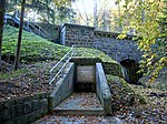
3 entry towers (65, 66, 67), 2 canal bridges (Hummelbach, Umbachkogel) ObjectID : 129602 since 2012 |
Location see description KG: Kettenreith |
The second Viennese spring water pipeline is a 183 km long drinking water supply pipeline for the city of Vienna . It was built at the instigation of Karl Lueger and, after a ten-year construction period, opened on December 2, 1910 as the 2nd Kaiser-Franz-Josef Spring Pipeline .
In this section are the entry towers 65 ( Lage ), 66 ( Lage ), 67 ( Lage ) and the two canal bridges Hummelbach ( Lage ) and Umbachkogel ( Lage ). |
ObjectID : 129602 Status : Notification Status of the BDA list: 2020-02-29 Name: 3 entry towers (65, 66, 67), 2 canal bridges (Hummelbach, Umbachkogel) GstNr .: 229; 231/2; 238/3; 1302; 759; 784/2; 785; 612/9 Access towers and canal bridges Kilb |

|
Tavern of the Melk Abbey ObjectID : 32139 |
Kettenreith 5 KG location : Kettenreith |
The former tavern of the Melk Benedictine monastery is dated between 1700 and 1800. |
ObjektID : 32139 Status : Notification Status of the BDA list: 2020-02-29 Name: Tavern of the Melk Abbey GstNr .: .32 / 1 Tavern of the Melk Kettenreith Abbey |

|
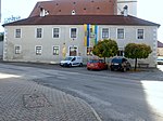
Residential and commercial building ObjectID : 32144 |
FWRaiffeisenplatz 1 location KG: Kilb |
ObjektID : 32144 Status : Notification Status of the BDA list: 2020-02-29 Name: Residential and commercial building GstNr .: 1302/2 Administration and office building Kilb |
|

|
Plague / Trinity Column ObjectID : 91653 |
in front of Hürmerstraße 7 KG location : Kilb |
ObjectID : 91653 Status: § 2a Status of the BDA list: 2020-02-29 Name: Pest- / Dreifaltigkeitssäule GstNr .: 1382/2 |
|

|
Figure shrine, St. Johannes Nepomuk ObjectID : 91657 |
Kirchenplatz KG location : Kilb |
The John of Nepomuk Statue on the church square of Kilb was according to the inscription on the base board in 1840 at the instigation of the market judge erected Simon Eder. |
ObjectID : 91657 Status: § 2a Status of the BDA list: 2020-02-29 Name: Figurine shrine , hl. Johannes Nepomuk GstNr .: 1379/6 Johannes Nepomuk Kilb |

|
Vicarage and former Rossstall ObjectID : 91648 |
Kirchenweg 2 KG location : Kilb |
ObjectID : 91648 Status: § 2a Status of the BDA list: 2020-02-29 Name: Pfarrhof and former Rossstall GstNr .: .93 / 1; 827/1; 1257/2 rectory and former Rossstall Kilb |
|

|
Grünbichl Castle / Grünbühel ObjectID : 32146 |
Mankerstraße 7, 9, 9a KG location : Kilb |
The three-storey castle with a rectangular floor plan, five window axes on each side and four corner towers goes back to a medieval fortification, which was rebuilt in the Renaissance style in the 16th century and got its classicist appearance in 1830 . |
ObjektID : 32146 Status : Notification Status of the BDA list: 2020-02-29 Name: Schloss Grünbichl / Grünbühel GstNr .: .16; .18 / 1; .18 / 5; .18 / 6 |

|
Former Citizens Hospital ObjectID : 70645 |
St.Pöltnerstraße 2 KG location : Kilb |
The building was erected around 1570 as a replacement for a house named "Siechenbichl", mentioned in 1409, to provide shelter for impoverished people who were employed in the Vogtei and Gut Grünbichl. In 1766 it was expanded into a hospital for all citizens. Later it was rented out, among other things, for residential purposes, served as a fire brigade depot, for interning prisoners of war and as a community dumpster . In the 20th / 21st In the 19th century, the basement was adapted as a community library and for exhibition purposes. There are apartments on the upper floor. |
ObjectID : 70645 Status: § 2 Status of the BDA list: 2020-02-29 Name: Former Bürgerspital GstNr .: .79 Former. Kilb Citizens Hospital |

|
Catholic parish church hl. Simon and Judas ObjectID : 54428 |
Location KG: Kilb |
The Gothic parish church in Kilb was built from the second half of the 15th century. It was partially completed in 1486, the last phase of construction was probably the tower completed in 1578. Although Kilb was mentioned in a document as early as 1080 as a parish, there are no records of the church building at that time. |
ObjectID : 54428 Status: § 2a Status of the BDA list: 2020-02-29 Name: Catholic parish church hl. Simon and Judas GstNr .: .95 Parish Church Kilb |

|
Hansingerbrücke, entry tower 68 ObjectID : 129607 since 2012 |
Location see description KG: Rametzberg |
The second Viennese spring water pipeline is a 183 km long drinking water supply pipeline for the city of Vienna . It was built at the instigation of Karl Lueger and, after a ten-year construction period, opened on December 2, 1910 as the 2nd Kaiser-Franz-Josef Spring Pipeline .
The canal bridge Hansingerbrücke ( Lage ) and the entry tower 68 ( Lage ) are located in this section . |
ObjectID : 129607 Status : Notification Status of the BDA list: 2020-02-29 Name: Hansingerbrücke, Einsteigurm 68 GstNr .: 1231; 1227; 812/2; 424/1 Hansingerbrücke, entry tower 68 Kilb |

|
Sierningbach aqueduct ObjectID : 129608 since 2012 |
KG location : Rametzberg |
The second Viennese spring water pipeline is a 183 km long drinking water supply pipeline for the city of Vienna . It was built at the instigation of Karl Lueger and, after a ten-year construction period, opened on December 2, 1910 as the 2nd Kaiser-Franz-Josef Spring Pipeline . |
ObjectID : 129608 Status : Notification Status of the BDA list: 2020-02-29 Name: Sierningbachaquädukt GstNr .: 784; 786; 1217/3; 413 |

|
Teufelsbach canal bridge ObjectID : 129606 since 2012 |
KG location : Rametzberg |
The Teufelsbach canal bridge connects the cadastral communities of Kettenreith (see there) and Rametzberg. Note: The property with the number 1220/2 is not in the property area. |
ObjektID : 129606 Status : Notification Status of the BDA list: 2020-02-29 Name: Teufelsbach Canal Bridge GstNr .: 1220/2; 1239 canal bridge Teufelsbach Kilb |
Web links
Commons : Listed Objects in Kilb - collection of images, videos and audio files
Individual evidence
- ↑ a b Lower Austria - immovable and archaeological monuments under monument protection. (PDF), ( CSV ). Federal Monuments Office , as of February 14, 2020.
- ↑ Kettenreith (Kilb), former tavern. In: Website of the University of Salzburg. Retrieved April 14, 2020 .
- ↑ Entry about Grünbühel Castle on Burgen-Austria
- ↑ The Kulturhaus Bürgerspital. In: member.kilb.at. Retrieved May 25, 2020 .
- ↑ Parish Church of Saints Simon and Jude - Kilb. In: sakralbauten.at . Retrieved April 15, 2020.
- ↑ § 2a Monument Protection Act in the legal information system of the Republic of Austria .
